Saint-Luc-de-Bellechasse
| Saint-Luc-de-Bellechasse | |
|---|---|
| Municipality | |
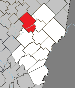 Location within Les Etchemins RCM. | |
 Saint-Luc-de-Bellechasse Location in southern Quebec. | |
| Coordinates: 46°30′N 70°29′W / 46.500°N 70.483°WCoordinates: 46°30′N 70°29′W / 46.500°N 70.483°W[1] | |
| Country |
|
| Province |
|
| Region | Chaudière-Appalaches |
| RCM | Les Etchemins |
| Constituted | August 12, 1921 |
| Government[2] | |
| • Mayor | Denis Laflamme (2013-2017) |
| • Federal riding | Lévis—Bellechasse |
| • Prov. riding | Bellechasse |
| Area[2][3] | |
| • Total | 159.50 km2 (61.58 sq mi) |
| • Land | 162.46 km2 (62.73 sq mi) |
|
There is an apparent contradiction between two authoritative sources | |
| Population (2011)[3] | |
| • Total | 480 |
| • Density | 3.0/km2 (8/sq mi) |
| • Pop 2006-2011 |
|
| • Dwellings | 325 |
| Time zone | UTC−5 (EST) |
| • Summer (DST) | UTC−4 (EDT) |
| Postal code(s) | G0R 1L0 |
| Area code(s) | 418 and 581 |
| Highways | No major routes |
| Website |
www |
Saint-Luc-de-Bellechasse is a municipality in the Municipalité régionale de comté des Etchemins in Quebec, Canada. It is part of the Chaudière-Appalaches region and the population is 485 as of 2009. Originally named Saint-Abdon, it was changed to Saint-Luc-de-Dijon, due to confusion in spelling and difficulties of pronunciation. It was later renamed to Saint-Luc and since 1997, Saint-Luc-de-Bellechasse. Saint-Luc honours Luc Gilbert of Saint-Augustin-de-Portneuf, who would have given an important sum for the construction of the rector.
The source of the Etchemin River is in Saint-Luc-de-Bellechasse.
References
- Commission de toponymie du Québec
- Ministère des Affaires municipales, des Régions et de l'Occupation du territoire
Places adjacent to Saint-Luc-de-Bellechasse | |
|---|---|
| Municipalities | |
|---|---|
| Parishes | |
| |
This article is issued from
Wikipedia.
The text is licensed under Creative Commons - Attribution - Sharealike.
Additional terms may apply for the media files.