Rural area
In general, a rural area or countryside is a geographic area that is located outside towns and cities.[1] The Health Resources and Services Administration of the U.S. Department of Health and Human Services defines the word rural as encompassing "...all population, housing, and territory not included within an urban area. Whatever is not urban is considered rural."[2]
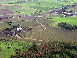
Typical rural areas have a low population density and small settlements. Agricultural areas are commonly rural, as are other types of areas such as forest. Different countries have varying definitions of rural for statistical and administrative purposes.
North America
Canada
In Canada, the Organisation for Economic Co-operation and Development defines a "predominantly rural region" as having more than 50% of the population living in rural communities where a "rural community" has a population density less than 150 people per square kilometre. In Canada, the census division has been used to represent "regions" and census consolidated sub-divisions have been used to represent "communities". Intermediate regions have 15 to 49 percent of their population living in a rural community. Predominantly urban regions have less than 15 percent of their population living in a rural community. Predominantly rural regions are classified as rural metro-adjacent, rural non-metro-adjacent and rural northern, following Ehrensaft and Beeman (1992). Rural metro-adjacent regions are predominantly rural census divisions which are adjacent to metropolitan centres while rural non-metro-adjacent regions are those predominantly rural census divisions which are not adjacent to metropolitan centres. Rural northern regions are predominantly rural census divisions that are found either entirely or mostly above the following lines of parallel in each province: Newfoundland and Labrador, 50th; Quebec 54th; Ontario, 54th; Manitoba, 53rd; Saskatchewan, Alberta and British Columbia, 54th. As well, rural northern regions encompass all of the Yukon, Northwest Territories and Nunavut.
Statistics Canada defines rural for their population counts. This definition has changed over time (see Appendix A in du Plessis et al., 2002). Typically, it has referred to the population living outside settlements of 1,000 or fewer inhabitants. The current definition states that census rural is the population outside settlements with fewer than 1,000 inhabitants and a population density below 400 people per square kilometre (Statistics Canada, 2007).
United States
84% of the United States' inhabitants live in suburban and urban areas,[3] but cities occupy only 10 percent of the country. Rural areas (villages) occupy the remaining 90 percent. The U.S. Census Bureau, the USDA's Economic Research Service, and the Office of Management and Budget (OMB) have come together to help define rural areas. United States Census Bureau: The Census Bureau definitions (new to the 2000 census), which are based on population density, defines rural areas as all territory outside Census Bureau-defined urbanized areas and urban clusters.
- An urbanized area consists of a central surrounding areas whose population ("urban nucleus") is greater than 50,000. They may or may not contain individual cities with 50,000 or more; rather, they must have a core with a population density generally exceeding 1,000 persons per square mile; and may contain adjoining territory with at least 500 persons per square mile (other towns outside an urbanized area whose population exceeds 2,500).
- Thus, rural areas comprise open country and settlements with fewer than 2,500 residents; areas designated as rural can have population densities as high as 999 per square mile or as low as 1 person per square mile.[4]
USDA
- The USDA's Office of Rural Development may define rural by various population thresholds. The 2002 farm bill (P.L. 107-171, Sec. 6020) defined rural and rural area as any area other than (1) a city or town that has a population of greater than 50,000 inhabitants, and (2) the urbanized areas contiguous and adjacent to such a city or town.
- The rural-urban continuum codes, urban influence code, and rural county typology codes developed by USDA’s Economic Research Service (ERS) allow researchers to break out the standard metropolitan and non-metropolitan areas into smaller residential groups.[4] For example, a metropolitan county is one that contains an urbanized area, or one that has a twenty-five percent commuter rate to an urbanized area regardless of population.
OMB:
Under the Core Based Statistical Areas used by the OMB (commonly referred to as 'CBSA Codes'),[5]
- a metropolitan county, or Metropolitan Statistical Area,(MSA) consists of (1) central counties with one or more urbanized areas (as defined by the Census Bureau) and (2) outlying counties that are economically tied to the core counties as measured by worker commuting data (i.e. if 25% of workers living there commute to the core counties, or if 25% of the employment in the county consists of workers coming from the central counties).
- Non-metro counties are outside the boundaries of metro areas and are further subdivided into Micropolitan Statistical Areas centered on urban clusters of 10,000–50,000 residents, and all remaining non-core counties.[4][6]
In 2014, the USDA updated their rural / non-rural area definitions based on the 2010 Census counts.[5]
Rural schools
National Center for Education Statistics (NCES) revised its definition of rural schools in 2006 after working with the Census Bureau to create a new locale classification system to capitalize on improved geocoding technology.
Rural health
Rural health definitions can be different for establishing under-served areas or health care accessibility in rural areas of the United States. According to the handbook, Definitions of Rural: A Handbook for Health Policy Makers and Researchers, "Residents of metropolitan counties are generally thought to have easy access to the relatively concentrated health services of the county's central areas. However, some metropolitan counties are so large that they contain small towns and rural, sparsely populated areas that are isolated from these central clusters and their corresponding health services by physical barriers." To address this type of rural area, "Harold Goldsmith, Dena Puskin, and Dianne Stiles (1992) described a methodology to identify small towns and rural areas within large metropolitan counties (LMCs) that were isolated from central areas by distance or other physical features." This became the Goldsmith Modification definition of rural. "Bhoomeet rural education The Goldsmith Modification has been useful for expanding the eligibility for federal programs that assist rural populations—to include the isolated rural populations of large metropolitan counties."
Health care delivery in rural areas of the United States can be challenging. From 2005-2011, the rate of potentially preventable hospitalizations for acute conditions was highest in rural areas (as compared to large metropolitan, small metropolitan, or micropolitan areas).[7]
South America
Brazil
In Brazil, there are different notions of rural area and countryside. Rural areas are any place outside a municipality's urban development (buildings, streets) and it's carried by informal usage. Otherwise, countryside (interior in Portuguese) are officially defined as all municipalities outside the state/territory capital's metropolitan region. Some states as Mato Grosso do Sul doesn't have any metropolitan region, thus all of the state, except its capital is officially countryside. Rio de Janeiro is singular in Brazil and it's de facto a metropolitan state, as circa 70% of its population are located in Greater Rio. In the Federal District it's not applicable and there's no countryside as all of it is treated as the federal capital. Brasília is nominally the capital, but the capitality is shared through all Federal District, because Brazil de facto defines its capital as a municipality, and in municipal matters, the Federal District is treated and governs as a single municipality, city-state-like (Brasília, DF).
Europe
Germany
The country is divided into 402 administrative districts: 295 rural districts and 107 urban districts. Germany is among the largest agricultural producers in the European Union. More than half of Germany's territory – almost 19 million hectares – is used for farming, and are located in the rural areas. Almost 10% of employees in Germany has work linked directly or indirectly with the agricultural, forest and fisheries sectors; approximately a fifth of them are employed in primary production. The implication is that, unlike in some other European countries, where rural areas are known for being backward when compared to urban areas, in Germany, the trend is changing. Due to the country's policy of equal living conditions, this is not the case in Germany. Rural areas receive nearly equivalent attention as the urban areas do. Also, through a special approach to rural development, usually referred to as Village Renewal, the challenges of rural Germany are taken care of.[8]
United Kingdom
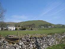
In Britain, "rural" is defined[9] by the government Department for Environment, Food and Rural Affairs (DEFRA), using population data from the latest census, such as the United Kingdom Census 2001. These definitions have various grades, but the upper point is any local government area with more than 26% of its population living in a rural settlement or market town ("market town" being defined as any settlement which has permission to hold a street market). A number of measures are in place to protect the British countryside, including green belts.
Rural health
In England an NHS patient is defined as rural if they live more than 1 mile (1.6 km) from either a doctor or a dispensing chemist. In Scotland a different definition of rural is used. This is important for defining whether the patient is expected to collect their own medicines. While doctors' surgeries in towns will not have a medicines dispensary instead expecting patients to use a high-street chemist to purchase their prescription medicines (in Scotland collection not purchase, as prescriptions are paid by the state), in rural village surgeries,[10] an NHS medicines dispensary will be built into the same building.
Asia
India
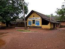
Rural areas are also known as the 'countryside' or a 'village' in India. It has a very low population density. In rural areas, agriculture is the chief source of livelihood along with fishing[11], cottage industries, pottery etc.
The quest to discover the real rural India still continues in great earnest. Almost every economic agency today has a definition of rural India. Here are a few definitions: According to the Planning Commission, a town with a maximum population of 15,000 is considered rural in nature. In these areas the panchayat makes all the decisions. There are five persons in the panchayat. The National Sample Survey Organisation (NSSO) defines ‘rural’ as follows:
- An area with a population density of up to 400 per square kilometer,
- Villages with clear surveyed boundaries but no municipal board,
- A minimum of 75% of male working population involved in agriculture and allied activities.[12]
RBI defines rural areas as those areas with a population of less than 49,000 (tier -3 to tier-6 cities).[12]
It is generally said that the rural areas house up to 70% of India’s population. Rural India contributes a large chunk to India’s GDP by way of agriculture, self-employment, services, construction etc. As per a strict measure used by the National Sample Survey in its 63rd round, called monthly per capita expenditure, rural expenditure accounts for 55% of total national monthly expenditure. The rural population currently accounts for one-third of the total Indian FMCG sales.[12]
Pakistan
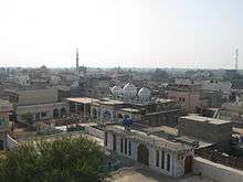
According to the 2017 census about 64% of Pakistanis live in rural areas. Most rural areas in Pakistan tend to be near cities, and are peri-urban areas, This is due to the definition of a rural area in Pakistan being an area that does not come within an urban boundary.[13] The remote rural villagers of Pakistan commonly live in houses made of bricks, clay or mud. Socioeconomic status among rural Pakistani villagers is often based upon the ownership of agricultural land, which also may provide social prestige in village cultures.[14] The majority of rural Pakistani inhabitants livelihoods is based upon the rearing of livestock, which also comprises a significant part of Pakistan's gross domestic product.[15] Some livestock raised by rural Pakistanis include cattle and goats.[16] However rural areas in Pakistan that are near cities are considered suburban areas or suburbs.
Human fertility
Rural residence is a fertility factor, with total fertility rates and pregnancy being higher among women in rural areas than among women in urban areas and the rural population is much younger than urban areas.[17]
See also
References
- ↑ "WordNet Search - 3.1". Wordnetweb.princeton.edu. Retrieved 2013-04-25.
- ↑ "Defining the Rural Population". Hrsa.gov. Retrieved 2013-04-25.
- ↑ Yen, Hope (2011-07-28). "Rural US Disappearing? Population Share Hits Low". Yahoo News. Associated Press. Retrieved 2016-01-07.
- 1 2 3 CRS Report for Congress: Agriculture: A Glossary of Terms, Programs, and Laws, 2005 Edition - Order Code 97-905 Archived 2011-02-12 at the Wayback Machine.
- 1 2 "Rural, Urban and Suburban Definitions". GreatData.com.
- ↑ What is Rural? Archived 2007-10-17 at the Wayback Machine. USDA, National Agricultural Library, Rural Information Center.
- ↑ Torio CM, Andrews RM (September 2014). "Geographic Variation in Potentially Preventable Hospitalizations for Acute and Chronic Conditions, 2005-2011". HCUP Statistical Brief #178. Rockville, MD: Agency for Healthcare Research and Quality.
- ↑ Chigbu, Uchendu Eugene (2012). "Village renewal as an instrument of rural development: evidence from Weyarn, Germany". Community Development. 43 (2): 209–224. doi:10.1080/15575330.2011.575231.
- ↑ "Local Authority Rural-Urban Classification". UK Government. 24 June 2011.
- ↑ "About Dispensing Practice". Dispensing Doctors' Association. Archived from the original on 1 April 2017.
- ↑ 林, 榮祥. "Greening the Blue: End Child Labour in Agriculture". Greening the Blue. Retrieved 24 July 2018.
- 1 2 3 "In Focus" (PDF). www.dhanbank.com. December 2010.
- ↑ Zaidi, S. Akbar (29 August 2017). "Rethinking urban and rural". Dawn.
- ↑ Knerr, Béatrice (Prof. Dr.). page 102.
- ↑ Knerr, Béatrice (Prof. Dr.). page 105.
- ↑ Knerr, Béatrice (Prof. Dr.). page 106.
- ↑ Rai, Piyush Kant; Pareek, Sarla; Joshi, Hemlata (2013). "Regression Analysis of Collinear Data using r-k Class Estimator: Socio-Economic and Demographic Factors Affecting the Total Fertility Rate (TFR) in India" (PDF). Journal of Data Science. 11.
Further reading
- "Definitions of Rural: A Handbook for Health Policy Makers and Researchers" (PDF). (6.12 MB) Thomas C. Ricketts, Karen D. Johnson-Webb, Patricia Taylor. Chapel Hill: North Carolina Rural Health Research Program, Cecil G. Sheps Center for Health Services Research, University of North Carolina, 1998. 13 p.
External links
| Wikimedia Commons has media related to Countryside. |
| Wikiquote has quotations related to: Country life |
| Look up rural or countryside in Wiktionary, the free dictionary. |