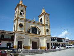
La Unión, Antioquia
Coordinates: 5°58′25″N 75°21′41″W / 5.97361°N 75.36139°W
| La Unión, Antioquia | |||
|---|---|---|---|
| Municipality and town | |||
 | |||
| |||
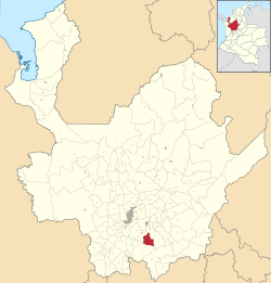 Location of the municipality and town of La Unión, Antioquia in the Antioquia Department of Colombia | |||
 La Unión, Antioquia Location in Colombia | |||
| Coordinates: 5°58′22″N 75°21′40″W / 5.97278°N 75.36111°W | |||
| Country |
| ||
| Department |
| ||
| Subregion | Eastern | ||
| Elevation | 2,500 m (8,200 ft) | ||
| Time zone | UTC-5 (Colombia Standard Time) | ||


La Unión is a town and municipality in the Colombian department of Antioquia. It is part of the subregion of Eastern Antioquia.
References
Capital: Medellín | |||||||||||||||||||
| Regions and municipalities |
| ||||||||||||||||||
| Related topics | |||||||||||||||||||
This article is issued from
Wikipedia.
The text is licensed under Creative Commons - Attribution - Sharealike.
Additional terms may apply for the media files.