Kvæfjord
| Kvæfjord kommune Giehtavuotna | |||
|---|---|---|---|
| Municipality | |||
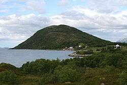 View of the island of Gapøya | |||
| |||
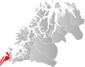 Kvæfjord within Troms | |||
| Coordinates: 68°42′07″N 16°08′49″E / 68.70194°N 16.14694°ECoordinates: 68°42′07″N 16°08′49″E / 68.70194°N 16.14694°E | |||
| Country | Norway | ||
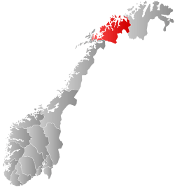
| County | Troms | ||
| District | Central Hålogaland | ||
| Established | 1 Jan 1838 | ||
| Administrative centre | Borkenes | ||
| Government | |||
| • Mayor (2011) | Torbjørn Larsen (Ap) | ||
| Area | |||
| • Total | 512.58 km2 (197.91 sq mi) | ||
| • Land | 497.24 km2 (191.99 sq mi) | ||
| • Water | 15.34 km2 (5.92 sq mi) 3% | ||
| Area rank | #207 in Norway | ||
| Population (2017) | |||
| • Total | 2,986 | ||
| • Rank | #265 in Norway | ||
| • Density | 6.0/km2 (16/sq mi) | ||
| • Change (10 years) | -2.0% | ||
| Demonym(s) | Kvæfjerding[1] | ||
| Time zone | UTC+01:00 (CET) | ||
| • Summer (DST) | UTC+02:00 (CEST) | ||
| ISO 3166 code | NO-1911 | ||
| Official language form | Neutral | ||
| Website |
kvafjord | ||

Kvæfjord (Northern Sami: Giehtavuotna) is a municipality in Troms county, Norway. It is part of the traditional region of Central Hålogaland. The administrative centre of the municipality is the village of Borkenes. Other villages include Hundstad, Langvassbukta, and Revsnes.
Together with Harstad, the two municipalities cover a large part of the island of Hinnøya in the southern part of the Troms county. Kvæfjord consists mostly of mountains and fjords. The municipality centers on the Kvæfjorden and Gullesfjorden.
Kvæfjord is also where the Norwegian national cake, Kvæfjord cake, originally comes from.
The 513-square-kilometre (198 sq mi) municipality is the 207th largest by area out of the 422 municipalities in Norway. Kvæfjord is the 265th most populous municipality in Norway with a population of 2,986. The municipality's population density is 6 inhabitants per square kilometre (16/sq mi) and its population has decreased by 2% over the last decade.[2]
General information

Kvæfjord was established as a municipality on 1 January 1838 (see formannskapsdistrikt). On 25 October 1956, a part of Kvæfjord (population: 32) was transferred to neighboring Trondenes municipality. On 1 January 2000, the part of Kvæfjord that surrounded the Godfjorden (population: 102) was transferred from Kvæfjord to Sortland municipality (in neighboring Nordland county).[3]
Name
The municipality is named after the fjord (Old Norse: Kviðjufjǫrðr). The first element is the genitive case of the name of the island Kviðja (now Kvæøya) and the last element is fjǫrðr which means "fjord". The name of the island might be derived from the word kviðr which means "belly" or "stomach". Prior to 1889, the name was spelled Kvædfjord.[4]
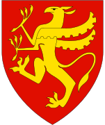
Coat of arms
The coat of arms is from modern times; they were granted on 4 April 1986. The green arms show a yellow strawberry plant. The symbolism of the color and the plant is that the main source of income in the municipality is agriculture, and it is also the northernmost village in Norway where strawberries can grow.[5]
Churches
The Church of Norway has one parish (sokn) within the municipality of Kvæfjord. It is part of the Trondenes prosti (deanery) in the Diocese of Nord-Hålogaland.
| Parish (Sokn) | Church Name | Location of the Church | Year Built |
|---|---|---|---|
| Kvæfjord | Kvæfjord Church | Borkenes | 1867 |
| Langvassbukt Chapel | Langvassbukta | 1981 |
Economy
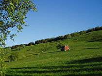
The municipality is known for agriculture and farming. The quality of the strawberries is famous. The long hours of daylight, combined with relatively low summer temperatures, make the strawberries more tasteful than berries grown in warmer climates.
A large institution for the mentally handicapped was once located in Kvæfjord. It employed a large number of health workers.
Geography
The municipality is located on Hinnøya island and it is split by three smaller branches of the large Andfjorden: Gullesfjorden, Kvæfjorden, and Godfjorden. The island of Kvæøya is located in the middle of the Kvæfjorden, across from Borkenes.
The landscape of today was largely formed during the last ice age. When the ice retreated, the terrain rose by 50 metres (164 ft). It is in this belt of old seabed that today's best farm land is located. There are four county roads connecting the municipality: two to the north and one each to the east and south. The 412-metre (1,352 ft) tall mountain Nupen is located in the northern part of the municipality on the border with Harstad.
Climate
| Climate data for Borkenes, Kvæfjord | |||||||||||||
|---|---|---|---|---|---|---|---|---|---|---|---|---|---|
| Month | Jan | Feb | Mar | Apr | May | Jun | Jul | Aug | Sep | Oct | Nov | Dec | Year |
| Average high °C (°F) | −0.5 (31.1) |
−0.3 (31.5) |
1.6 (34.9) |
4.3 (39.7) |
9.0 (48.2) |
13.3 (55.9) |
15.6 (60.1) |
15.0 (59) |
10.8 (51.4) |
6.4 (43.5) |
2.3 (36.1) |
0.4 (32.7) |
6.5 (43.7) |
| Daily mean °C (°F) | −2.8 (27) |
−2.5 (27.5) |
−1.0 (30.2) |
1.9 (35.4) |
6.4 (43.5) |
10.2 (50.4) |
12.6 (54.7) |
12.1 (53.8) |
8.3 (46.9) |
4.3 (39.7) |
0.4 (32.7) |
−1.9 (28.6) |
4.0 (39.2) |
| Average low °C (°F) | −5.2 (22.6) |
−5.0 (23) |
−3.6 (25.5) |
−1.0 (30.2) |
3.1 (37.6) |
7.2 (45) |
9.7 (49.5) |
9.0 (48.2) |
5.6 (42.1) |
1.9 (35.4) |
−1.9 (28.6) |
−4.2 (24.4) |
1.3 (34.3) |
| Average precipitation mm (inches) | 81 (3.19) |
74 (2.91) |
59 (2.32) |
47 (1.85) |
33 (1.3) |
40 (1.57) |
51 (2.01) |
56 (2.2) |
82 (3.23) |
109 (4.29) |
94 (3.7) |
94 (3.7) |
820 (32.28) |
| Average precipitation days (≥ 1 mm) | 12.6 | 12.4 | 10.6 | 9.9 | 7.9 | 9.2 | 11.0 | 11.6 | 14.3 | 16.3 | 13.9 | 15.0 | 144.7 |
| Source: Norwegian Meteorological Institute[6] | |||||||||||||
Government
All municipalities in Norway, including Kvæfjord, are responsible for primary education (through 10th grade), outpatient health services, senior citizen services, unemployment and other social services, zoning, economic development, and municipal roads. The municipality is governed by a municipal council of elected representatives, which in turn elect a mayor.[7] The municipality falls under the Trondenes District Court and the Hålogaland Court of Appeal.
Municipal council
The municipal council (Kommunestyre) of Kvæfjord is made up of 23 representatives that are elected to four year terms. Currently, the party breakdown is as follows:[8]
| Party Name | Name in Norwegian | Number of representatives | |
|---|---|---|---|
| Labour Party | Arbeiderpartiet | 9 | |
| Progress Party | Fremskrittspartiet | 3 | |
| Conservative Party | Høyre | 2 | |
| Centre Party | Senterpartiet | 4 | |
| Socialist Left Party | Sosialistisk Venstreparti | 2 | |
| Liberal Party | Venstre | 3 | |
| Total number of members: | 23 | ||
References
- ↑ "Navn på steder og personer: Innbyggjarnamn" (in Norwegian). Språkrådet. Retrieved 2015-12-01.
- ↑ Statistisk sentralbyrå (2017). "Table: 06913: Population 1 January and population changes during the calendar year (M)" (in Norwegian). Retrieved 2017-09-09.
- ↑ Jukvam, Dag (1999). "Historisk oversikt over endringer i kommune- og fylkesinndelingen" (PDF) (in Norwegian). Statistisk sentralbyrå.
- ↑ Rygh, Oluf (1911). Norske gaardnavne: Troms amt (in Norwegian) (17 ed.). Kristiania, Norge: W. C. Fabritius & sønners bogtrikkeri. p. 1.
- ↑ "Civic heraldry of Norway - Norske Kommunevåpen". Heraldry of the World. Retrieved 2018-09-02.
- ↑ "eKlima Web Portal". Norwegian Meteorological Institute. Archived from the original on 2004-06-14.
- ↑ Hansen, Tore, ed. (2016-05-12). "kommunestyre". Store norske leksikon (in Norwegian). Kunnskapsforlaget. Retrieved 2018-09-02.
- ↑ "Table: 04813: Members of the local councils, by party/electoral list at the Municipal Council election (M)" (in Norwegian). Statistics Norway.
External links
- Municipal fact sheet from Statistics Norway (in Norwegian)


| |||||||||
| |||||||||
| |||||||||
| Authority control |
|---|