Kuils River
| Kuilsrivier | |
|---|---|
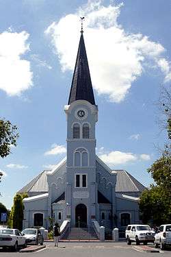 Dutch Reformed Church, Kuilsrivier | |
 Kuilsrivier | |
|
Location within Cape Town  Kuilsrivier  Kuilsrivier Kuilsrivier (South Africa)  Kuilsrivier Kuilsrivier (Africa) | |
| Coordinates: 33°56′29″S 18°42′24″E / 33.9414°S 18.7066°ECoordinates: 33°56′29″S 18°42′24″E / 33.9414°S 18.7066°E | |
| Country | South Africa |
| Province | Western Cape |
| Municipality | City of Cape Town |
| Established | 1898 |
| Area[1] | |
| • Total | 39.86 km2 (15.39 sq mi) |
| Population (2011)[1] | |
| • Total | 46,686 |
| • Density | 1,200/km2 (3,000/sq mi) |
| Racial makeup (2011)[1] | |
| • Black African | 11.4% |
| • Coloured | 53.1% |
| • Indian/Asian | 0.9% |
| • White | 32.6% |
| • Other | 1.9% |
| First languages (2011)[1] | |
| • Afrikaans | 60.2% |
| • English | 33.2% |
| • Xhosa | 3.2% |
| • Other | 3.4% |
| Time zone | UTC+2 (SAST) |
| Postal code (street) | 7580 |
| PO box | 7579 |
Kuils River (Afrikaans: Kuilsrivier) is a town in the Western Cape, South Africa, 25 km (15 miles) east of Cape Town.
Origin
Originally named De Boss, Kuils River was a refreshment post of the Dutch East India Company in 1680, also known as de Kuijlen. In 1700 the farm Leeuwenhof and other parts of de Kuijlen were sold to Olof Bergh.
Developments during the 19th and 20th century
It started to developed into a village. A church was founded by Rhenish Missionary Society in 1843 in Sarepta. A proper road was built in 1845, a railway station in 1862 and a school in 1898. In 1898 stands were sold for residential development. On 4 December 1950 it attained municipal status. The town takes its name from the nearby river, in which there are many pools, or kuile (Kuile is the Dutch word for dams).[2] [3]
Administration and location
Kuils River is a level two administrative region, and is close to Cape Town's wine routes.[4] It is located near the intersection of the M12 and the R102.[5]
Kuils River is home to the Alta du Toit School for mentally handicapped children.[6] and is the birthplace of Herman Charles Bosman (3 February 1905); journalist, poet and author. He is regarded as one of South Africa's greatest writers (in English).[7]
Coat of arms
Kuils River was a municipality from 1950 to 1996. The town council assumed a coat of arms, designed by Ivan Mitford-Barberton, in 1955 and registered it with the Cape Provincial Administration in January 1956.[8]
The shield was divided into three horizontal sections: (1) a running buck on a silver background, (2) a golden yoke on a red background, and (3) four silver and blue stripes with wavy edges. The crest was a bull's head, and the motto Via trita via tuta.
References
- 1 2 3 4 "Main Place Kuilsrivier". Census 2011.
- ↑ "Dictionary of Southern African Place Names (Public Domain)". Human Science Research Council. p. 265.
- ↑ Vermaak, A. L. "die geskiedenis van Kuilsrivier 1652-1905(translated: the history of Kuilsrivier 1652-1905\". Retrieved 30 April 2018.
- ↑ Kuils River website
- ↑ Kuils River Satellite Map
- ↑ altadutoit.com
- ↑ Herman Charles Bosman biography
- ↑ Cape of Good Hope Official Gazette 2793 (13 January 1956).
.svg.png)