Flinders Park, South Australia
| Flinders Park Adelaide, South Australia | |||||||||||||||
|---|---|---|---|---|---|---|---|---|---|---|---|---|---|---|---|
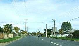 Holbrooks Road | |||||||||||||||
| Population |
4,631 (2011 census)[1] 4,368 (2006 Census)[2] | ||||||||||||||
| Postcode(s) | 5025[3] | ||||||||||||||
| Location | 5.3 km (3 mi) NW of Adelaide city centre[3] | ||||||||||||||
| LGA(s) | City of Charles Sturt[4] | ||||||||||||||
| State electorate(s) | West Torrens | ||||||||||||||
| Federal Division(s) | Hindmarsh (2011)[5] | ||||||||||||||
| |||||||||||||||
Flinders Park is a western suburb of Adelaide, South Australia. It is located in the City of Charles Sturt.
History
The suburb is named after explorer Matthew Flinders, with many of its streets bearing the names of famous explorers.
Geography
Flinders Park is bound by Grange Road to the north, the River Torrens to the south, Findon Rd to the west and Holbrooks Rd to the east.[6]
Demographics
The 2011 Census by the Australian Bureau of Statistics counted 4,631 persons in Flinders Park on census night. Of these, 49.0% were male and 51.0% were female.[1]
The majority of residents (72.2%) are of Australian birth, with other common census responses being Italy (5.7%), Greece (2.4%) and India (2.0%).[1]
The age distribution of Flinders Park residents is skewed slightly higher than the greater Australian population. 69.9% of residents were over 25 years in 2011, compared to the Australian average of 67.4%; and 30.1% were younger than 25 years, compared to the Australian average of 32.6%.[1]
Politics
Local government
Flinders Park is part of Beverley Ward in the City of Charles Sturt local government area, being represented in that council by Edgar Agius and Mick Harley.[4]
State and federal
Flinders Park lies in the state electoral district of Croydon[7] and the federal electoral division of Hindmarsh.[5] The suburb is represented in the South Australian House of Assembly by Michael Atkinson[7] and federally by Matt Williams.[5]
Community
Schools
Flinders Park Primary School, a government school, is located on Holbrooks Road.[8] Additionally, a newly created R-12 co-ed Catholic school, Nazareth Catholic College, was formed in 2007 following the merger of three local Catholic primary schools (Cardinia (Flinders Park), Mater Christi (Seaton) and Our Lady of the Manger (Findon)), and girls' secondary school (Siena College, Findon). The primary campus is located on the site of the former Our Lady of the Manger and Siena schools, while the secondary campus is located on Holbrooks Road at Flinders Park, adjacent the River Torrens.
Facilities and attractions
Parks
The largest greenspace in the suburb is Torrens Linear Park, lying along the River Torrens. The reserve of Flinders Park is located between Hartley Road and Flinders Parade. Other small reserves lie between Ross and Scott avenues and between Bass Place and Grant Place.[6]
Football Club
The pride of the suburb is the Flinders Park Football Club located on Hartley Road. The team colours are Red, Gold and Blue. The club also fields a cricket team in the summer months.
Netball Club
Associated with the football club, the Flinders Park Netball Clubs enters teams in the Open Women's competitions at SAUCNA.
Transportation
Roads
Flinders Park is serviced by Grange Road, linking the suburb to Adelaide city centre and the coast, and by Findon Road, which forms its western boundary. Holbrooks Road divides the east of the suburb.[6]
Public transport
Flinders Park is serviced by public transport run by the Adelaide Metro.[9]
Buses
The suburb is serviced by buses run by the Adelaide Metro.[9]
See also
| Wikimedia Commons has media related to Flinders Park, South Australia. |
References
- 1 2 3 4 Australian Bureau of Statistics (31 October 2012). "Flinders Park (State Suburb)". 2011 Census QuickStats. Retrieved 11 July 2013.

- ↑ Australian Bureau of Statistics (9 March 2006). "Flinders Park (State Suburb)". 2001 Census QuickStats. Retrieved 11 July 2013.
- 1 2 "Flinders Park, South Australia (Adelaide)". Postcodes-Australia. Postcodes-Australia.com. Retrieved 5 June 2011.
- 1 2 "City of Charles Sturt Wards and Council Members" (PDF). City of Charles Sturt. Archived from the original (PDF) on 5 August 2011. Retrieved 5 June 2011.
- 1 2 3 "Find my electorate: Hindmarsh". Australian Electoral Commission. Archived from the original on 30 September 2011. Retrieved 5 June 2011.
- 1 2 3 Adelaide and surrounds street directory (47th ed.). UBD. 2009. ISBN 978-0-7319-2336-6.
- 1 2 "Electoral Districts - Electoral District for the 2010 Election". Electoral Commission SA. Archived from the original on 22 August 2011. Retrieved 5 June 2011.
- ↑ "Australian Schools Directory". Australian Schools Directory. Retrieved 5 June 2011.
- 1 2 "Public Transport in Adelaide". Adelaide Metro official website. Dept. for Transport, Energy and Infrastructure, Public Transport Division. Archived from the original on 26 April 2011. Retrieved 5 June 2011.
External links
- "City of Charles Sturt". Official website. City of Charles Sturt. Retrieved 5 June 2011.