Kawachi, Ibaraki
| Kawachi 河内町 | |||
|---|---|---|---|
| Town | |||
 Kawachi town hall | |||
| |||
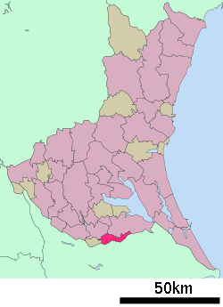 Location of Kawachi in Ibaraki Prefecture | |||
 Kawachi | |||
| Coordinates: 35°53′5.1″N 140°14′40.2″E / 35.884750°N 140.244500°ECoordinates: 35°53′5.1″N 140°14′40.2″E / 35.884750°N 140.244500°E | |||
| Country | Japan | ||
| Region | Kantō | ||
| Prefecture | Ibaraki Prefecture | ||
| District | Inashiki | ||
| Area | |||
| • Total | 44.30 km2 (17.10 sq mi) | ||
| Population (September 2015) | |||
| • Total | 9,126 | ||
| • Density | 206/km2 (530/sq mi) | ||
| Time zone | UTC+9 (Japan Standard Time) | ||
| - Tree | Zelkova serrata | ||
| - Flower | Hydrangea macrophylla | ||
| - Bird | Eurasian skylark | ||
| Phone number | 0297-84-2111 | ||
| Address | 1183 Genseida, Kawachi-machi, Inashiki-gun, Ibaraki-ken 300-1392 | ||
| Website | http://www.town.ibaraki-kawachi.lg.jp/ | ||


Kawachi (河内町 Kawachi-machi) is a town located in Ibaraki Prefecture, Japan. As of September 2015, the town had an estimated population of 9,126, and a population density of 206 persons per km². Its total area is 44.30 km².
Geography
Located in extreme southern Ibaraki Prefecture bordering Chiba Prefecture, Kawachi is long and narrow east-west, and bordered by the Tone River and Shin-Tone River.
Surrounding municipalities
History
The villages of Nagasao, Genseida, and Mamaita were created with the establishment of the municipalities system on April 1, 1889. The three villages were merged to form the village of Kawachi on April 1, 1955. On February 15, 1958, the neighboring village of Kanaetsu was annexed to Kawachi.
Education
- Kawachi has three elementary schools and two middle schools.
Transportation
Railway
Highway
External links
![]()
- Official Website (in Japanese)
| Special cities | ||
|---|---|---|
| Cities | ||
| Districts | ||
This article is issued from
Wikipedia.
The text is licensed under Creative Commons - Attribution - Sharealike.
Additional terms may apply for the media files.