Hitachiōmiya
| Hitachiōmiya 常陸大宮市 | |||
|---|---|---|---|
| City | |||
 Hitachiōmiya city hall | |||
| |||
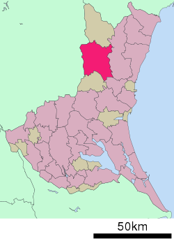 Location of Hitachiōmiya in Ibaraki Prefecture | |||
 Hitachiōmiya | |||
| Coordinates: 36°32′33.1″N 140°24′39.2″E / 36.542528°N 140.410889°ECoordinates: 36°32′33.1″N 140°24′39.2″E / 36.542528°N 140.410889°E | |||
| Country | Japan | ||
| Region | Kantō | ||
| Prefecture | Ibaraki Prefecture | ||
| Area | |||
| • Total | 348.45 km2 (134.54 sq mi) | ||
| Population (September 2015) | |||
| • Total | 42,438 | ||
| • Density | 122/km2 (320/sq mi) | ||
| Time zone | UTC+9 (Japan Standard Time) | ||
| Tree | Sakura | ||
| Flower | Rose | ||
| Bird | Common kingfisher | ||
| Phone number | 0295-52-1111 | ||
| Address | 3135-6 Nakatomi-chō, Hitachiōmiya-shi, Ibaraki-ken 319-2292 | ||
| Website | http://www.city.hitachiomiya.lg.jp/ | ||


Hitachiōmiya (常陸大宮市 Hitachiōmiya-shi) is a city located in Ibaraki Prefecture, Japan. As of September 2015, the city had an estimated population of 42,438, and a population density of 122 persons per km2. Its total area is 348.45 square kilometres (134.54 sq mi).
Geography
Hitachiōmiya is located in northeastern Ibaraki Prefecture, bordered by Tochigi Prefecture to the west. The Naka River and the Kuji River flows through the city.
Surrounding municipalities
- Ibaraki Prefecture
- Tochigi Prefecture
History
The town of Ōmiya was created within Naka District with the establishment of the municipalities system on April 1, 1889. The city of Hitachiōmiya was established on October 16, 2004, from the merger of Ōmiya with the neighboring the villages of Miwa and Ogawa (all from Naka District), the town of Yamagata, and the village of Gozenyama (both from Higashiibaraki District).
Education
Hitachiōmiya has 11 elementary schools, five middle schools, and two high schools.
Transportation
Railway
Highway
Notable people from Hitachiōmiya
- Miho Shiraishi – actress
- Dōmei Yakazu – physician
External links
![]()
- Official Website (in Japanese)
| Special cities | ||
|---|---|---|
| Cities | ||
| Districts | ||
| Authority control |
|---|