Namegata, Ibaraki
| Namegata 行方市 | |||
|---|---|---|---|
| City | |||
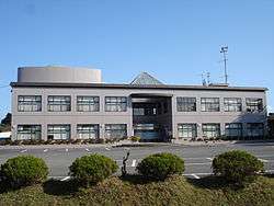 Namegata city hall | |||
| |||
 Location of Namegata in Ibaraki Prefecture | |||
 Namegata | |||
| Coordinates: 35°59′25.8″N 140°29′20.5″E / 35.990500°N 140.489028°ECoordinates: 35°59′25.8″N 140°29′20.5″E / 35.990500°N 140.489028°E | |||
| Country | Japan | ||
| Region | Kantō | ||
| Prefecture | Ibaraki Prefecture | ||
| Area | |||
| • Total | 222.48 km2 (85.90 sq mi) | ||
| Population (September 2015) | |||
| • Total | 34,928 | ||
| • Density | 157/km2 (410/sq mi) | ||
| Time zone | UTC+9 (Japan Standard Time) | ||
| Tree | Ginkgo biloba | ||
| Flower | Lilium auratum | ||
| Bird | Egret | ||
| Phone number | 0299-72-0811 | ||
| Address | Aso 1561-9, Namegat-shi, Ibaraki-ken 311-3892 | ||
| Website | http://www.city.namegata.ibaraki.jp/ | ||


Namegata (行方市 Namegata-shi) is a city located in Ibaraki Prefecture, Japan. As of September 2015, the city had an estimated population of 34,928, and a population density of 157 persons per km2. Its total area is 222.48 square kilometres (85.90 sq mi).
Geography
Namegata is located in south-central Ibaraki Prefecture, bordered by Lake Kasumigaura to the east and west. It is located approximately 70 kilometers from central Tokyo.
Surrounding municipalities
- Ibaraki Prefecture
History
During the Edo period, portions of what later became the city of Namegata were under the control of Asō Domain, a feudal domain under the Tokugawa shogunate. The towns of Asō and Tamazukuri were created with the establishment of the municipalities system on April 1, 1889. The village of Kitaura was established on April 1, 1955, and elevated to town status on October 1, 1997. The three towns merged to form the city of Namegata on September 2, 2005.
Economy
The economy of Namegata is primarily agriculture, with aquaculture on Lake Kasumigaura taking a predominant role.
Education
Namegata has 18 elementary schools, five middle schools, and two high schools.
Transportation
Railway
- Namegata does not have any commercial passenger rail service.
Highway
Noted people from Namegata
- Hiromi Nagasaku – actress, singer
- Fukushiro Nukaga – politician
- Hideaki Ozawa – professional football player
External links
| Wikimedia Commons has media related to Namegata, Ibaraki. |
- Official website (in Japanese)
| Special cities | ||
|---|---|---|
| Cities | ||
| Districts | ||