Kōzaki
| Kōzaki 神崎町 | |||
|---|---|---|---|
| Town | |||
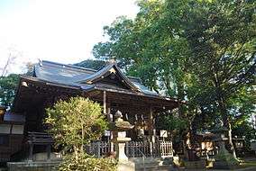 Kozaki Shrine | |||
| |||
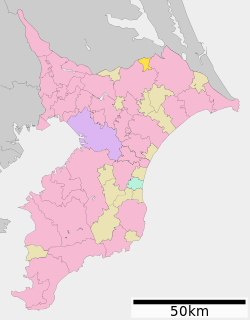 Location of Kōzaki in Chiba Prefecture | |||
 Kōzaki | |||
| Coordinates: 35°54′N 140°24′E / 35.900°N 140.400°ECoordinates: 35°54′N 140°24′E / 35.900°N 140.400°E | |||
| Country | Japan | ||
| Region | Kantō | ||
| Prefecture | Chiba Prefecture | ||
| District | Katori | ||
| Area | |||
| • Total | 19.85 km2 (7.66 sq mi) | ||
| Population (April 2012) | |||
| • Total | 6,415 | ||
| • Density | 323/km2 (840/sq mi) | ||
| Time zone | UTC+9 (Japan Standard Time) | ||
| City symbols | |||
| • Tree | Cinnamomum camphora | ||
| • Flower | Rose | ||
| • Bird | Japanese white-eye | ||
| Phone number | 0478(72)2111 | ||
| Address | 163 Honjuku. Katori-gun, Kōzaki-machi, Chiba-ken 289-0292 | ||
| Website | http://www.town.kozaki.chiba.jp/ | ||


Kōzaki (神崎町 Kōzaki-machi) is a town located in Chiba Prefecture, Japan. As of April 2012, the town had an estimated population of 6,415, and a population density of 323 persons per km2. The total area is 19.85 square kilometres (7.66 sq mi).[1]
Etymology
The name of the town of Kōzaki in the Japanese language is formed from two kanji characters. The first, 神, means kami, the Japanese term for god, spirit, or a natural force; and the second, 崎 means "cape" or "small peninsula".
Geography
Kōzaki is located in far northern Chiba Prefecture. The town faces the Tone River to the north, and sits on the lowlands of the river to the north and the Shimōsa Plateau to the south. Kōzaki is part of Ōtone Prefectural Natural Park.[1]
Neighboring municipalities
History
Kōzaki was historically part of Shimōsa Province until the formation of Chiba Prefecture at the beginning of the Meiji Period (1868 – 1912). Kōzaki and Yonezawa villages were founded on April 1, 1889 within Katori District of Chiba Prefecture. Kōzaki was elevated to town status on March 12, 1890. On January 5, 1955, old Kōzaki and Yonezawa merged into new and expanded town of Kōzaki.[1]
Economy
Kōzaki is a regional commercial center with some light manufacturing industries.
Transportation
Railway
Highway
| Wikimedia Commons has media related to Kozaki, Chiba. |
References
External links
- Official Website (in Japanese)
| Wards of Chiba | ||
|---|---|---|
| Core cities | ||
| Cities | ||
| Districts | ||