Kallakoopah Creek
| Kallakoopah | |
| Creek | |
| Country | Australia |
|---|---|
| State | South Australia |
| Region | Far North |
| Part of | Lake Eyre Basin |
| Source | Mount Gason |
| - elevation | 17 m (56 ft) |
| Mouth | Warburton River |
| - elevation | −5 m (−16 ft) |
| - coordinates | 27°29′S 138°15′E / 27.483°S 138.250°ECoordinates: 27°29′S 138°15′E / 27.483°S 138.250°E |
| Length | 353 km (219 mi) |
| Waterholes | Dunchadunchadinna, Kuncherinna, Anarowdinna, Kalanchadinna, Murdawadinna and Muckratuckaalinna |
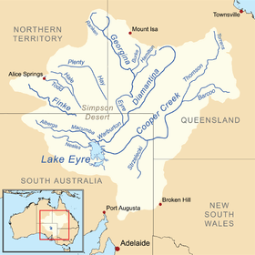 Map of the Lake Eyre Basin showing the Warburton River | |
| [1] | |
The Kallakoopah Creek, part of the Lake Eyre basin, is a watercourse located in the southern part of the Simpson Desert in the Australian state of South Australia. It is an anabranch of Warburton Creek.[2]
See also
References
- ↑ "Map of Kallakoopah Creek, SA". Bonzle Digital Atlas of Australia. Retrieved 26 April 2017.
- ↑ Rothwell, Nicolas (18 August 2007). "Found: the secret river in the nation's parched desert". The Australian. Retrieved 2007-08-19.
This article is issued from
Wikipedia.
The text is licensed under Creative Commons - Attribution - Sharealike.
Additional terms may apply for the media files.