Officer Creek
| Officer | |
| Creek | |
| Country | Australia |
|---|---|
| State | South Australia |
| Region | Far North |
| Part of | Lake Eyre Basin |
| Tributaries | |
| - left | Wallinna (Apayatiyanya) Creek |
| - right | Currie (Aliwanyiwanyinya) Creek |
| Settlement | Kaltjiti |
| Source | Musgrave Ranges |
| - elevation | 619 m (2,031 ft) |
| Mouth | Warburton River |
| - elevation | 388 m (1,273 ft) |
| - coordinates | 27°40′S 132°19′E / 27.667°S 132.317°ECoordinates: 27°40′S 132°19′E / 27.667°S 132.317°E |
| Length | 200 km (124 mi) |
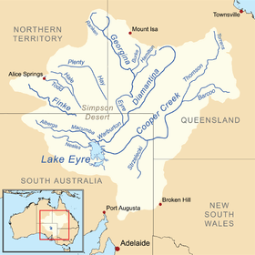 Map of the Lake Eyre Basin showing Warburton River | |
| [1] | |
The Officer Creek, part of the Lake Eyre basin, is an ephemeral watercourse located in the Far North region in the Australian state of South Australia.
The creek rises in the Musgrave Ranges and flows through the Aboriginal community of Kaltjiti in the Anangu Pitjantjatjara Yankunytjatjara Lands. With the Ammaroodinna and Currie Creeks, the creek empties into the Warburton River.
Officer Creek is usually a dry sandy bed and only flows at times of very high rainfall.
History
In September 1873 during his second trip into the South Australian interior, Ernest Giles and another party member, William Tietkens, encountered 200 male Aborigines. The Europeans fired shots, allegedly in retaliation for the throwing of spears. The Europeans escaped unharmed - there is no mention of Aboriginal casualties. Giles later acknowledged that Aboriginal aggression was usually due to white trespass on black land. Giles named the river where this occurred "The Officer", by which it was known until the 1930s when it was renamed Officer Creek.[2] Officer Creek took its name from the surname of one of the donors towards Giles' expedition that he wished to honour in that way.[3]
See also
References
- ↑ "Map of Officer Creek, SA". Bonzle Digital Atlas of Australia. Retrieved 26 April 2017.
- ↑ South Australian Department of Primary Industry and Resources
- ↑ Gara, Tom. "Reference : Doggers in the North West" (PDF). Archived from the original (PDF) on 28 September 2007. Retrieved 6 July 2007.
External links
- "Warburton Basin" (PDF) (Map). Bureau of Rural Sciences. Australian Government. Retrieved 2007-07-06.