Gawler River (South Australia)
| Gawler | |
| Mette Watte[1] | |
| River | |
 | |
| Country | Australia |
|---|---|
| State | South Australia |
| Region | Mid North |
| District | Adelaide Plains |
| Towns | Gawler, Angle Vale, Virginia |
| Source confluence | South Para River and North Para River |
| - location | Gawler |
| - elevation | 52 m (171 ft) |
| Mouth | Gulf St Vincent |
| - location | between Port Gawler and Buckland Park |
| - elevation | 0 m (0 ft) |
| - coordinates | 34°40′30″S 138°28′25″E / 34.6750°S 138.4737°ECoordinates: 34°40′30″S 138°28′25″E / 34.6750°S 138.4737°E |
| Length | 41 km (25 mi) |
| Discharge | for Port Gawler |
| - average | 10 m3/s (353 cu ft/s) |
| National park | Adelaide International Bird Sanctuary |
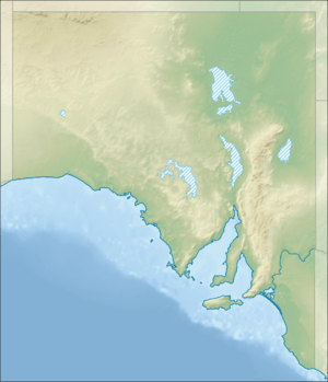 Location of the river mouth in South Australia | |
| [2] | |
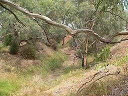
The Gawler River is a river located in the Adelaide Plains district of the Mid North region in the Australian state of South Australia.
The district surrounding the river produces cereal crops and sheep for both meat and wool, as well as market gardens, almond orchards and vineyards.
Course and features
Formed by the confluence of the North Para and South Para Rivers in the town of Gawler, the river flows generally west onto the Adelaide Plains. The mouth is in the Adelaide International Bird Sanctuary National Park—Winaityinaityi Pangkara, which consists primarily of mangroves in the tidal flats as the river empties into Gulf St Vincent. The outflow represents the boundary between the suburbs of Port Gawler on the northern bank and Buckland Park on the southern bank. The river descends 50 metres (160 ft) over its 41-kilometre (25 mi) course.[2]
Flooding
The Gawler is subject to periodic flood events and the cause of occasional flash flooding (during 1:10 to 1:50 year flood events). Major overtopping in large floods occurs along much of the river length. Significant flooding commences within Gawler township from both the North and South Para Rivers.[3]
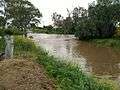
Angle Vale
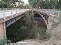
 Angle Vale Bridge
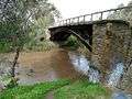 September 2010
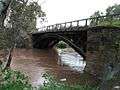 September 2016
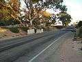
 Heaslip Road Bridge
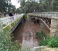 September 2016
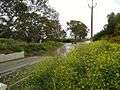
Baker Road ford, Virginia
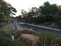
September 2016[4]

See also
References
| Wikimedia Commons has media related to Gawler River. |
- ↑ "Placename Details: Mette Watte". Property Location Browser. Land Services, Government of South Australia. 4 January 2011. SA0000252. Retrieved 29 February 2016.
- 1 2 "Map of Gawler River, SA". Bonzle Digital Atlas of Australia. Retrieved 25 March 2017.
- ↑ Australian Water Environments (15 September 2015). "Gawler River Floodplain Mapping Report" (PDF). Gawler River Floodplain Management Authority. Retrieved 25 March 2017.
- ↑ "SA weather: Gawler flooding in wake of severe storms as river levels peak". ABC News. abc.net.au. 30 September 2016. Retrieved 2017-04-15.