Kale, Kayin State
| Kale ခလယ် | |
|---|---|
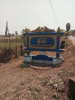 Signboard of Kha Lel or Kale | |
 Kale Location in Myanmar | |
| Coordinates: 16°5′46″N 97°53′56″E / 16.09611°N 97.89889°ECoordinates: 16°5′46″N 97°53′56″E / 16.09611°N 97.89889°E | |
| Country |
|
| State |
|
| District | Kawkareik District |
| Township | Kyain Seikgyi Township |
| Elevation | 18 m (59 ft) |
| Population (2014) | 5,355[1] |
| • Religions | Buddhism |
| Time zone | UTC+6.30 (MST) |
| Postal code | 170764 |
| Area code(s) | 58[2] |
| WOEID | 1017440 |
Kale[3] (S'gaw Karen: ခၠိုင့်; Burmese: ခလယ် [kʰa̰ lɛ], also spelled Kha Lel or Khale)[4] is a large village in Kyain Seikgyi Township, Kawkareik District, in the Kayin State of Myanmar.[5] According to 2014 Myanmar Census, the total population in Kale is 5,355.[1] The Kha Lel village tract contains 5 villages and in 2014, it had a total population of 8,869 people.[6]
People from Kale
References
- 1 2 Census Report. The 2014 Myanmar Population and Housing Census. 2. Naypyidaw: Ministry of Immigration and Population. May 2015. p. 51.
- ↑ "Myanmar Area Codes". Retrieved 2009-04-10.
- ↑ "Kale (Approved)" Kale, Kayin State at GEOnet Names Server, United States National Geospatial-Intelligence Agency
- ↑ "Township Map of Kyainseikgyi" (PDF). Myanmar Information Management Unit (MIMU). 3 May 2016. Retrieved 22 November 2017.
- ↑ "Burma 1:250,000 topographic map, Series U542, NE 47-14, Moulmein" U.S. Army May Service, December 1959
- ↑ OCHA Myanmar; Population – Census 2014 (excelfil) Retrieved 13 April 2017.
External links

- "Kale Map — Satellite Images of Kale" Maplandia World Gazetteer
|
Capital: Hpa-an | ||
| Hpa-an District | 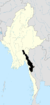 | |
| Hpapun District | ||
| Kawkareik District | ||
| Myawaddy District | ||
| Cities and towns | ||
This article is issued from
Wikipedia.
The text is licensed under Creative Commons - Attribution - Sharealike.
Additional terms may apply for the media files.