Paya-ngokto
| Paya-ngokto[1] | |
|---|---|
 Paya-ngokto[1] Location in Myanmar | |
| Coordinates: 15°54′0″N 98°9′0″E / 15.90000°N 98.15000°ECoordinates: 15°54′0″N 98°9′0″E / 15.90000°N 98.15000°E | |
| Country |
|
| State | Kayin State |
| District | Kawkareik District |
| Township | Kyain Seikgyi Township |
| Population | |
| • Religions | Buddhism |
| Time zone | UTC+6.30 (MST) |
| Area code(s) | 58[2] |
Paya-ngokto is a village in Kyain Seikgyi Township, Kawkareik District, in the Kayin State of Myanmar. It is located on the west bank of Zami River.
References
- 1 2 3 4 "Image: txu-oclc-6924198-nd47-2.jpg, (5000 × 3798 px)". lib.utexas.edu. Retrieved 2017-09-19.
- ↑ "Myanmar Area Codes". Retrieved 2009-04-10.
External links
- "Paya-ngokto Map — Satellite Images of Paya-ngokto" Maplandia World Gazetteer
|
Capital: Hpa-an | ||
| Hpa-an District | 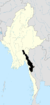 | |
| Hpapun District | ||
| Kawkareik District | ||
| Myawaddy District | ||
| Cities and towns | ||
This article is issued from
Wikipedia.
The text is licensed under Creative Commons - Attribution - Sharealike.
Additional terms may apply for the media files.