Hlaingbwe
| Hlaingbwe | |
|---|---|
| Town | |
 Hlaingbwe Location in Myanmar (Burma) | |
| Coordinates: 17°8′N 97°50′E / 17.133°N 97.833°ECoordinates: 17°8′N 97°50′E / 17.133°N 97.833°E | |
| Country |
|
| Division |
|
| District | Hpa-an District |
| Township | Hlaignbwe Township |
| Elevation | 56 ft (17 m) |
| Population (2014) | 11,511 |
| • Religions | Buddhism and Christianity |
| Time zone | UTC+6.30 (MMT) |
| Area code(s) | 58[1] |
Hlaingbwe (Mon: လိုၚ်ဗၟဲ, [làŋ plòa],S'gaw Karen: လူၢ်ပျဲၢ်, ; spelled "Loo ppleh") is a town in Kayin State, Myanmar, located on the Hlaingbwe River, which runs from north to south through the town. Most residents are from the Karen ethnic group.
References
- ↑ "Myanmar Area Codes". Retrieved 2009-04-10.
External links
Capital: Hpa-an | ||
| Hpa-an District | 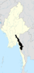 | |
| Hpapun District | ||
| Kawkareik District | ||
| Myawaddy District | ||
| Cities and towns | ||
This article is issued from
Wikipedia.
The text is licensed under Creative Commons - Attribution - Sharealike.
Additional terms may apply for the media files.