Jhorahat
| Jhorahat झोराहाट | |
|---|---|
| Village development committee | |
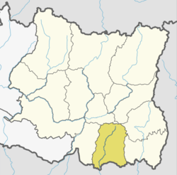
 Jhorahat Location in Nepal | |
| Coordinates: 26°31′08″N 87°19′44″E / 26.51889°N 87.32889°ECoordinates: 26°31′08″N 87°19′44″E / 26.51889°N 87.32889°E | |
| Country |
|
| Zone | Kosi Zone |
| District | Morang District |
| Population (2001) | |
| • Total | 4,844 |
| Time zone | UTC+5:45 (Nepal Time) |
| Postal code | 56615 |
| Area code(s) | 021 |
| Website |
ejhorahat |
Jhorahat is a village development committee in Morang District in the Kosi Zone of south-eastern Nepal. At the time of the 2001 Nepal census it had a population of 4844 people with 2457 male population and 2387 female population.[1]
Toponymy
The name of the village of Jhorahat is formed from jhora, which means "forest", and hat, which means "bazaar". The name is perhaps an indication that the place was settled by cutting down a forest present there hundreds of years ago.
Economy
Farming is the main source of income for people in Jhorahat, and it is an agricultural trade centre, being situated along a secondary road between Biratnagar and the east-west highway. Being only about 5 km from the outskirts of Biratnagar, some residents of the area work as laborers in factories in Biratnagar or some in higher ranks in various firms and government offices. There are some brick kilns in the countryside east of Jhorahat. Large haat or Bazaar is organised every Monday and Friday. This complements a number of much smaller haats held in surrounding villages.
Education
Janak Memorial Secondary Boarding School, Saradha Secondary Boarding School has been established for secondary level while for the higher secondary level education, Shree Sharaswoti Higher Secondary School, Sharaswati Higher Secondary School has been established. Janak Memorial Secondary Boarding School, Jhorahat-1 is one of the educational institution of Jhorahat established in 1991 A.D. Apart from these private school, Jhorahat has public school offering education up to class 12, Saraswati Higher Secondary school.
Ethnicity
The Brahmins and Chhetris mostly reside in the central area, while other communities such as Tharus, Musahars, Batars, Bhojpuri, Newars, Kamis, Damais also live in the scattered hamlets such as Khuniyakatta, Tetariya, Batrain, and Birta. Pidarboni in the north is a large village home predominantly to the Tharu community.
Politics
Nepali Congress stronghold after the democratic revolution of 1990. Jhorahat has now seen varying political consensus. Political parties like: Madhesi Jana Adhikar Forum, Nepal and Unified Communist Party of Nepal (Maoist) are uprising after the Constituent Assembly Election held in 2008. This area falls under Morang-6 constituency according to Election Commission of Nepal.
References
- ↑ "Nepal Census 2001". Nepal's Village Development Committees. Central Bureau of Statistics. Archived from the original on 23 July 2011. Retrieved 22 March 2011.