Interstate 395 (Connecticut–Massachusetts)
| |||||||||||||
|---|---|---|---|---|---|---|---|---|---|---|---|---|---|
|
I-395 highlighted in red | |||||||||||||
| Route information | |||||||||||||
| Auxiliary route of I‑95 | |||||||||||||
| Maintained by ConnDOT and MassDOT | |||||||||||||
| Length |
66.6 mi[1] (107.2 km)
| ||||||||||||
| Existed | 1983 – present | ||||||||||||
| Major junctions | |||||||||||||
| South end |
| ||||||||||||
| |||||||||||||
| North end |
| ||||||||||||
| Location | |||||||||||||
| Counties |
CT: New London, Windham MA: Worcester | ||||||||||||
| Highway system | |||||||||||||
| |||||||||||||
Interstate 395 (I-395) is an auxiliary Interstate Highway in the U.S. states of Connecticut and Massachusetts; it is maintained by the Connecticut Department of Transportation (ConnDOT) and the Massachusetts Department of Transportation (MassDOT). Spanning nearly 67 miles (108 km) on a south-north axis, it is the only spur route of Interstate 95 in Connecticut. The 36-mile (58 km) section between its splits from I-95 in East Lyme and Route 695 in Plainfield is a component highway of the Connecticut Turnpike. Within that state, the highway is named the American Ex-Prisoner of War Memorial Highway from Plainfield to Thompson.
The highway was first established as part of the Connecticut Turnpike in 1958, while the Route 52 designation was applied to the portion north of the turnpike in 1967. Route 52 was intended to become a southern extension of I-290, although the current designation of I-395 was ultimately assigned in 1983.[2]
Route description
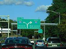
I-395 begins in East Lyme as the Connecticut Turnpike leaves I-95 as I-95 turns more easterly toward New London. It is a relatively rural interstate for most of its length. It passes through Waterford into Montville where it meets Route 2A at Exit 9. Eastbound Route 2A provides access to Mohegan Sun Casino, while westbound Route 2A duplexes with I-395 into Norwich, and ends at Exit 13, where it terminates as it joins its parent route, Route 2. After passing Route 2, I-395 bends to the east, and continues into Lisbon, Griswold, and Plainfield, where it bends more northerly and parallels Route 12 for most of the rest of its length. On the Plainfleld/Killingly town line, the Connecticut Turnpike splits to the east as unsigned SR 695 providing access to US 6 at the Rhode Island state line. I-395 continues north, and meets US 6 in Killingly. After crossing into Putnam, it has an interchange with US 44. It then passes through Thompson before crossing the Massachusetts state line into Webster. [3] After passing through Webster and Oxford, it enters Auburn where it has an interchange with US 20, which provides access to the Route 146 expressway. The I-395 designation for the highway ends as it meets I-90 (the Mass Pike) at Exit 10 (future Exit 90), and becomes I-290 as it heads toward Worcester.
Service plazas
In Connecticut, there are three Service Plazas (a legacy of the Turnpike) that provide 24-hour gas stations, convenience stores, plus a Subway and Dunkin' Donuts.
- Montville — MP 8 - Southbound only between exits 6 (former 79) and 9 (former 79A).
- Plainfield — MP 35 - Northbound and Southbound between exits 32 (former 89) and 35 (former 90).
A State Police station is on the northbound side of the highway in Montville (between exits 6 and 9) in what used to be the Montville Northbound Service Plaza.
History
In May 2013, the Connecticut Department of Transportation (ConnDOT) announced that a project that would begin in spring 2014 that included renumbering exits along its section of I-395, and Route 2A from the then-current sequential numbering system to a distance-based scheme to conform with federal exit numbering standards. During the transition, old exit numbers were posted atop the new exit numbers through 2017 to lessen any confusion.[4] The renumbering began on June 24, 2015, and ended in January 2016; the project included renumbering one sign in Massachusetts announcing the first southbound Connecticut exit.
Exit list
Exit numbers were changed from sequential to distance-based numbering in Connecticut between July and December 2015. Along with Connecticut Route 2A, these are Connecticut's initial distance-based exit numbers.[5] MassDOT also planned to switch exit numbers on all of its interstates, including I-395, to distance-based numbering in 2016. But the contract to change exit numbers which was to be awarded in December 2015 was indefinitely postponed in the summer of 2016.[6][7]
| State | County | Location[8] | mi[8] | km | Old exit | New exit[9] | Destinations[9] | Notes |
|---|---|---|---|---|---|---|---|---|
| Connecticut | New London | East Lyme | 0.00 | 0.00 | – | – | Southern terminus; I-95 Exit 76 northbound | |
| 0.00 | 0.00 | 76 | 1 | Proposed project, later scrapped by ConnDOT | ||||
| Waterford | 2.13 | 3.43 | 77 | 2 | ||||
| Montville | 5.34 | 8.59 | 78 | 5 | Southbound left exit and northbound entrance | |||
| 6.33 | 10.19 | 79 | 6 | |||||
| 9.60 | 15.45 | 79A | 9 | Southern terminus of concurrency with Route 2A | ||||
| Norwich | 11.08 | 17.83 | 80 | 11 | ||||
| 13.71 | 22.06 | 81E/W | 13 | Northbound signed as exits 13A (east/south) and 13B (west/north); southbound access to Route 2 East/Route 32 South only; northern terminus of concurrency with Route 2A | ||||
| 14.23 | 22.90 | 82 | 14 | West Town Street (SR 642) – Yantic, Norwichtown (NB)
| ||||
| 18.17 | 29.24 | 83 | 18 | |||||
| Lisbon | 19.53 | 31.43 | 83A | 19 | Northbound exit and southbound entrance | |||
| 21.16 | 34.05 | 84S/N | 21 | Signed as exits 21A (south) and 21B (north) southbound | ||||
| Griswold | 22.28 | 35.86 | 85 | 22 | ||||
| 24.26 | 39.04 | 86 | 24 | |||||
| Windham | Plainfield | 28.23 | 45.43 | 87 | 28 | Lathrop Road (SR 647) – Plainfield, Hopeville | ||
| 29.65 | 47.72 | 88 | 29 | |||||
| 32.30 | 51.98 | 89 | 32 | |||||
| 35.50 | 57.13 | 90 | 35 | Northbound exit and southbound left entrance | ||||
| Killingly | 37.62 | 60.54 | 91E/W | 37 | Signed as exit 37A (east) and 37B (west) Southbound | |||
| 38.40 | 61.80 | 92 | 38 | Lhomme Street / Westcott Road (SR 607) – South Killingly, Danielson | ||||
| 41.16 | 66.24 | 93 | 41 | |||||
| 42.99 | 69.19 | 94 | 43 | Lake Road – Attawaugen, Ballouville | ||||
| Putnam | 45.24 | 72.81 | 95 | 45 | Kennedy Drive / Park Road – Putnam | |||
| 46.09 | 74.17 | 96 | 46 | |||||
| 47.05 | 75.72 | 97 | 47 | |||||
| Thompson | 49.52 | 79.69 | 98 | 49 | Northbound left exit and southbound entrance | |||
| 50.25 | 80.87 | 99 | 50 | |||||
| 53.57 | 86.21 | 100 | 53 | Wilsonville Road – East Thompson, Wilsonville | ||||
| Connecticut–Massachusetts state line | ||||||||
| Massachusetts | Worcester | Webster | 1.006 | 1.619 | 1 | |||
| 2.578 | 4.149 | 2 | ||||||
| 4.025 | 6.478 | 3 | Cudworth Road – North Webster, South Oxford | Exit partially in Oxford | ||||
| Oxford | 6.583 | 10.594 | 4 | Sutton Avenue – Oxford, Sutton | Split into exits 4A (east) and 4B (west) | |||
| 8.989 | 14.466 | 5 | Depot Road – North Oxford | |||||
| Auburn | 11.495 | 18.499 | 6A | |||||
| 11.500 | 18.507 | 6B | ||||||
| 11.94 | 19.22 | – | Continuation as I-290 | |||||
1.000 mi = 1.609 km; 1.000 km = 0.621 mi
| ||||||||
References
- ↑ "Route Log and Finder List - Interstate System: Table 2". FHWA. Retrieved 2007-10-03.
- ↑ "State Ordered To Lift Ban on Tandem Trucks." Hartford Courant, June 14, 1983. The article lists "I-290 (formerly Route 52)" as one of the highways the lifting of the ban applies to.
- ↑ "Archived copy" (PDF). Archived from the original (PDF) on 2015-07-26. Retrieved 2008-03-22.
- ↑ "New Details Emerge for I-395 Exit Renumbering". Montville Patch. May 14, 2013. Retrieved October 5, 2014.
- ↑ 2010 Connecticut Highway Log, Connecticut Department of Transportation, Accessed Dec 31, 2013 Archived 2015-07-26 at WebCite
- ↑ "Massachusetts COMMBUYS Bid Solicitation:AP# HSIP-002S(874)X Exit Signage Conversion to Milepost-Based Numbering System along Various Interstates, Routes and the Lowell Connector". Commonwealth of Massachusetts. September 12, 2015. Retrieved September 21, 2015.
- ↑ Robert H. Malme (2017). ""Massachusetts Interstate Highways Exit Lists". Retrieved January 18, 2017.
- 1 2 MassDOT Planning Division. "Massachusetts Route Log Application". Massachusetts Department of Transportation. Retrieved August 21, 2014.
- 1 2 Massachusetts Department of Transportation. "Exit Numbers and Names: Route I-395 (Webster to Auburn)". Retrieved August 21, 2014.
External links
Route map:
| Wikimedia Commons has media related to Interstate 395 (Connecticut–Massachusetts). |
- Kurumi - I-395 Connecticut; Massachusetts
- Current and Speculative Future I-395 Exits List - Massachusetts
| ||