Interstate 495 (Massachusetts)
| ||||
|---|---|---|---|---|
| Blue Star Memorial Highway | ||||
|
I-495 highlighted in red | ||||
| Route information | ||||
| Auxiliary route of I‑95 | ||||
| Maintained by MassDOT | ||||
| Length | 120.74 mi[1] (194.31 km) | |||
| Existed | 1957 – present | |||
| Major junctions | ||||
| South end |
| |||
| ||||
| North end |
| |||
| Location | ||||
| Counties | Plymouth, Bristol, Norfolk, Worcester, Middlesex, Essex | |||
| Highway system | ||||
| ||||
Interstate 495 (I-495) is an auxiliary route of I-95 in the U.S. state of Massachusetts, maintained by the Massachusetts Department of Transportation (MassDOT). Spanning 120.74 miles (194.31 km), it is the second-longest auxiliary route in the Interstate Highway System, ranking behind I-476 in Pennsylvania by a difference of roughly 11 miles (18 km).[2][3][4]
Serving as one of two beltways (the other being Route 128) that circumnavigate Boston, I-495 has its northern terminus in Salisbury, where it splits from I-95. Its route forms an arc with an approximately 30-mile (48 km) radius around the city, and intersects seven additional radial expressways: I-93, U.S. Route 3 (US-3), Route 2, I-290, I-90 (the Massachusetts Turnpike), Route 24, and I-95 once more. I-495 has its southern terminus in Wareham, at the meeting of I-195 and Route 25. Originally, the stretch from Route 24 to I-195 was signed as Route 25, that status now only begins east of I-195.
I-495 and areas to its immediate west are often regarded as the outermost boundary of the Greater Boston region. The freeway's northern segment parallels the New Hampshire border, at one point coming as close as 400 feet (120 m) of the boundary, and its southern end is roughly 10 miles north of Cape Cod. West of I-495 is the Worcester area and Central Massachusetts. The stretch of I-495 north and east of Route 2 until its terminus at I-95 in Salisbury is also the main thoroughfare connecting the communities of the Merrimack Valley region, separate from its purpose as a beltway around Boston.
Route description
Interstate 495 begins as the direct continuation of Route 25 at the intersection with Interstate 195 in West Wareham. It starts as a two-lane highway in both directions. It gets the third lane during the interchange with Route 24. The junction includes the unusual transition of shrinking from the six-lane Route 25 to the four-lane interstate, due to the third lane of Route 25 joining to and from I-195. The road heads roughly northwest, passing through the towns of Rochester and Middleborough (where the road meets U.S. Route 44) as a four-lane highway before entering Bristol County, crossing the Taunton River at Raynham. There, it becomes a six-lane highway just southeast of the Route 24 interchange (which is actually in neighboring Bridgewater).
The road continues northwest through Taunton and Norton before entering Mansfield, where there is a short exit lane concurrency with Route 140. Interstate 495 makes its southern junction with its parent route, Interstate 95 on the border between Mansfield in Bristol County and Foxborough in Norfolk County. The road continues through Plainville (where there is a junction with U.S. Route 1, a popular exit for those heading to Gillette Stadium) and Wrentham (where the Wrentham Village Premium Outlets lie beside the highway at Route 1A). The highway comes within 2 miles of the Rhode Island state line before turning in a more northerly direction through Franklin and Bellingham.
Interstate 495 passes through Milford, Medway and Hopkinton (where the junction with the Massachusetts Turnpike, or Interstate 90, is located), Westborough (where the road meets Route 9). Southborough, Marlborough (where the road meets U.S. Route 20 and Interstate 290), Hudson, Berlin, Bolton (where the road finally begins to turn northeasterly) and Harvard.
Continuing to turn to a more easterly direction, the road passes through Boxborough, Littleton (where there is an intersection with Route 2), Westford and Chelmsford. At the Chelmsford-Lowell line lies the intersection with U.S. Route 3 and the Lowell Connector (formerly Business Spur 495). The road continues through Lowell and Tewksbury before entering Essex County at Andover, directly at exit 39.
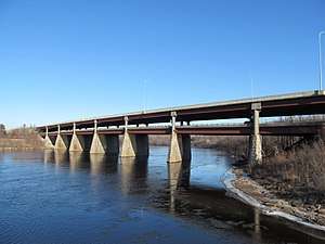
In Andover, the road has a junction with Interstate 93. It then enters the city of Lawrence, where the road turns due north, crossing the Shawsheen River into North Andover before crossing the Merrimack River at the O'Reilly Bridge back into Lawrence. It then heads into Methuen, where the road turns back to a northeasterly route after the junction with the Loop Connector (Rte. 213). The road heads into Haverhill, crossing the Merrimack twice more at a bend in the Bradford section of town. It passes north of downtown Haverhill, coming within 150 yards of the New Hampshire state line, the closest the road comes to leaving the state. Interstate 495 then passes through the towns of Merrimac and Amesbury before entering Salisbury where it immediately meets Interstate 95 and ends approximately 1.5 miles (2.4 km) south of where that interstate enters New Hampshire.
Throughout its path, the road passes closely to several existing state highways. From Wareham through to the Middleborough Rotary, it parallels Route 28. For much of the stretch between Norton and Milford, the road is within a few miles of Route 140, with two junctions of that highway in Mansfield and Franklin. From Milford to Bolton, the road passes just west of Route 85. Much of the northern third of the route also roughly parallels Massachusetts Route 110.[5]
History
As early as the late 1940s, a plan was developing for an "outer circumferential highway" around Boston, a limited-access freeway of meant to have an approximate 30 mile (49 km) radius from the Boston city center. A portion of this new "outer circumferential highway" southeast of the US Route 1 junction in Foxborough was meant to be a "relocation" of the existing MA Route 28, which was quickly changed in 1947 to a new designation of Route 25 as a full-length freeway from MA 24 expwy in Raynham to Wareham. The section of I-495 between MA 24 in Raynham and I-95 at the Foxboro/Mansfield line was not constructed until the late seventies with construction beginning at I-95 in 1976 and reaching the MA 25/MA 24 interchange in 1982. (Prior to 1982 I-495 ended at I-95, the section from Raynham to Wareham was just signed as MA 25). MA 25 was constructed in stages from the late fifties to the late 60’s.[6]
Future improvements
In 2014, a new ITS system was installed to help commuters and the state better understand the traffic congestion on I-495.[7] Some improvements expected to come to I-495 in the next few years include a project that will install fiber optic cable, traffic cameras and VMS Signs on I-495 from I-90 (Hopkinton) to I-93 (Andover).
In 2015, the state pledged $165–285 million for improvements to the Interstate 495-Massachusetts Turnpike intersection, and is considering three different plans. The work is expected to begin in 2021 and be completed in 2025.[8] Improvements to the 495-Route 9 intersection will commence at the same duration, with a different budget.[9]
Exit list
Interchanges were to be renumbered to mileage-based numbers under a project scheduled to start in 2016, however this project has been indefinitely postponed by MassDOT.[10][11]
| County | Location[12] | mi[12] | km | Exit[13] | Destinations[13] | Notes |
|---|---|---|---|---|---|---|
| Plymouth | Wareham | 0.000 | 0.000 | – | Southern terminus; continuation from Route 25 | |
| 0.012 | 0.019 | 1 | Eastern terminus of I-195 | |||
| 2.487 | 4.002 | 2 | No signage for Route 58 south, which ends .45 miles (0.72 km) to the south | |||
| Middleborough | 7.600 | 12.231 | 3 | |||
| 12.068 | 19.422 | 4 | ||||
| 14.304 | 23.020 | 5 | US 44 only appears on northbound signage | |||
| 14.722 | 23.693 | 6 | ||||
| Bridgewater | 18.962 | 30.516 | 7A | |||
| 19.200 | 30.899 | 7B | ||||
| Bristol | Raynham | 21.681 | 34.892 | 8 | ||
| Taunton | 24.508 | 39.442 | 9 | Bay Street Taunton, Easton | ||
| Norton | 26.906 | 43.301 | 10 | No signage for Route 140 southbound | ||
| Mansfield | 29.875 | 48.079 | 11 | No northbound exit | ||
| 29.913 | 48.140 | 12 | ||||
| 32.859 | 52.881 | 13A | ||||
| Norfolk | Foxborough | 32.935 | 53.004 | 13B | ||
| Plainville | 35.554 | 57.219 | 14A | Access to Gillette Stadium and Patriot Place | ||
| 35.605 | 57.301 | 14B | ||||
| Wrentham | 37.565 | 60.455 | 15 | |||
| Franklin | 40.954 | 65.909 | 16 | King Street – Franklin, Woonsocket, RI | ||
| 43.183 | 69.496 | 17 | ||||
| Bellingham | 45.820 | 73.740 | 18 | |||
| Worcester | Milford | 48.318 | 77.760 | 19 | To Route 16 | |
| 50.245 | 80.861 | 20 | To Route 16 | |||
| Middlesex | Hopkinton | 54.151 | 87.148 | 21A | West Main Street east Hopkinton, Ashland | |
| 54.151 | 87.148 | 21B | West Main Street west Upton, Northbridge | |||
| 57.928 | 93.226 | 22 | Exit 11A on I-90 | |||
| Worcester | Westborough | 59.414 | 95.618 | 23A | ||
| 59.472 | 95.711 | 23B | ||||
| Middlesex | Marlborough | 61.758 | 99.390 | 23C | Simarano Drive Marlboro, Southboro | Interchange constructed in 2000 |
| 63.155 | 101.638 | 24 | Split into exits 24A (east) and 24B (west) | |||
| 64.895 | 104.438 | 25A | Connection to Route 85 via unnumbered connector road | |||
| 64.951 | 104.529 | 25B | Eastern terminus of I-290 | |||
| Worcester | Berlin | 67.314 | 108.331 | 26 | ||
| Bolton | 70.006 | 112.664 | 27 | |||
| Middlesex | Boxborough | 74.652 | 120.141 | 28 | ||
| Littleton | 77.641 | 124.951 | 29 | Split into exits 29A (east) and 29B (west); Exits 40A-B on Route 2 | ||
| 79.176 | 127.421 | 30 | ||||
| 80.209 | 129.084 | 31 | ||||
| Westford | 83.297 | 134.054 | 32 | Boston Road Westford | To Route 225 | |
| Chelmsford | 87.328 | 140.541 | 33 | Northbound exit and southbound entrance | ||
| 88.175 | 141.904 | 34 | No signage for Route 4 northbound | |||
| 89.143 | 143.462 | 35 | Split into exits 35A (south) and 35B (north) | |||
| Lowell | 89.425 | 143.916 | 35C | Lowell Connector | Formerly Exit 36 | |
| 91.192 | 146.759 | 37 | Woburn Street South Lowell, North Billerica | |||
| Tewksbury | 92.284 | 148.517 | 38 | |||
| 94.613 | 152.265 | 39 | Southbound offramp begins in Essex County | |||
| Essex | Andover | 97.000 | 156.106 | 40A | ||
| 97.045 | 156.179 | 40B | ||||
| 99.411 | 159.986 | 41 | Split into exits 41A (south) and 41B (north) northbound | |||
| Lawrence | 100.149 | 161.174 | 42 | Split into exits 42A (east) and 42B (west) | ||
| North Andover | 100.953 | 162.468 | 43 | Massachusetts Avenue North Andover | ||
| 101.370 | 163.139 | 44 | Merrimack Street | |||
| Lawrence | 101.938 | 164.053 | 45 | Commonwealth Drive / Marston Street Lawrence, Methuen | Split into exits 45A (Commonwealth Dr) and 45B (Marston St) | |
| Methuen | 103.121 | 165.957 | 46 | |||
| 104.057 | 167.464 | 47 | Exit 5 on the Loop Connector; Eastern end of the Loop Connector | |||
| Haverhill | 105.788 | 170.249 | 48 | |||
| 106.624 | 171.595 | 49 | ||||
| 107.303 | 172.687 | 50 | ||||
| 108.997 | 175.414 | 51 | Split into exits 51A (south) and 51B (north) | |||
| 111.182 | 178.930 | 52 | ||||
| Merrimac | 114.894 | 184.904 | 53 | Broad Street Merrimac, Merrimacport | ||
| Amesbury | 117.854 | 189.668 | 54 | |||
| 118.880 | 191.319 | 55 | Northbound exit and southbound entrance | |||
| Salisbury | 120.95 | 194.65 | – | Northern terminus | ||
1.000 mi = 1.609 km; 1.000 km = 0.621 mi
| ||||||
References
- ↑ Executive Office of Transportation - Office of Transportation Planning Roads GIS Data
- ↑ Pennsylvania Turnpike Commission, November 1, 1996.
- ↑ "Interstate 476, pahighways.com". Retrieved 5 October 2014.
- ↑ Shortest and Longest 3-digit interstates, kurumi.com. Note the discrepancy between the mileage listed on kurumi.com and the actual mileage indicated by the exit list from Interstate 476. Google Maps lists the distance as 130 miles (210 km).
- ↑ BostonRoads.com, Outer Circumferential Highway: Historical Overview Retrieved Jan. 24, 2010
- ↑ "Outer Circumferential Highway - Historic Overview - AN OUTER LOOP FOR EASTERN MASSACHUSETTS". bostonroads.com. Steve Anderson's Boston Roads website. 2015. Retrieved March 27, 2017.
- ↑ MassDOT (April 2014). "A 2014 Synthesis; the Status of Intelligent Transportation Systems Deployment" (PDF). http://www.massdot.state.ma.us/. Massachusetts Department of Transportation. Retrieved January 6, 2016. External link in
|website=(help) - ↑ Worcester Telegram (March 29, 2015). "State outlines improvements to congested I-495-Mass Pike interchange". http://www.telegram.com/. Worcester Telegram & Gazette. Retrieved January 6, 2016. External link in
|website=(help) - ↑ MassDOT (November 7, 2012). "Interstate 495/Route 9 Interchange Improvement Study". http://www.massdot.state.ma.us/. Massachusetts Department of Transportation. Retrieved January 6, 2016. External link in
|website=(help) - ↑ Commonwealth of Massachusetts (2015). "COMMBUYS - Bid Solicitation FAP# HSIP-002S(874) Exit Signage Conversion to Milepost-Based Numbering System along Various Interstates, Routes and the Lowell Connector". Retrieved January 6, 2016.
- ↑ Robert H. Malme (2017). "Massachusetts Interstate Highways Exit Lists". Retrieved January 18, 2017.
- 1 2 MassDOT Planning Division. "Massachusetts Route Log Application". Massachusetts Department of Transportation. Retrieved August 21, 2014.
- 1 2 Massachusetts Department of Transportation. "Exit Numbers and Names: Route I-495 (Wareham to Salisbury)". Retrieved August 21, 2014.
External links
Route map:
| Wikimedia Commons has media related to Interstate 495 (Massachusetts). |
- Interstate 495 at Steve Anderson's Boston Roads site
- Mass. I-495 Current and Speculative Future Exit Numbers List
| ||