Hubbard's Hill
| Site of Special Scientific Interest | |
 | |
| Area of Search | Kent |
|---|---|
| Grid reference | TQ 534 520[1] |
| Interest | Geological |
| Area | 66.6 hectares (165 acres)[1] |
| Notification | 1986[1] |
| Location map | Magic Map |
Hubbard's Hill is a 66.6-hectare (165-acre) geological Site of Special Scientific Interest south of Sevenoaks in Kent.[1][2] It is a Geological Conservation Review site.[3]
This Quaternary site exhibits solifluction (erosion by freezing and thawing). The main deposits date to the Wolstonian glaciation around 130,000 years ago, but the latest have radiocarbon dates of only 12,500 years, during the most recent Younger Dryas ice age.[4]
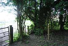
The Greensand Way long distance footpath goes through the site.
References
- 1 2 3 4 "Designated Sites View: Hubbard's Hill". Sites of Special Scientific Interest. Natural England. Retrieved 13 February 2018.
- ↑ "Map of Hubbard's Hill". Sites of Special Scientific Interest. Natural England. Retrieved 13 February 2018.
- ↑ "Hubbard`s Hill (Quaternary of South-East England)". Geological Conservation Review. Joint Nature Conservation Committee. Retrieved 11 January 2018.
- ↑ "Hubbard's Hill citation" (PDF). Sites of Special Scientific Interest. Natural England. Retrieved 13 February 2018.
| Wikimedia Commons has media related to Hubbard's Hill. |
This article is issued from
Wikipedia.
The text is licensed under Creative Commons - Attribution - Sharealike.
Additional terms may apply for the media files.