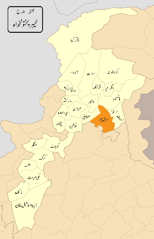
Haripur District
| Haripur | |
|---|---|
| District | |
 Location of Haripur District (highlighted in red). | |
| Country | Pakistan |
| Province | Khyber Pakhtunkhwa |
| Headquarters | Haripur |
| Area | |
| • Total | 1,725 km2 (666 sq mi) |
| Population (2017)[1] | |
| • Total | 1,003,031 |
| • Density | 580/km2 (1,500/sq mi) |
| Time zone | UTC+5 (PST) |
| District Nazim | Adil Islam |
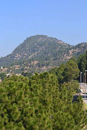
Haripur (Urdu: ہری پور, "The Town of Hari") is a district in the Hazara region of Khyber Pakhtunkhwa province of Pakistan with an altitude of around 610 metres (2,000 ft) above sea level. As of 2015, Haripur District has a High level of Human Development. Before becoming a district in 1991, Haripur had the status of a tehsil in Abbottabad District.[2]:5
History
Durrani rule
When Ahmad Shah Durrani expanded his kingdom to Punjab, Hazara came under his control. Durrani considered it wise to rule the area through local tribal chiefs, especially the Tareen chiefs who remained the main administrators from around the 1760s to 1818/1819.[3] The Durranis' rule ended abruptly in the beginning of the 19th century, circa 1819 or 1820, with the advent of the Sikhs.
Sikh annexation
The Sikhs annexed Hazara in two stages: first, Lower Hazara was annexed when the Sikhs under Makhan Singh took over the plains, on the invitation of a Turk chieftain, who betrayed his country to save himself.[4] Upper Hazara suffered a similar fate when the Sikhs took Kashmir from the Barakzai Afghans in 1819.[5]
The town of Haripur (meaning 'Hari's town') was founded in 1822 by Hari Singh Nalwa, the Commander-in-Chief of Ranjit Singh's army. On the successful completion of his tenure as governor of Kashmir in 1821, Pakhli and Damtaur were bestowed upon Nalwa as a jagir. Tanolis were the greater threat to sikhs. Painda Khan Tanoli defeated Ranjit Singh near Tarbeela .As soon as Nalwa received this grant, he built the walled town of Haripur in the heart of the Haripur plain, centered on the fort of Harkishan Garh, which he encircled with a deep trench. The site selected had seen some of the fiercest fighting between Sikhs and Afghans.[6] Despite the presence of the fort and a strong Sikh garrison, the Lahore government wasn't finally able to get full control of the Lower Hazara until they had defeated and captured and executed the Tareen chiefs and warriors like Muhammad Khan, Bostan Khan, and some others.[7]
British India
The presence of the fort at Harkishangarh, with its four-yard thick and 16-yard high wall, eventually brought a feeling of security to the region. In 1835, Baron Heugel, a German traveler found only remnants of that wall remaining.[8]
Haripur was the sole example of a planned town in this region until the British built Abbottabad many years later. It continued to grow, eventually becoming a city and later a district.
Haripur once bore the official name of Haripur Hazara and was the capital of Hazara until 1853, when the new capital Abbottabad was built. In March 1849, the Punjab was annexed by the British Empire. Abbott later painted a noted picture of the town of Haripur and its commanding fort of Harkishangarh.[9]
Administration
The district of Haripur was a tehsil (sub-division) of Abbottabad District, until 1992 when it became a district. The district was (2010–2011) represented in the provincial assembly by four elected MPAs. One of those MPAs is elected to the National/Federal Assembly.
Currently, Haripur District is divided into three tehsils, further subdivided into 45 Union Councils of which 15 are urban Union Councils:
- Al Wali Shareef
- Ali Khan
- Bagra
- Baitgali
- Bakka
- Bandi Sher Khan
- Barkot
- Beer
- Behki
- Bherrary
- Breela
- Darwesh
- Dheendah
- Dingi
- Ghazi
- Haripur Central
- Haripur North
- Haripur South
- Hattar
- Jabri
- Jatti Pind
- Kalinjar
- Khalabat Township
- Khanpur (On 15 October 2016 the chief minister of KP announced status of tehsil to Khanpur.)
- Kholian Bala
- Kot Najeebullah
- Kotehrra
- Kundi
- Lalogali
- Landarmang
- Mankrai
- Maqsood
- Najifpur
- Nara Amaz
- Pandak
- Panian
- Pind Hasham Khan
- Pind Kamal Khan
- Pharhari
- Qazipur
- Rehana
- Sarai Saleh
- Serai Niamat Khan
- Sikandarpur
- Sirikot
- Sirya
- Tarbela
- Tofkian
Notable people
- Abdul Majid Khan Tarin, OBE, renowned early legal and legislative figure and member of the AIML
- Ayub Khan, military dictator and president of Pakistan (1958 to 1969)
- Abdus Salim Khan former Pakistani ambassador and senior diplomat
- Sardar Bahadur Khan, Muslim League politician from Haripur area
- Pir Sabir Shah, ex-chief minister North-West Frontier Province (1996 to 1997)
- Qateel Shifai, Urdu language poet
Natural resources
The area is rich in natural resources and contains two reservoirs, the Tarbela Dam and Khanpur Dam. Geographically, it is the gateway to Hazara, the Hazara Division, and the Pakistani capital Islamabad.
Boundary
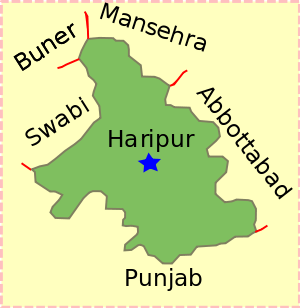
Geographically, the district borders Abbottabad District to the northeast, Mansehra District in the northeast, the Punjab to the southeast, the Buner to the northwest and Swabi to the west. The Federal Capital of Islamabad is adjacent to the district in the south.
Demographics
As of the 1998 census, Haripur's population was 692,228. By 2005, it was estimated to have increased to 803,000. 12.0% live in urban districts with the remaining 88.0% residing in rural areas.
The population is spread over an area of 1,725 square kilometres (666 sq mi), resulting in a density of 401.3 persons per km².[10] This compares to an average density of 233 persons per km² in Hazara as a whole. The average household size of the district is 6.6 persons compared to 8 at the provincial level. Agriculture is the predominant livelihood of the population while the total arable area is 77,370 acres (313.1 km²).
According to the 1981 census data for Haripur tehsil, the predominant language is Hindko, spoken as a first language in 89% of all households, followed by Pashto (7.6%) and Punjabi (1.3%).[11]
The literacy rate in the Haripur district is 53.7%, substantially higher than the literacy rate in the region of Hazara, which is 35.2%. The female literacy rate is only 37.4% compared to male literacy of 63.6%, and urban literacy rate of 69.7% is significantly higher than the rural rate of 51.4%.
Education
Haripur District has two government funded post graduate colleges, providing higher level education, as well as four degree colleges for women. Haripur University was established in 2012 by the efforts of Higher Education Minister Qazi Muhammad Asad.
In 2000–2001, Haripur had 907 government primary schools, including 656 for boys and 251 for girls. In addition to government primary schools, 166 mosque schools were in the district. The primary school population (5–9 years) consisted of 101,670 students, of which 52,240 (51.38%) were boys and 49,430 (48.61%) were girls.
The district had 83 middle schools (56 for boys and 27 for girls), during 2001.
See also
References
- ↑ "DISTRICT WISE CENSUS RESULTS CENSUS 2017" (PDF). www.pbscensus.gov.pk.
- ↑ 1998 District Census report of Haripur. Census publication. 91. Islamabad: Population Census Organization, Statistics Division, Government of Pakistan. 2000.
- ↑ Dr SB Panni 'Tarikh i Hazara' Peshawar 1969
- ↑ Hazara District Gazetteer 1883-84, Lahore, 1884, pp 23-24
- ↑ Nalwa, V. (2009), Hari Singh Nalwa — Champion of the Khalsaji, New Delhi: Manohar, pp. 77-104, ISBN 81-7304-785-5.
- ↑ Panni, 1969
- ↑ Hazara Gazetteer 1883-84, p. 26
- ↑ Nalwa, V. (2009), Hari Singh Nalwa — Champion of the Khalsaji, New Delhi: Manohar, pp. 224-5, ISBN 81-7304-785-5.
- ↑ 'The Rock Aornos from Huzara', British Library Online Gallery
- ↑ Information Pakistan - Districts of Pakistan Archived 2009-03-28 at the Wayback Machine.
- ↑ 1981 District Census report of Abbottabad. District Census Report. 24. Islamabad: Population Census Organization, Statistics Division, Government of Pakistan. 1983. p. 76.
Further reading
- Waldemar Heckel, Lawrence A. Tritle, ed (2009). Alexander the Great: A New History. Wiley-Blackwell. pp. 47–48. ISBN 978-1-4051-3082-0. https://books.google.com/?id=jbaPwpvt8ZQC&pg=PA46&lpg=PA46&dq=callisthenes+of+olynthus+conspiracy&q=callisthenes%20of%20olynthus%20conspiracy
- Tripathi (1999). History of Ancient India. Motilal Banarsidass Publ.. pp. 118–121. ISBN 978-81-208-0018-2. https://books.google.com/?id=WbrcVcT-GbUC
- Narain, pp. 155–165
- Curtius in McCrindle, Op cit, p 192, J. W. McCrindle; History of Punjab, Vol I, 1997, p 229, Punajbi University, Patiala, (Editors): Fauja Singh, L. M. Joshi; Kambojas Through the Ages, 2005, p 134, Kirpal Singh.
Provincial capital: Peshawar | ||
| Divisions | Districts | 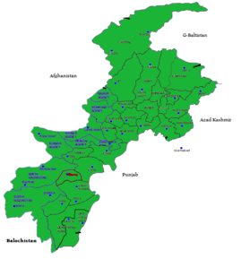 |
| Bannu | ||
| Dera Ismail Khan | ||
| Hazara | ||
| Kohat | ||
| Malakand | ||
| Mardan | ||
| Peshawar | ||