Karak District
| Karak, Pukhtunkhwa Khattak | |
|---|---|
| District | |
| Karak | |
_(14586994117).jpg) Bahadur Khel salt hill | |
| Coordinates: 33°08′N 71°05′E / 33.133°N 71.083°ECoordinates: 33°08′N 71°05′E / 33.133°N 71.083°E | |
| Country | Pakistan |
| Established | Karak was granted district status in July 1982 |
| Headquarters | Karak |
| Government | |
| • District Nazim | Dr Omer Daraz |
| • District Naib Nazim | Major Sajjad Barak |
| Area | |
| • Total | 3,372 km2 (1,302 sq mi) |
| Population (2017)[1] | |
| • Total | 706,299 |
| • Density | 210/km2 (540/sq mi) |
| Time zone | UTC+5 (PST) |
| Number of Tehsils | 3 |
Karak (Pashto: کرك, Urdu: کرک![]()
Demographics
Population
The population of Karak by the 2017 census is 706,299[3].
Resources
There are several natural resources that have been discovered in Karak. The salt mines were well known in antiquity and a major source of salt for the Indian subcontinent into British imperial times. More recently oil, gas, and uranium have all been discovered. Oil and gas reservoirs have been found in the towns of Makori, Noshpa Banda, Gurguri and Lachi circle.
Oil and gas reservoirs explored in Karak district are producing 7000 barrels of oil and 2500 cubic feet gas on a daily basis which is a record production from one oil well in the country[4]. The oil and gas reservoirs at Noshapa Banda in district Karak are generating millions of rupees revenue daily. District Karak is blessed with mineral resources and many national and international companies and OGDCL are busy in oil and gas exploration in different areas of the district. Vast reservoirs of oil and gas have been explored in Gurguri and Noshpa Banda areas of the district so far whereas exploration is under way in other areas.
According to a serve conducted by International Nuclear Information System [5] where Fission Track Technique has been applied for the estimation of uranium in 30 drinking water sources of Tehsil Takht-e-Nasrati and District Karak, Pakistan. These samples have mean, minimum and maximum concentration of uranium of 13.45 +- 3.207, 1.07 +- 0.6, 84.23 +- 15.63 micro g l/sup -1/, respectively. The significant finding was the observation of very high level of uranium in drinking water sources obtained from uranium rich bedrocks than the safe limit of WHO (15 micro g l/sup -1/) for human consumption. On the basis of this study, it was concluded that the origin of uranium is potentially due to one of the Asia richest mineral deposit of uranium in Karak, Pakistan. The results could be of vital concern in diagnosis and prognosis of uranium induced disease in the local population under investigation.
Politics
The District is represented in the national assembly by one elected MNA Shahid khattak and provincial assembly two elected MPAs who represent the following constituencies:
- NA-34 (Karak) Shahid Khattak;
- Pk-85 (Karak-1) Mian Nisar Gul Kakakhel and
- Pk-86 (Karak-2) Malik Zafar Azam.
Administrative divisions
The district of Karak is administratively subdivided into three tehsils[3].
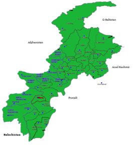
Neighboring areas
See also
References
- ↑ "DISTRICT WISE CENSUS RESULTS CENSUS 2017" (PDF). www.pbscensus.gov.pk.
- 1 2 3 1998 District Census report of Karak. Census publication. 97. Islamabad: Population Census Organization, Statistics Division, Government of Pakistan. 2000.
- 1 2 "Pakistan Bureau of Statistics Census 2017" (PDF). www.pbscensus.gov.pk. Retrieved 26 September 2017.
- ↑ "Vast reserves of oil, gas in Karak". DAWN.COM. 20 December 2009. Retrieved 27 September 2017.
- ↑ "Estimation of uranium concentration in drinking water sources of tehsil takht-e-nasrati, district karak, khyber pakhtunkhwa, pakistan using fission track technique". iaea. 20 December 2009. Retrieved 27 September 2017.