Ghazi, Khyber Pakhtunkhwa
| Ghazi غازی | |
|---|---|
| Town and union council | |
 Ghazi Location in Pakistan  Ghazi Ghazi (Pakistan) | |
| Coordinates: 34°01′05″N 72°39′04″E / 34.01806°N 72.65111°ECoordinates: 34°01′05″N 72°39′04″E / 34.01806°N 72.65111°E | |
| Country | Pakistan |
| Region | Khyber Pakhtunkhwa |
| District | Haripur District |
| Time zone | UTC+5 (PST) |
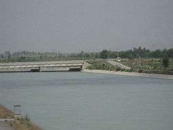
Ghazi Barotha Canal
Ghazi (Urdu: غازی) is an administrative subdivision of Haripur District in Khyber Pakhtunkhwa province of Pakistan.[1] Ghazi lies to the west of the district capital, Haripur. A number of villages and hamlets located in Ghazi's midst are Hassanpur, Essa, Khalo and Hamlet Colony. Villages
- Bhai
- Bharwasa
- Isa
- Jalu
- Khalo
- SalamKhand
- Gahara*
- Jammun
- Sobra[2]
References
- ↑ Tehsils & Unions in the District of Haripur Archived January 24, 2008, at the Wayback Machine.
- ↑ Location of Ghazi - Falling rain
This article is issued from
Wikipedia.
The text is licensed under Creative Commons - Attribution - Sharealike.
Additional terms may apply for the media files.