Hajeb El Ayoun
| Hajeb El Ayoun حاجب العيون Masclianae | |
|---|---|
| Commune and town | |
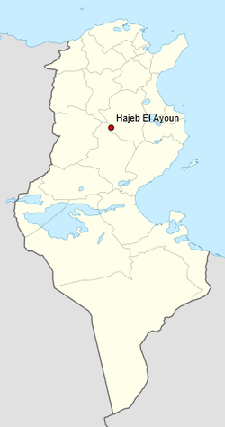 map showing the location of Hadjeh-El-Aïoun a town in Tunisia | |
| Country |
|
| Governorate | Kairouan Governorate |
| Government | |
| • Mayor | Hassen Zaïdi |
| Elevation | 490 ft (150 m) |
| Population (2014)[1] | |
| • Total | 10,631 |
| Time zone | UTC+1 (CET) |
Hajeb El Ayoun (حاجب العيون) is a town and commune in the Kairouan Governorate, Tunisia. As of 2004 it had a population of 9,648.[2] Attached to the governorate of Kairouan, it is a town of 9648 inhabitants in 2004. It is also the capital of a district of 35,403 inhabitants.[3][4]
The Mayor is Hassen Zaïdi, and the post code is 3160.
Geography
It is located at 35° 23′N, 9° 32′E and across fields from the west shores of Sidi Saad lake having the largest dam in Tunisia, which enables agricultural irrigation in the surrounding fields. The economy includes olive and apricot production. The town is 49m above sea level.
history
Ruins near the town have tentatively been identified with the remains of a Roman era town of Masclianae. The town is also the seat in name at least of an ancient Christian titular Bishopric[5] In the 1830s the site was excavated by Lieutenant Harinezo,[6] who discovered the remains of a Christian era, basilica, with various inscriptions in situ. The ruins have been suggested as the remains of the Roman civitas of Germaniciana.
The United States Army engaged Rommels Afrika Korps here on 19th February 1943.[7]
See also
References
- ↑ " Populations, dwellings and households by administrative units and settings " (2017).
- ↑ (in French) Recensement de 2004 (Institut national de la statistique) Archived 2016-02-19 at the Wayback Machine.
- ↑ (in French) Recensement de 2004 (Institut national de la statistique) Archived 2016-02-19 at the Wayback Machine.
- ↑ Décret du 6 mai 2013 modifiant le décret du 23 septembre 2011 portant nomination de délégations spéciales dans certaines communes du territoire de la République tunisienne (Hajeb El Ayoun), Journal officiel de la République tunisienne, n°39, 14 mai 2013, p. 1462
- ↑ Annuario Pontificio 2013 (Libreria Editrice Vaticana 2013 ISBN 978-88-209-9070-1)
- ↑ Souvenirs de l'ancienne eglise d'Afrique p8.
- ↑ David T. Zabecki, World War II in Europe: An Encyclopedia (Routledge, 2015) p 1333.