Kef Governorate
| Kef ولاية الكاف | |
|---|---|
| Governorate | |
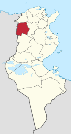 Map of Tunisia with Kef highlighted | |
| Coordinates: 36°10′56″N 8°42′53″E / 36.18222°N 8.71472°ECoordinates: 36°10′56″N 8°42′53″E / 36.18222°N 8.71472°E | |
| Country | Tunisia |
| Created | June 21, 1956 |
| Capital | El Kef |
| Area | |
| • Total | 4,965 km2 (1,917 sq mi) |
| Area rank | Ranked 10th of 24 |
| Population (2014) | |
| • Total | 243,156 |
| • Rank | Ranked 19th of 24 |
| • Density | 49/km2 (130/sq mi) |
| Time zone | UTC+01 (CET) |
| Postal prefix | xx |
| ISO 3166 code | TN-33 |
Kef Governorate (Tunisian Arabic: ولاية الكاف Wilāyat el-Kāf pronounced [lkæːf]) is one of the twenty-four governorates of Tunisia. It comprises chiefly part of the dorsal Atlas Mountains and their foothills in north-western Tunisia, bordering Algeria. It covers an area of 4,965 km² and has a population of 243,156 (2014 census).[1] The capital is El Kef.
Administrative divisions
Twelve municipalities are in Kef Governorate: | 2311 | El Kef | 54,690 |- | 2312 | Nebeur | 3,299 |- | 2313 | Touiref | 2,178 |- | 2314 | Sakiet Sidi Youssef | 6,335 |- | 2315 | Tajerouine | 17,530 |- | 2316 | Menzel Salem | 1,824 |- | 2317 | Kalaat es Senam | 8,145 |- | 2318 | Kalâat Khasba | 2,558 |- | 2319 | Jérissa | 9,807 |- | 2320 | El Ksour | 5,852 |- | 2321 | Dahmani | 12,964 |- | 2322 | Sers | 12,108
Demographics
Due to its close proximity to the Algerian border and its historical role in the Algerian War of Independence, Kef has a significant Algerian population, hosting over 6,000 registered Algerian voters, the second largest such community in Tunisia after Tunis.[2] Its capital city, El Kef, was the command centre of the Front de Libération Nationale during the Algerian War of Independence against the French in the 1950s.
References
- ↑ (in French) Census 2014 (National Institute of Statistics) Archived 2014-10-29 at the Wayback Machine.
- ↑ Arfaoui, Jamel (April 6, 2009). "Les Algériens de Tunisie se préparent à voter" (in French). Maghrebia. Retrieved April 18, 2012.
Governorates and regions of Tunisia | ||
|---|---|---|
| Governorates | ||
| Regions |
| |
WikiProject Tunisia | ||