Habsiguda
| Habsiguda | |
|---|---|
| Neighbourhood | |
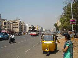 Habsiguda main road in 2012 | |
 Habsiguda Location in Telangana, India | |
| Coordinates: 17°25′09″N 78°32′29″E / 17.41917°N 78.54139°ECoordinates: 17°25′09″N 78°32′29″E / 17.41917°N 78.54139°E | |
| Country |
|
| State | Telangana |
| District | Hyderabad |
| Zone | East |
| Circle | Uppal Kalan |
| Ward | 6 |
| Government | |
| • Body | GHMC |
| Population (2012)[1] | |
| • Total | 36,206 |
| Languages | |
| • Official | Telugu |
| Time zone | UTC+5:30 (IST) |
| PIN | 500007 |
| Telephone code | +9140 |
| Vehicle registration | TS |
| Lok Sabha constituency | Malkajgiri |
| Vidhan Sabha constituency | Uppal |
| Civic agency | GHMC |
Habsiguda is a neighbourhood in Hyderabad, Telangana, India. It is located at the eastern end of the city between Tarnaka and Uppal.
History of Habsiguda
The origin of the name Habsiguda may have originated from Habshi, which was a common term referring to Africans although it relates to Abyssinia, an ancient name for Ethiopia in Africa.[2] This barren land was a Cattle ground for Nizams of Deccan Princely State, and was probably the home of the African troops in Nizam's military. Abyssinians used to be brought as slaves and later as laborers by Nizams to take care of their cattle. Habeesis (people from Abyssinia) lived for decades in and around this area hence the name "Habeesguda" and now being called as Habsiguda.[3] Today one can still find these Abyssinians in many parts of Old City and especially in "Barkaas". Many of these people were mixed with local people and accepted in Muslim communities.
Later Habsiguda was occupied by many construction and plantation labourers that were brought from surrounding districts to construct Osmania University by Asaf Jha iiv Osman Ali Khan Bahadur (Prince of then Deccan Princely State).
Habsiguda remained as a hamlet under "Nacharam Village" until 1981 and later became an independent Grampanchayat under Uppal Kalan Municipality and now its part of Hyderabad Metropolitan City.
Research institutes
Transport
The Hyderabad Metro Rail has a route covering from Nagole to Raidurg which is laid via Habsiguda. It has three Metro stops one at Cricket Stadium, second at National Geophysical Research Institute and other at Crossroads of Habsiguda.[4]
Habsiguda is well connected by TSRTC buses. It is about 5 km from Secunderabad Railway Station and about 11 km from Hyderabad Nampally Railway Station of the South Central Railway. Rajiv Gandhi International Airport, Hyderabad is about 30 km away from Habsiguda. The closest MMTS Train station is 2.5 km away at Sitaphalmandi.
Late at night, shared autos/cabs keep moving Secunderabad and Uppal directions and provide an affordable alternative to metered autos which charge almost double fares at that time.
References
- ↑ "Delimitation of Election Wards" (PDF). Greater Hyderabad Municipal Corporation. Archived from the original (PDF) on 10 November 2011. Retrieved 12 June 2017.
- ↑ Ababu Minda yimene An African Indian community in Hyderabad: Siddi identity, its maintenance and change Cuvillier Verlag, 2004 ,P.123.
- ↑ Ababu Minda yimene An African Indian community in Hyderabad: Siddi identity, its maintenance and change Cuvillier Verlag, 2004 ,P.124.
- ↑ "For IPL matches at Uppal, Hyderabad Metro extends train services till midnight".