Serilingampally
| Serilingampally | |
|---|---|
| suburb | |
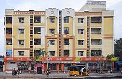 A More store in Serilingampally | |
 Serilingampally Location in Telangana, India  Serilingampally Serilingampally (India) | |
| Coordinates: 17°28′48″N 78°19′48″E / 17.48000°N 78.33000°ECoordinates: 17°28′48″N 78°19′48″E / 17.48000°N 78.33000°E | |
| Country |
|
| State | Telangana |
| District | Ranga Reddy, Greater Hyderabad |
| City | Hyderabad |
| Population (2011) | |
| • Total | 153,364 |
| Languages | |
| • Official | Telugu, English |
| Time zone | UTC+5:30 (IST) |
| PIN | 500019 |
| Vehicle registration | TS-07 |
| Sex ratio | 107% ♂/♀ |
Serilingampally is a town in Ranga Reddy district of the Indian state of Telangana. It is located in Shamshabad mandal of Rajendranagar revenue division.[1] [2] It forms a part of the Greater Hyderabad Municipal Corporation.[3] Due to its close proximity to Hitech City, Gachibowli, Nanakramguda, Manikonda, and Kondapur, there has been a heavy influx of IT companies.[4] University of Hyderabad (UoH) is also located here.
Demographics
As of 2011 India census, Serilingampally had a population of 153,364 composed of 32,642 households. This population contains 79,225 males and 74,139 females.[5] As of 2001 census, Serilingampally has an average literacy rate of 42%, lower than the national average of 59.5%: male literacy is 42%, and female literacy is 41%. In Serilingampally, 11% of the population is under 6 years of age.[6]
Transport
The buses run by TSRTC connect it to major parts of the city. The closest Train station is at Lingampally.
Politics
MLA of Serilingampally constituency is Arekapudi Gandhi who was elected in 2014 General Elections.
References
- ↑ "Rangareddy district" (PDF). New Districts Formation Portal. Government of Telangana. Archived from the original (PDF) on 30 November 2016. Retrieved 26 March 2017.
- ↑ "Three SEZS Approvals Union Commerce". articles.timesofindia.indiatimes.com. 2006-10-11.
- ↑ "You Become a Hyderabadi As Soon As You Come to Hyderabad". indianexpress.com.
- ↑ "Andhra parties eye cosmopolitan Serilingampally segment". timesofindia.indiatimes.com. Retrieved 2014-08-03.
- ↑ The Registrar General & Census Commissioner (2011). "Sub-district details". censusindia.gov.in. New Delhi, India: Government of India. Retrieved 15 July 2014.
- ↑ "Census of India 2001: Data from the 2001 Census, including cities, villages and towns (Provisional)". Census Commission of India. Archived from the original on 2004-06-16. Retrieved 2008-11-01.