Gyöngyös District
| Gyöngyös District Gyöngyösi járás | ||
|---|---|---|
| Districts of Hungary | ||
| ||
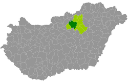 Gyöngyös District within Hungary and Heves County. | ||
| Country |
| |
| County | Heves | |
| District seat | Gyöngyös | |
| Area | ||
| • Total | 750.78 km2 (289.88 sq mi) | |
| Area rank | 1st in Heves | |
| Population (2011 census) | ||
| • Total | 73,834 | |
| • Rank | 2nd in Heves | |
| • Density | 98/km2 (250/sq mi) | |

Gyöngyös (Hungarian: Gyöngyösi járás) is a district in central-western part of Heves County. Gyöngyös is also the name of the town where the district seat is found. The district is located in the Northern Hungary Statistical Region. This district is a part of Mátra Mountains geographical region.
Geography
Gyöngyös District borders with Bátonyterenye District (Nógrád County) and Pétervására District to the north, Eger District, Füzesabony District and Heves District to the east, Jászberény District (Jász-Nagykun-Szolnok County) to the south, Hatvan District and Pásztó District (Nógrád County) to the west. The number of the inhabited places in Gyöngyös District is 25.
Municipalities
The district has 2 towns and 23 villages. (ordered by population, as of 1 January 2012)[1]
- Abasár (2,498)
- Adács (2,690)
- Atkár (1,695)
- Detk (1,158)
- Domoszló (1,988)
- Gyöngyös (32,385) – district seat
- Gyöngyöshalász (2,531)
- Gyöngyösoroszi (1,518)
- Gyöngyöspata (2,472)
- Gyöngyössolymos (2,972)
- Gyöngyöstarján (2,460)
- Halmajugra (1,196)
- Karácsond (3,045)
- Kisnána (993)
- Ludas (809)
- Markaz (1,748)
- Mátraszentimre (465)
- Nagyfüged (1,877)
- Nagyréde (3,091)
- Pálosvörösmart (675)
- Szűcsi (1,563)
- Vámosgyörk (1,991)
- Vécs (578)
- Visonta (1,127)
- Visznek (1,082)
The bolded municipalities are cities.
Demographics
Religion in Gyöngyös District (2011 census)
In 2011, it had a population of 73,834 and the population density was 98/km².
| Year | County population[2] | Change |
|---|---|---|
| 2011 | 73,834 | n/a |
Ethnicity
Besides the Hungarian majority, the main minorities are the Roma (approx. 4,000), Slovak (400), German (300) and Romanian (150).
Total population (2011 census): 73,834
Ethnic groups (2011 census):[3] Identified themselves: 70,115 persons:
- Hungarians: 65,039 (92.76%)
- Gypsies: 3,564 (5.08%)
- Others and indefinable: 1,512 (2.16%)
Approx. 3,500 persons in Gyöngyös District did not declare their ethnic group at the 2011 census.
Religion
Religious adherence in the county according to 2011 census:[4]
- Catholic – 39,722 (Roman Catholic – 39,490; Greek Catholic – 225);
- Reformed – 2,675;
- Evangelical – 214;
- other religions – 1,082;
- Non-religious – 10,725;
- Atheism – 891;
- Undeclared – 18,525.
Gallery
 Gyöngyös, Town Hall
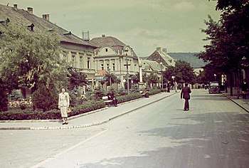 Gyöngyös 1938
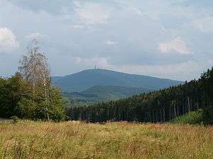 View of Kékes
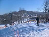 Ski resort in Mátraszentistván
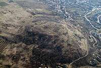 Castle Ruins of Gyöngyöspata
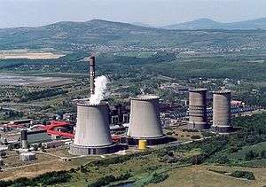 Mátra Power Plant near Visonta
 Saint Bartholomew Church in Gyöngyös
See also
References
- ↑ A KSH 2012. évi helységnévkönyve
- ↑ népesség.com, "Gyöngyösi járás népessége"
- ↑ 4.1.6.1 A népesség nemzetiség szerint, 2011, (in Hungarian)
- ↑ 4.1.7.1 A népesség vallás, felekezet szerint, 2011, (in Hungarian)
External links
| Towns (2) |
| |
|---|---|---|
| Villages (23) |
| |