Guindulman
| Guindulman | |
|---|---|
| Municipality | |
| Municipality of Guindulman | |
 Public market of Guindulman | |
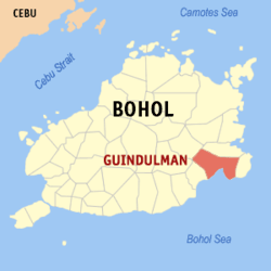 Map of Bohol with Guindulman highlighted | |
.svg.png) Guindulman Location within the Philippines | |
| Coordinates: 9°46′N 124°29′E / 9.77°N 124.48°ECoordinates: 9°46′N 124°29′E / 9.77°N 124.48°E | |
| Country |
|
| Region | Central Visayas (Region VII) |
| Province | Bohol |
| District | 3rd District |
| Founded | around 1622 |
| Barangays | 19 (see Barangays) |
| Government [1] | |
| • Type | Sangguniang Bayan |
| • Mayor | Albino Balo |
| • Vice Mayor | Maria Fe Piezas |
| • Congressman | Arthur Yap |
| • Electorate | 20,529 voters (2016) |
| Area [2] | |
| • Total | 179.17 km2 (69.18 sq mi) |
| Population (2015 census)[3] | |
| • Total | 32,408 |
| • Density | 180/km2 (470/sq mi) |
| Time zone | UTC+8 (PST) |
| ZIP code | 6310 |
| PSGC | 071223000 |
| IDD : area code | +63 (0)38 |
| Climate type | Tropical monsoon climate |
| Income class | 4th municipal income class |
| Revenue (₱) | 90,149,420.54 (2016) |
| Native languages |
Boholano dialect Cebuano Tagalog |
Guindulman, officially the Municipality of Guindulman, (Cebuano: Lungsod sa Guindulman; Tagalog: Bayan ng Guindulman), is a 4th class municipality in the province of Bohol, Philippines. According to the 2015 census, it has a population of 32,408 people.[3]
Etymology
In the olden days, names of certain places were sometimes ascribed to some usual or common incidents or occurrences as is the case with the town of Guindulman. The place was originally called Guinduluman, from a vernacular expression which means "something or somebody who is overtaken by darkness".[4]
There is no official record to show how the town really got its name. However, folklore has it that during the early part of the Spanish era in the Philippines, there were only two formally organized towns along the southeastern and eastern coastal borders of Bohol, namely, Jagna and Batuanan (now known as Alicia). Because of the distances, travelers starting from either of these towns in the early morning were sure to be overtaken by nightfall before reaching the next place; hence the name "guinduluman".[4]
Folklore further says that the early condition of the area itself had something to contribute to the appropriateness of the term because the center of the town was once surrounded and almost entirely shaded by a dense forest which also made the town dark even during daytime.[lower-alpha 1] Travelers from other places passing through this thick forest could observe its surrounding darkness because the sunlight could hardly penetrate through the thick foliage, thus causing darkness in the area at any time of the day. Such actual condition of the particular place, therefore, gave added significance to the created name.
History
It is hard to fix a definite date when this town was established as official records were destroyed during the war. However, Francisca Libres Piezas cited in her compilation that the town of Guindulman was already established before the Tamblot Rebellion of 1622. So Guindulman may now be around 400 years old.
During the Philippine revolution against the Spanish government there was no fighting in town reported. The people were submissive to the Spanish authorities.
Guindulman was burned down during the Philippine–American War in 1898. Guerrilla warfare was already resorted to by the local insurgents known as "insurectos". A resistance movement was organized under the leadership of Colonel Pedro Samson whose headquarters was in Monte Verde in the upper part of the town. There was no battle fought in the poblacion of Guindulman, but a memorable encounter took place in the barrio of Cabantian wherein both sides suffer heavy casualties.
The historical incident happened when American troops passed by the barrio of Cabantian, the "insurectos" ambushed the troops by jumping from the hilltops and killing many American soldiers with their bolos. However, because of the superiority of the American weapons, the insurgents likewise suffered several casualties. On account of such incident, the furious American patrols then burned the houses of the particular village including the rice stocks in the fields. Still dissatisfied, they shot cows and carabaos on sight.
During the Japanese occupation in 1944, another encounter occurred between the Japanese troops and members of the guerrilla unit which was organized by the Major Esteban Bernido, native of Guindulman who also became a representative of the 3rd Congressional district of Bohol, governor of the province, and who finally occupied one of the important cabinet positions of the country. The memorable incident started with an ambush made by the guerrillas under Major Bernido right on the boundary of Guindulman and Duero. The Japanese suffered heavy casualties while the guerrilla unit escaped unharmed. As reprisal, the Japanese burned the entire poblacion, leaving only the convent and the church which were occupied by their garrison.
Barangays
Guindulman comprises 19 barangays:
| PSGC | Barangay | Population | ±% p.a. | |||
|---|---|---|---|---|---|---|
| 2015[3] | 2010[5] | |||||
| 071223001 | Basdio | 5.8% | 1,887 | 1,883 | 0.04% | |
| 071223002 | Bato | 3.9% | 1,262 | 1,263 | −0.02% | |
| 071223003 | Bayong | 4.0% | 1,300 | 1,352 | −0.74% | |
| 071223004 | Biabas | 4.1% | 1,314 | 1,491 | −2.38% | |
| 071223005 | Bulawan | 3.1% | 1,008 | 918 | 1.80% | |
| 071223006 | Cabantian | 4.8% | 1,549 | 1,388 | 2.11% | |
| 071223007 | Canhaway | 9.5% | 3,071 | 3,150 | −0.48% | |
| 071223008 | Cansiwang | 2.6% | 851 | 786 | 1.52% | |
| 071223009 | Casbu | 3.0% | 960 | 929 | 0.63% | |
| 071223011 | Catungawan Norte | 3.0% | 977 | 1,069 | −1.70% | |
| 071223010 | Catungawan Sur | 6.5% | 2,095 | 1,764 | 3.33% | |
| 071223013 | Guinacot | 5.6% | 1,828 | 1,767 | 0.65% | |
| 071223014 | Guio‑ang | 8.8% | 2,858 | 2,627 | 1.62% | |
| 071223016 | Lombog | 6.0% | 1,956 | 2,050 | −0.89% | |
| 071223017 | Mayuga | 7.6% | 2,448 | 2,535 | −0.66% | |
| 071223018 | Sawang (Poblacion) | 5.7% | 1,837 | 1,869 | −0.33% | |
| 071223019 | Tabajan (Poblacion) | 7.8% | 2,530 | 2,437 | 0.72% | |
| 071223021 | Tabunok | 2.2% | 711 | 747 | −0.94% | |
| 071223022 | Trinidad | 6.1% | 1,966 | 1,764 | 2.09% | |
| Total | 32,408 | 31,789 | 0.37% | |||
Demographics
| Population census of Guindulman | ||
|---|---|---|
| Year | Pop. | ±% p.a. |
| 1903 | 12,002 | — |
| 1918 | 22,017 | +4.13% |
| 1939 | 23,855 | +0.38% |
| 1948 | 27,220 | +1.48% |
| 1960 | 28,352 | +0.34% |
| 1970 | 29,972 | +0.56% |
| 1975 | 31,820 | +1.21% |
| 1980 | 32,918 | +0.68% |
| 1990 | 26,225 | −2.25% |
| 1995 | 26,945 | +0.51% |
| 2000 | 31,028 | +3.07% |
| 2007 | 32,355 | +0.58% |
| 2010 | 31,789 | −0.64% |
| 2015 | 32,408 | +0.37% |
| Source: Philippine Statistics Authority[3] [5] [6] [7] | ||
Gallery
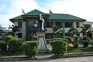 Guindulman Town Hall
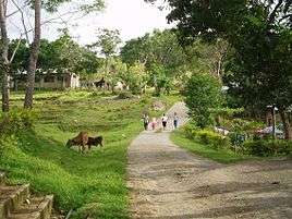 Biabas barangay
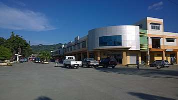 Guindulman Public Market
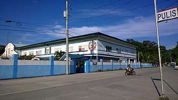 St. Mary Academy, Guindulman, Bohol
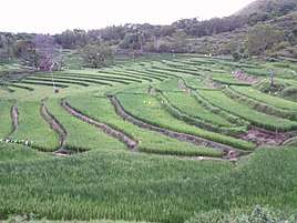 Rice Terraces in Brgy. Guinacot
See also
Notes
- ↑ At the latitude of Guindulman, daylight is only 12h07 ± 35 minutes throughout the year.
References
- ↑ "Municipality". Quezon City, Philippines: Department of the Interior and Local Government. Retrieved 31 May 2013.
- ↑ "Province: Bohol". PSGC Interactive. Quezon City, Philippines: Philippine Statistics Authority. Retrieved 12 November 2016.
- 1 2 3 4 Census of Population (2015). "Region VII (Central Visayas)". Total Population by Province, City, Municipality and Barangay. PSA. Retrieved 20 June 2016.
- 1 2 "Municipality of Guindulman". Province of Bohol. Retrieved 2012-09-18.
- 1 2 Census of Population and Housing (2010). "Region VII (Central Visayas)". Total Population by Province, City, Municipality and Barangay. NSO. Retrieved 29 June 2016.
- ↑ Censuses of Population (1903–2007). "Region VII (Central Visayas)". Table 1. Population Enumerated in Various Censuses by Province/Highly Urbanized City: 1903 to 2007. NSO.
- ↑ "Province of Bohol". Municipality Population Data. Local Water Utilities Administration Research Division. Retrieved 17 December 2016.
| Wikimedia Commons has media related to Guindulman. |