San Isidro, Bohol
| San Isidro | |
|---|---|
| Municipality | |
| Municipality of San Isidro | |
 Municipal Hall of San Isidro | |
 Map of Bohol with San Isidro highlighted | |
.svg.png) San Isidro Location within the Philippines | |
| Coordinates: 9°48′N 124°18′E / 9.8°N 124.3°ECoordinates: 9°48′N 124°18′E / 9.8°N 124.3°E | |
| Country |
|
| Region | Central Visayas (Region VII) |
| Province | Bohol |
| District | 2nd District |
| Founded | 21 June 1969 |
| Barangays | 12 (see Barangays) |
| Government [1] | |
| • Type | Sangguniang Bayan |
| • Mayor | Jacinto Naraga |
| • Vice Mayor | Filemon Mantabote |
| • Electorate | 6,509 voters (2016) |
| Area [2] | |
| • Total | 60.04 km2 (23.18 sq mi) |
| Population (2015 census)[3] | |
| • Total | 8,744 |
| • Density | 150/km2 (380/sq mi) |
| Time zone | UTC+8 (PST) |
| ZIP code | 6345 |
| PSGC | 071237000 |
| IDD : area code | +63 (0)38 |
| Climate type | Tropical monsoon climate |
| Income class | 5th municipal income class |
| Revenue (₱) | 47,911,054.31 (2016) |
| Native languages |
Boholano dialect Cebuano Tagalog |
San Isidro, officially the Municipality of San Isidro, (Cebuano: Lungsod sa San Isidro; Tagalog: Bayan ng San Isidro), is a 5th class municipality in the province of Bohol, Philippines. According to the 2015 census, it has a population of 8,744 people.[3]
This town is quite unique because it is the only town covered by the 2nd District surrounded by towns of the 1st District.
Barangays
San Isidro comprises 12 barangays. Of these, only Poblacion is classified as urban and the rest are rural.
|
|||||||||||||||||||||||||||||||||||||||||||||||||||||||||||||||||||||||||||||||||||||||||||||||||||||||||

Demographics
| Population census of San Isidro | ||
|---|---|---|
| Year | Pop. | ±% p.a. |
| 1970 | 6,923 | — |
| 1975 | 7,281 | +1.02% |
| 1980 | 7,369 | +0.24% |
| 1990 | 7,840 | +0.62% |
| 1995 | 7,548 | −0.71% |
| 2000 | 9,106 | +4.10% |
| 2007 | 9,176 | +0.11% |
| 2010 | 9,125 | −0.20% |
| 2015 | 8,744 | −0.81% |
| Source: Philippine Statistics Authority[3][4][5][6] | ||
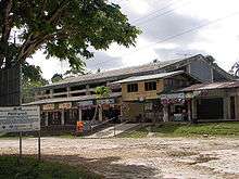
Public market
References
- ↑ "Municipality". Quezon City, Philippines: Department of the Interior and Local Government. Retrieved 31 May 2013.
- ↑ "Province: Bohol". PSGC Interactive. Quezon City, Philippines: Philippine Statistics Authority. Retrieved 12 November 2016.
- 1 2 3 4 Census of Population (2015). "Region VII (Central Visayas)". Total Population by Province, City, Municipality and Barangay. PSA. Retrieved 20 June 2016.
- 1 2 Census of Population and Housing (2010). "Region VII (Central Visayas)". Total Population by Province, City, Municipality and Barangay. NSO. Retrieved 29 June 2016.
- ↑ Censuses of Population (1903–2007). "Region VII (Central Visayas)". Table 1. Population Enumerated in Various Censuses by Province/Highly Urbanized City: 1903 to 2007. NSO.
- ↑ "Province of Bohol". Municipality Population Data. Local Water Utilities Administration Research Division. Retrieved 17 December 2016.
External links
This article is issued from
Wikipedia.
The text is licensed under Creative Commons - Attribution - Sharealike.
Additional terms may apply for the media files.