Botad district
| Botad District | |
|---|---|
| District of Gujarat | |
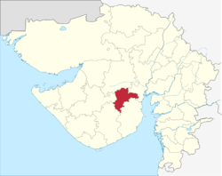 Location in Gujarat | |
| Country | India |
| State | Gujarat |
| Region | Saurashtra |
| Headquarters | Botad |
| Area[1] | |
| • Total | 2,564 km2 (990 sq mi) |
| Population (2011)[1] | |
| • Total | 652,000 |
| • Density | 250/km2 (660/sq mi) |
| Languages | |
| • Official | Gujarati, Hindi |
| Time zone | UTC+5:30 (IST) |
| Website | https://botad.gujarat.gov.in |
Botad District is a district of the state of Gujarat, India. It was created on 15 August 2013 from the southwestern part of Ahmedabad District and the northwestern part of Bhavnagar District. Botad consist of four taluka Botad, Gadhada, Barvala, Ranpur.[2][3] Botad city is the administrative headquarters of the district.[4]
This district is surrounded by Bhavnagar District to the southeast, Surendranagar District to the north and northwest, Amreli District to the southwest, Ahmedabad District to the northeast and Rajkot District to the west.[3]
Botad District consists of four talukas:[3]
Demographics
The district had a population of 652,556 according to the 2011 census, with an area of 2,564 square kilometres (990 sq mi) and a population density of 255 per square kilometre.
Points of Interest in District[5]
- Salangpur Hanumanji Temple [Shri Kashtabhanjan Hanumanji Temple and BAPS Swaminarayan Temple]- Gadhada is among the more prominent centres in the Swaminarayan Sampraday.
- Shree Swaminarayan Temple, Gadhada - old temple initiated by Lord Swaminarayan himself; and the massive new one built by BAPS gadi
- Bhimnath Mahadev - at Bhimnath, Polarpur is an ancient temple, associated with mythology of Mahabharata times [across border with Ahmedabad district]. The temple is small and housed in the middle of a River path, which gets flooded during monsoon.[6]
- With in the Botad city - Shree Swaminarayna mandir located Inside Nagalpar gate in the city centre is big and popular.[5] Swaminarayan temple built by BAPS gadi in Sahjanand Society is located little easterly Nagalpar gate. There is another popular Swaminarayan Temple with an associated Gurukul in Mangal Para, located south-westerly in the outskirts. Also there are few other smaller Swaminarayan temples in the city. Virateshvar Mahadev Temple is located easterly in the outskirts.
Notes and references
- 1 2 Botad District Panchayat, Government of Gujarat
- ↑ Kapil, Dave (14 August 2013). "7 new districts to start functioning from Independence Day". The Times of India. Archived from the original on 15 April 2015.
- 1 2 3 "Maps of Gujarat's new 7 districts and changes in existing districts". Desh Gujarat. 13 August 2013. Archived from the original on 16 August 2013.
- ↑ https://botad.gujarat.gov.in/tourist-places
- ↑ http://botaddp.gujarat.gov.in/historical-places-eng.htm
- ↑ https://botad.gujarat.gov.in/tourist-places/bhimnath-mahadev-bhimnath
External links
Coordinates: 22°10′12″N 71°40′12″E / 22.17000°N 71.67000°E
Places adjacent to Botad district | |
|---|---|