Surendranagar Dudhrej
| Surendranagar Dudhrej Jhalawad | |
|---|---|
| City | |
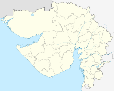
 Surendranagar Dudhrej Location in Gujarat, India  Surendranagar Dudhrej Surendranagar Dudhrej (India) | |
| Coordinates: 22°43′0″N 71°43′0″E / 22.71667°N 71.71667°ECoordinates: 22°43′0″N 71°43′0″E / 22.71667°N 71.71667°E | |
| Country |
|
| State | Gujarat |
| District | Surendranagar District |
| Government | |
| • Body | Surendranagar-Dudhrej Municipality |
| Area | |
| • Total | 45 km2 (17 sq mi) |
| Elevation | 98 m (322 ft) |
| Population (2001) | |
| • Total | 156,417 |
| • Density | 3,500/km2 (9,000/sq mi) |
| Languages | |
| • Official | Gujarati, Hindi |
| Time zone | UTC+5:30 (IST) |
| PIN | 3630xx |
| Telephone code | 02752 |
| Vehicle registration | GJ-13 |
| Nearest city | Wadhwan |
| Civic agency | Surendranagar-Dudhrej Municipality |
| Climate | Dry almost (Köppen) |
| Website |
gujaratindia |
Surendranagar Dudhrej is a municipality in Surendranagar district in the Indian state of Gujarat. mainly Dudhrej municipality is directly connected with wadhwan city and wadhwan municipality.
Demographics
As of 2001 India census,[1] Dudhrej had a population of 156,417. Males constitute 52% of the population and females 48%. Dudhrej has an average literacy rate of 71%, higher than the national average of 59.5%: male literacy is 77%, and female literacy is 64%. In Dudhrej, 12% of the population is under 6 years of age. C U Shah Medical College & Hospital is the main hospital of the area.
Religious Importance
Vadwala Mandir of Rabari community is situated here.[2] This community's people do visit this place often and on the important ritual days.
References
- ↑ "Census of India 2001: Data from the 2001 Census, including cities, villages and towns (Provisional)". Census Commission of India. Archived from the original on 2004-06-16. Retrieved 2008-11-01.
- ↑ http://dudhrejvadwala.com
This article is issued from
Wikipedia.
The text is licensed under Creative Commons - Attribution - Sharealike.
Additional terms may apply for the media files.