Ginatilan
| Ginatilan | |
|---|---|
| Municipality | |
| Municipality of Ginatilan | |
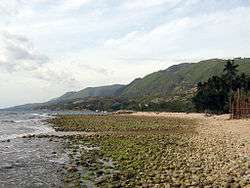 Coastal view | |
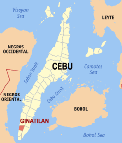 Map of Cebu with Ginatilan highlighted | |
.svg.png) Ginatilan Location within the Philippines | |
| Coordinates: 9°36′N 123°21′E / 9.6°N 123.35°ECoordinates: 9°36′N 123°21′E / 9.6°N 123.35°E | |
| Country |
|
| Region | Central Visayas (Region VII) |
| Province | Cebu |
| District | 7th district of Cebu |
| Founded | 1847 |
| Barangays | 14 (see Barangays) |
| Government [1] | |
| • Type | Sangguniang Bayan |
| • Mayor | Dean Singco |
| • Vice Mayor | Jose Gornez |
| • Congressman | Peter John Calderon |
| • Electorate | 11,143 voters (2016) |
| Area [2] | |
| • Total | 70.10 km2 (27.07 sq mi) |
| Population (2015 census)[3] | |
| • Total | 15,919 |
| • Density | 230/km2 (590/sq mi) |
| Time zone | UTC+8 (PST) |
| ZIP code | 6026 |
| PSGC | 072225000 |
| IDD : area code | +63 (0)32 |
| Climate type | Tropical climate |
| Income class | 5th municipal income class |
| Revenue (₱) | 57,545,949.08 (2016) |
| Native languages |
Cebuano Tagalog |
Ginatilan, officially the Municipality of Ginatilan, (Cebuano: Lungsod sa Ginatilan; Tagalog: Bayan ng Ginatilan), is a 5th class municipality in the province of Cebu, Philippines. According to the 2015 census, it has a population of 15,919 people.[3]
Ginatilan is bordered to the north by the town of Malabuyoc, to the west is the Tañon Strait, to the east is the town of Oslob, and to the south is the town of Samboan.
Barangays
Ginatilan comprises 14 barangays:
| PSGC | Barangay | Population | ±% p.a. | |||
|---|---|---|---|---|---|---|
| 2015[3] | 2010[4] | |||||
| 072225001 | Anao | 2.7% | 428 | 534 | −4.13% | |
| 072225002 | Cagsing | 7.7% | 1,219 | 1,162 | 0.92% | |
| 072225003 | Calabawan | 3.5% | 553 | 538 | 0.52% | |
| 072225004 | Cambagte | 3.3% | 518 | 577 | −2.03% | |
| 072225005 | Campisong | 2.8% | 443 | 459 | −0.67% | |
| 072225006 | Canorong | 5.1% | 805 | 819 | −0.33% | |
| 072225007 | Guiwanon | 6.6% | 1,047 | 968 | 1.50% | |
| 072225008 | Looc | 6.7% | 1,071 | 1,050 | 0.38% | |
| 072225009 | Malatbo | 5.0% | 802 | 815 | −0.31% | |
| 072225010 | Mangaco | 8.0% | 1,280 | 1,218 | 0.95% | |
| 072225011 | Palanas | 15.1% | 2,407 | 1,970 | 3.89% | |
| 072225012 | Poblacion | 19.7% | 3,130 | 3,045 | 0.53% | |
| 072225013 | Salamanca | 4.1% | 660 | 640 | 0.59% | |
| 072225014 | San Roque | 9.8% | 1,556 | 1,532 | 0.30% | |
| Total | 15,919 | 15,327 | 0.72% | |||
Demographics
| Population census of Ginatilan | ||
|---|---|---|
| Year | Pop. | ±% p.a. |
| 1903 | 10,617 | — |
| 1918 | 11,989 | +0.81% |
| 1939 | 8,690 | −1.52% |
| 1948 | 8,390 | −0.39% |
| 1960 | 8,150 | −0.24% |
| 1970 | 9,036 | +1.04% |
| 1975 | 10,055 | +2.17% |
| 1980 | 10,566 | +1.00% |
| 1990 | 11,160 | +0.55% |
| 1995 | 11,924 | +1.25% |
| 2000 | 14,073 | +3.62% |
| 2007 | 13,654 | −0.42% |
| 2010 | 15,327 | +4.30% |
| 2015 | 15,919 | +0.72% |
| Source: Philippine Statistics Authority[3] [4] [5] [6] | ||
Attractions
Inambakan Falls is the municipality's most visited natural attraction. Hidden in a river valley in the middle of Ginatilan's highlands, the towering 100-foot (30 m) waterfall can be reached via motorcycles for hire.
Mount Hambubuyog straddles the border of Ginatilan and Samboan.[7] The summit offers views of Tañon Strait and Negros Island.
Local delicacies include palagsing, tinumpi, and kinugay, made from buli tree.
Every March is annual festival in honor of the patron St. Gregory the Great.
Livelihood includes farming, fishing, government, and business.
Ginatilan was the hometown of Catholic martyr and second Filipino saint, St. Pedro Calungsod, who was killed during his missionary work in Guam with Diego Luis de San Vitores in 1672.
- ROMAN CATHOLIC PARISHES for these 3 MUNICIPALITIES [8]
- SAN NICOLAS DE TOLENTINO PARISH (F-1834), Malabuyoc, Cebu 6029
- SAN GREGORIO MAGNO PARISH (F-1847), Ginatilan, Cebu 6028
- SAINT FRANCIS XAVIER PARISH (F-1857), Alegria, Cebu 6030
References
- ↑ "Municipality". Quezon City, Philippines: Department of the Interior and Local Government. Retrieved 31 May 2013.
- ↑ "Province: Cebu". PSGC Interactive. Quezon City, Philippines: Philippine Statistics Authority. Retrieved 12 November 2016.
- 1 2 3 4 Census of Population (2015). "Region VII (Central Visayas)". Total Population by Province, City, Municipality and Barangay. PSA. Retrieved 20 June 2016.
- 1 2 Census of Population and Housing (2010). "Region VII (Central Visayas)". Total Population by Province, City, Municipality and Barangay. NSO. Retrieved 29 June 2016.
- ↑ Censuses of Population (1903–2007). "Region VII (Central Visayas)". Table 1. Population Enumerated in Various Censuses by Province/Highly Urbanized City: 1903 to 2007. NSO.
- ↑ "Province of Cebu". Municipality Population Data. Local Water Utilities Administration Research Division. Retrieved 17 December 2016.
- ↑ Mount Hambubuyog
- ↑ https://en.wikipedia.org/wiki/Roman_Catholic_Archdiocese_of_Cebu
External links
Places adjacent to Ginatilan | ||||||||||
|---|---|---|---|---|---|---|---|---|---|---|
| ||||||||||
Cebu City (capital) | |
| Municipalities |
|
| Component cities | |
| Highly urbanized cities | (Administratively independent from the province but grouped under Cebu by the Philippine Statistics Authority. However, qualified voters in Mandaue are allowed to vote in elections for Cebu provincial officials as part of the 6th Sangguniang Panlalawigan district.) |