Ghost Town Trail (Saskatchewan)
| ||||
|---|---|---|---|---|
| Red Coat Trail Ghost Town Trail | ||||
 | ||||
| Route information | ||||
| Maintained by Ministry of Highways and Infrastructure (Saskatchewan) | ||||
| Length | 676.0 km[1] (420.0 mi) | |||
| Major junctions | ||||
| West end |
Alberta border continues west as | |||
| East end |
Manitoba border near Antler continues east as | |||
| Location | ||||
| Major cities | Weyburn | |||
| Highway system | ||||
|
Provincial highways in Saskatchewan
| ||||
.svg.png)
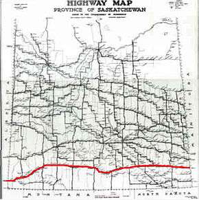
Ghost Town Trail, Saskatchewan is a stretch of highway located in the Palliser's Triangle region of the province of Saskatchewan, Canada. The trail coincides with Saskatchewan Highway 13 (Hwy 13) between Wauchope, Saskatchewan and Govenlock, Saskatchewan. Along this highway are 32 various "ghost towns". The nearest large communities are Swift Current and Maple Creek, Saskatchewan both located on the Trans Canada Highway which runs parallel and to the north of Hwy 13.[2]
List of Ghost Towns
[4] As a side note, near this ghost town trail are other ghost towns in the neighbouring vicinity. For example, the Rural Municipality of Griffin No. 66 also contains the localities, Brough, Huntoon, Innes. Similarly Key West No. 70 also was home to the localities of Bures, Dahinda, Edgeworth, Kayville, Key West, Querrin and Wheatstone near Glasnevin. Neighbouring localities to Valor are Ardwick, Bexhill, Congress, Lakenheath, Lynthorpe, Maxstone, Ogle, Stonehenge in Stonehenge No. 73 [5]
References
- ↑ Microsoft Streets and Tips (Map) (2004 ed.). Microsoft Corp. § Route Planner.
|access-date=requires|url=(help) - 1 2 3 4 5 Moore, Frank (1982). Saskatchewan ghost towns (digitised online by Our Roots Nos Racines ed.). Regina, Saskatchewan.
- ↑ Natural Resources Canada (202). Geographical Names of Canada. Government of Canada.
- ↑ History Television (© Shaw Media Inc., ed.). 202.
- ↑ Statistics Canada (202). Standard Geographical Classification (SGC) 1996. Government of Canada.