Limerick, Saskatchewan
| Limerick | |
|---|---|
| Village | |
| Village of Limerick | |
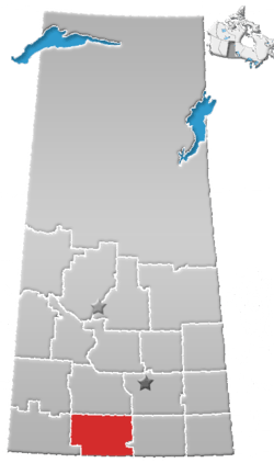
 Limerick Limerick in Saskatchewan  Limerick Limerick (Canada) | |
| Coordinates: 49°39′00″N 106°16′01″W / 49.650°N 106.267°W | |
| Country |
|
| Province |
|
| Region | Southwest |
| Census division | 3 |
| Rural Municipality | Stonehenge No. 73 |
| Government | |
| • Type | Municipal |
| • Governing body | Limerick Village Council |
| • Mayor | Robert Smith |
| • Administrator | Tammy Franks |
| Area | |
| • Total | 0.79 km2 (0.31 sq mi) |
| Population (2016) | |
| • Total | 115 |
| • Density | 146.5/km2 (379/sq mi) |
| Time zone | UTC-6 (CST) |
| Postal code | S0A 2G0 |
| Area code(s) | 306 |
| Highways |
|
| Railways | Red Coat Road and Rail |
| [1][2][3][4] | |
Limerick is a village with in the Rural Municipality of Stonehenge No. 73 in the province of Saskatchewan, Canada. The population of Limerick was 115 in the 2016 Canada Census, (a 0.0% change from 115 in the 2011 Canada Census). The village is about 150 km (94 mi) north of the US border near the towns of Lafleche and Gravelbourg. The village is named after the Irish city of Limerick.
Demographics
| Canada census – Limerick, Saskatchewan community profile | |||
|---|---|---|---|
| 2016 | 2011 | 2006 | |
| Population: | 115 (0.0% from 2011) | 115 (-11.5% from 2006) | 130 (-11.0% from 2001) |
| Land area: | 0.79 km2 (0.31 sq mi) | 0.79 km2 (0.31 sq mi) | 0.79 km2 (0.31 sq mi) |
| Population density: | 146.5/km2 (379/sq mi) | 146.5/km2 (379/sq mi) | 165.6/km2 (429/sq mi) |
| Median age: | 56.1 (M: 55.5, F: 56.5) | 54.9 (M: 55.0, F: 54.8) | 44.5 (M: 41.5, F: 49.0) |
| Total private dwellings: | 65 | 69 | 68 |
| Median household income: | |||
| References: 2016[5] 2011[6] 2006[7] earlier[8] | |||
See also
References
- ↑ National Archives, Archivia Net, Post Offices and Postmasters, archived from the original on October 6, 2006
- ↑ Government of Saskatchewan, MRD Home, Municipal Directory System, archived from the original on November 21, 2008
- ↑ Canadian Textiles Institute. (2005), CTI Determine your provincial constituency, archived from the original on 2007-09-11
- ↑ Commissioner of Canada Elections, Chief Electoral Officer of Canada (2005), Elections Canada On-line, archived from the original on April 21, 2007
- ↑ "2016 Community Profiles". Canada 2016 Census. Statistics Canada. February 21, 2017. Retrieved 2017-03-15.
- ↑ "2011 Community Profiles". Canada 2011 Census. Statistics Canada. July 5, 2013. Retrieved 2012-10-14.
- ↑ "2006 Community Profiles". Canada 2006 Census. Statistics Canada. March 30, 2011. Retrieved 2010-09-11.
- ↑ "2001 Community Profiles". Canada 2001 Census. Statistics Canada. February 17, 2012.
External links
| Subdivisions | |
|---|---|
| Communities | |
| Cities | |
| Topics |
|
| |
This article is issued from
Wikipedia.
The text is licensed under Creative Commons - Attribution - Sharealike.
Additional terms may apply for the media files.