Antler, Saskatchewan
| Antler | |
|---|---|
| Special service area | |
| Special Service Area of Antler | |
.jpg) Views of Antler, 1909 | |
 Antler  Antler | |
| Coordinates: 49°34′07″N 101°27′28″W / 49.5687°N 101.4578°WCoordinates: 49°34′07″N 101°27′28″W / 49.5687°N 101.4578°W | |
| Country |
|
| Province |
|
| Region | Southeast |
| Census division | 1 |
| Rural Municipality | Antler No. 61 |
| Post office Founded | September 1, 1900 |
| Dissolved (Special service area) | December 31, 2013[1] |
| Government | |
| • Type | Municipal |
| • Governing body | Rural Municipality of Antler No. 61 |
| • MP | Robert Kitchen |
| • MLA | Dan D'Autremont |
| Time zone | UTC-6 (CST) |
| Postal code | S0C 0E0 |
| Area code(s) | 306 |
| Highways |
|
| Railways | Canadian Pacific Railway |
| [2] | |
Antler is a special service area in the Rural Municipality of Antler No. 61, Saskatchewan, Canada. Listed as a designated place by Statistics Canada, the community had a population of 40 in the Canada 2016 Census.[3] The community is approximately 120 km east of the city of Estevan and 3 km from the Manitoba border. Antler was dissolved from village status to become part of the Rural Municipality of Antler No. 61 on December 31, 2013.[1]
Demographics
| Canada census – Antler, Saskatchewan community profile | |||
|---|---|---|---|
| 2016 | 2011 | 2006 | |
| Population: | 40 (-2.4% from 2011) | 41 (+2.5% from 2006) | 40 (-11.1% from 2001) |
| Land area: | 0.72 km2 (0.28 sq mi) | 0.72 km2 (0.28 sq mi) | 0.72 km2 (0.28 sq mi) |
| Population density: | 55.5/km2 (144/sq mi) | 56.8/km2 (147/sq mi) | 55.5/km2 (144/sq mi) |
| Median age: | 42.5 (M: 46.5, F: 39.0) | 41.8 (M: 41.2, F: 50.0) | 45.5 (M: 37.0, F: 51.5) |
| Total private dwellings: | 24 | 21 | 20 |
| Median household income: | |||
| References: 2016[4] 2011[5] 2006[6] earlier[7] | |||
See also
References
- 1 2 "The Saskatchewan Gazette: Part I: Volume 109" (PDF) (PDF). Government of Saskatchewan. November 29, 2013. pp. 2426&ndash, 2427. Retrieved April 6, 2014.
- ↑ National Archives, Archivia Net, Post Offices and Postmasters, archived from the original on 2006-10-06, retrieved 2011-12-08
- ↑ Canada 2016 Census: Special service areas in Saskatchewan
- ↑ "2016 Community Profiles". Canada 2016 Census. Statistics Canada. February 21, 2017. Retrieved 2017-03-15.
- ↑ "2011 Community Profiles". Canada 2011 Census. Statistics Canada. July 5, 2013. Retrieved 2012-10-30.
- ↑ "2006 Community Profiles". Canada 2006 Census. Statistics Canada. March 30, 2011. Retrieved 2009-02-24.
- ↑ "2001 Community Profiles". Canada 2001 Census. Statistics Canada. February 17, 2012.
External links
Places adjacent to Antler, Saskatchewan | ||||||||||
|---|---|---|---|---|---|---|---|---|---|---|
| ||||||||||
| Subdivisions | |
|---|---|
| Communities | |
| Cities | |
| Topics |
|
| |
| Cities | 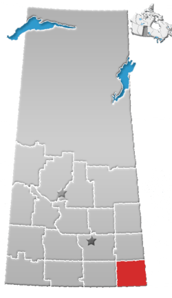 | ||||
|---|---|---|---|---|---|
| Towns | |||||
| Villages | |||||
| Rural municipalities | |||||
| First Nations | |||||
| Indian reserves | |||||
| Unincorporated communities |
| ||||
This article is issued from
Wikipedia.
The text is licensed under Creative Commons - Attribution - Sharealike.
Additional terms may apply for the media files.