Fremont, Ohio
| Fremont, Ohio | |
|---|---|
| City | |
 Downtown Fremont, Ohio on South Front Street | |
| Nickname(s): Cutlery Capital of the World[1] | |
| Motto(s): "Where People Come First" | |
 Location of Fremont, Ohio | |
 Location of Fremont in Sandusky County | |
| Coordinates: 41°20′56″N 83°7′2″W / 41.34889°N 83.11722°WCoordinates: 41°20′56″N 83°7′2″W / 41.34889°N 83.11722°W | |
| Country | United States |
| State | Ohio |
| County | Sandusky |
| Township | Ballville, Sandusky |
| Government | |
| • Mayor | Danny Sanchez (R) |
| Area[2] | |
| • Total | 8.57 sq mi (22.20 km2) |
| • Land | 8.35 sq mi (21.63 km2) |
| • Water | 0.22 sq mi (0.57 km2) |
| Elevation[3] | 627 ft (191 m) |
| Population (2010)[4] | |
| • Total | 16,734 |
| • Estimate (2012[5]) | 16,564 |
| • Density | 2,004.1/sq mi (773.8/km2) |
| Time zone | UTC-5 (Eastern (EST)) |
| • Summer (DST) | UTC-4 (EDT) |
| ZIP code | 43420 |
| Area code(s) | 419, 567 |
| FIPS code | 39-28826[6] |
| GNIS feature ID | 1040674[3] |
| Website | http://www.fremontohio.org/ |

Fremont (formerly Lower Sandusky) is a city in and the county seat of Sandusky County, Ohio, United States, located along the west bank of the Sandusky River. It is about 40 miles from Toledo.[8] The population was 16,734 at the 2010 census.
The city was the home of Rutherford B. Hayes, who served as President of the United States from 1877 to 1881. The Rutherford B. Hayes Presidential Center was the first presidential library and is one of the focal points of the city. The National Arbor Day Foundation designated Fremont as a Tree City USA.[9]
History
Fremont developed at the site of Junquindundeh, a historic Wyandot village along the west bank of the lower Sandusky River, near the falls and about 15 miles (24 km) upstream from the mouth at Sandusky Bay. In the 1750s a French trading post was established there. The British took over the post and the territory after its victory in the French and Indian War.
In 1787, after gaining independence, the United States established the Northwest Territory for unorganized lands west of the states, which included this area. In 1803 the southeastern portion of the Territory was admitted to the Union as part of the new state of Ohio. Under the terms of Ohio's admission as a state, the area of Lower Sandusky was defined as Indian Territory. The European Americans who settled here were violating the Treaty of Greenville of 1795, which was intended to preserve some land for Native Americans.
In the early 1800s tensions increased with Great Britain and the US established a boycott on trade with Britain, including Canada. The US built Fort Sandusky near the river to guard a supply depot. Its name was changed to Fort Stephenson during the War of 1812. The Battle of Fort Stephenson was fought there in August 1813.[10] The troops were commanded by Major George Croghan, who held off the British attack with a small garrison. During the War of 1812 the United States Army considered removing white settlers from this area by force as they were violating the Treaty of Greenville, but did not carry out the threat.[11]
The settlement became known as Lower Sandusky, referring to its location on the lower part of the Sandusky River. In 1821 Lower Sandusky was designated as the county seat of Sandusky County. The town gradually expanded, with primary occupations being shipbuilding, fishing, and agricultural processing. Sandusky Bay leads to Lake Erie, and there was good fishing for walleye in the river, which return annually to spawn upriver. By the 1830s, the population included more European Americans, although it had been part of a reserve for Native Americans. Numerous Wyandot people still lived here, and some African Americans, the latter predominantly refugee slaves who had settled in this area after reaching the free state of Ohio. The city had grain and sawmills, and the first sugar mill in Ohio.[11]
In 1849 the residents changed the name of Lower Sandusky to Fremont, in honor of American John C. Frémont, who helped acquire California by defeating Mexican forces in the Mexican–American War.[12]
In 1873, a few years before gaining national office, future president Rutherford B. Hayes moved into a family mansion in Fremont called Spiegel Grove, which was built by his late maternal uncle. That year Hayes announced his uncle Sardis Birchard's bequest in his will, donating property in his estate worth $50,000 to the City Council in order to establish a public library. It opened the following year on Front Street. A few years later, a new building was constructed for it in 1878 on the grounds of the Fort Stephenson State Park, per his bequest. It is now known as the Birchard Public Library of Sandusky County. Spiegel Grove was incorporated into the Rutherford B. Hayes Presidential Center, founded in 1916 as the first presidential library in the United States.[11]
In the late 19th and early 20th centuries, Fremont became a major center for the production of cutlery, with several manufacturing plants, as well as other industries. The cutlery industry has declined, but the city still has a large Heinz plant for producing ketchup.
Commemoration of Battle of Fort Stephenson
The city set aside Fort Stephenson Park to preserve and commemorate the site of the fort that had a role in the War of 1812. Only its stone foundations are still visible. In 1885 the Sandusky County Soldiers Monument was installed in the park near Croghan Street, which was named after the commanding major of the fort. (He was promoted to colonel afterward for his success.) Former president Rutherford B. Hayes attended the ceremony.
In 1906 Colonel Croghan's remains were brought from his hometown in Kentucky to Fremont and reinterred under the Soldiers Monument. In the same ceremony, the Daughters of the American Revolution (DAR) unveiled a plaque to the Soldiers Monument to commemorate Croghan and his garrison in their victory in the Battle of Fort Stephenson.
What is now the main building of the Birchard Public Library, which serves the entire county, was constructed in 1878 in Fort Stephenson Park, by the terms of the bequest from Sardis Birchard, who bequeathed $50,000 in assets to endow a public library in 1873. The first facility opened in 1874 in a building on Front Street.[13]
Geography
Fremont is located at 41°20′56″N 83°7′2″W / 41.34889°N 83.11722°W (41.348909, -83.117123),[14] along west side of the Sandusky River.
The city has a total area of 8.57 square miles (22.20 km2), of which 8.35 square miles (21.63 km2) is land and 0.22 square miles (0.57 km2) is water.[2]
Demographics
| Historical population | |||
|---|---|---|---|
| Census | Pop. | %± | |
| 1830 | 351 | — | |
| 1840 | 1,117 | 218.2% | |
| 1850 | 1,464 | 31.1% | |
| 1860 | 3,510 | 139.8% | |
| 1870 | 5,455 | 55.4% | |
| 1880 | 8,440 | 54.7% | |
| 1890 | 7,141 | −15.4% | |
| 1900 | 8,439 | 18.2% | |
| 1910 | 9,939 | 17.8% | |
| 1920 | 12,468 | 25.4% | |
| 1930 | 13,422 | 7.7% | |
| 1940 | 14,710 | 9.6% | |
| 1950 | 16,537 | 12.4% | |
| 1960 | 18,767 | 13.5% | |
| 1970 | 18,490 | −1.5% | |
| 1980 | 17,887 | −3.3% | |
| 1990 | 17,648 | −1.3% | |
| 2000 | 17,375 | −1.5% | |
| 2010 | 16,734 | −3.7% | |
| Est. 2017 | 16,193 | [15] | −3.2% |
| Sources:[6][16][17][18] | |||
2010 census
As of the census[4] of 2010, there were 16,734 people, 6,745 households, and 4,162 families residing in the city. The population density was 2,004.1 inhabitants per square mile (773.8/km2). There were 7,541 housing units at an average density of 903.1 per square mile (348.7/km2). The racial makeup of the city was 80.7% White, 8.3% African American, 0.2% Native American, 0.3% Asian, 5.3% from other races, and 5.1% from two or more races. Hispanic or Latino people of any race were 16.1% of the population.
There were 6,745 households of which 34.2% had children under the age of 18 living with them, 37.1% were married couples living together, 18.7% had a female householder with no husband present, 5.9% had a male householder with no wife present, and 38.3% were non-families. 32.5% of all households were made up of individuals and 12% had someone living alone who was 65 years of age or older. The average household size was 2.42 and the average family size was 3.04.
The median age in the city was 35.3 years. 27.2% of residents were under the age of 18; 8.6% were between the ages of 18 and 24; 25.7% were from 25 to 44; 24.7% were from 45 to 64; and 13.9% were 65 years of age or older. The gender makeup of the city was 47.8% male and 52.2% female.
2000 census
As of the census[6] of 2000, there were 17,375 people, 6,856 households, and 4,374 families residing in the city. The population density was 2,313.1 people per square mile (893.3/km²). There were 7,368 housing units at an average density of 980.9 per square mile (378.8/km²). The racial makeup of the city was 82.24% White, 8.29% African American, 0.18% Native American, 0.24% Asian, 5.85% from other races, and 3.19% from two or more races. Hispanic or Latino people of any race were 12.32% of the population.
There were 6,856 households out of which 33.6% had children under the age of 18 living with them, 42.5% were married couples living together, 16.4% had a female householder with no husband present, and 36.2% were non-families. 30.4% of all households were made up of individuals and 12.8% had someone living alone who was 65 years of age or older. The average household size was 2.46 and the average family size was 3.06.
In the city the population was spread out with 27.6% under the age of 18, 10.0% from 18 to 24, 28.7% from 25 to 44, 19.3% from 45 to 64, and 14.4% who were 65 years of age or older. The median age was 34 years. For every 100 females, there were 89.9 males. For every 100 females age 18 and over, there were 85.0 males.
The median income for a household in the city was $34,051, and the median income for a family was $39,439. Males had a median income of $32,453 versus $22,048 for females. The per capita income for the city was $16,014. About 9.8% of families and 12.9% of the population were below the poverty line, including 16.8% of those under age 18 and 9.9% of those age 65 or over.
Economy
A Heinz ketchup plant is still operating in this town. At one time the city was home to several cutlery companies: the Christy Company, Clauss Cutlery Company, Quikut, B.A.P. Manufacturing, and the Ginsu Cutlery Line, and Herbrand tools. It was also home to a Pioneer Sugar processing plant, but this closed in 1997.
Arts and culture
.jpg)
Annual cultural events
- May 17–19, 2012: 1st Annual Sandusky County Arts and Music Festival
- June 16, 2012: Farmer's Market and the Fremont Federal Credit Union Car Show
- July 21, 2012: Farmer's Market featuring the AEP Ohio Art and Music Fest
- August 4, 2012: Farmer's Market and the Fremont Athletic Supply Front Street Relay!
- August 18, 2012: Farmer's Market and the Green Bay Packaging Dog Days of Summer
- September 15, 2012: Farmer's Market and the Croghan Colonial Bank Service Club Olympics
- October 6, 2012: Farmer's Market and the Kid's Market
- October 20, 2012: Farmer's Market and the Memorial Health Care System Scarecrow Contest
Landmarks
- Birchard Public Library (built in a park at the former site of Fort Stephenson)
- H. J. Heinz Company ketchup factory (the world's largest ketchup factory)
- Rutherford B. Hayes Presidential Center
- Sandusky County Jail and Sheriff's House
- Spiegel Grove
- Fremont Speedway
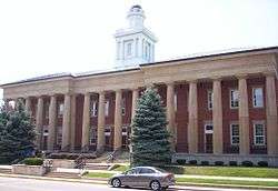
Historic downtown Fremont
Downtown Fremont is located next to the Sandusky River on Front Street. Front Street has a pedestrian scale and is home to many small businesses in historic buildings: they include boutiques, gift shops, restaurants, and other attractions. Downtown Fremont has been the center of the city for many years.
Government

The mayor of Fremont is Danny Sanchez, a Republican.
Education
Public education is provided by the Fremont City School District, which enrolls 3,760 students in public primary and secondary schools.[19] The district administers seven elementary schools, one middle school, and one high school, Fremont Ross. The city is also home to Bishop Hoffman Catholic Schools, affiliated with the Roman Catholic Diocese of Toledo, which serves students in grades preschool through 12 and includes Saint Joseph Central Catholic High School for grades nine through 12. Another private school for grades preschool through grade 12, Temple Christian Academy, is operated by Fremont Baptist Temple.[20]
Terra State Community College, a two-year community college founded in 1968, is located on a 143-acre (58 ha) campus in the western part of the city. It has an enrollment of approximately 2,400 students, mainly from Sandusky, Seneca, and Ottawa counties.
Fremont has a public library, a branch of the Birchard Public Library of Sandusky County.[21]
Media
Fremont's daily newspaper is The News-Messenger. WFRO-FM (99.1 FM) "Eagle 99" broadcasts from Fremont.
Infrastructure
Transportation

Two long-distance US routes run through Fremont, U.S. Route 6 and U.S. Route 20. State Routes 12, 19, 53 and 412 also pass through or terminate in the Fremont area. SR 53 roughly parallels the path of the Sandusky River, designated as a state scenic river, to its mouth at Sandusky Bay.
None of these routes passes through Fremont but were constructed outside. They are multiplexed on a bypass of the city, most of which is 4 lanes. The bypass has both grade-level crossings and controlled-access interchanges. Prior to completion of the bypass in the late 1950s, all of these routes passed through Fremont. Their former alignments are currently signed as "City Route (number)", with the number being that of the predecessor highway.[22]
The Ohio Turnpike, another long-distance east-west route, passes approximately 4 miles north of the city. The Turnpike is signed as Interstates 80 and 90. Exit 91 (originally Exit 6) links the Turnpike to Fremont via State Route 53.
Industry is served by the Norfolk Southern railroad. In the city, it uses parts of two defunct railroads as spurs to factories.
Notable people
- Tom Beier, National Football League player, All American in college football
- Bob Brudzinski, National Football League player
- Clarence Childs, 1912 US Olympic team, bronze medalist, hammer throw
- Mark Coleman, mixed martial artist, UFC champion, 1992 US Olympic wrestling team
- Everton Conger, capturer of John Wilkes Booth
- Dana DeMuth, Major League Baseball umpire
- Paul Dietzel, college football coach
- Doug Gallagher, Major League Baseball pitcher, Detroit Tigers
- Robert W. Hines, national wildlife artist for the U.S. Fish and Wildlife Service
- Alice E. Johnson, architect
- Carla F. Kim, Associate Professor of Genetics at Harvard Medical School
- Robert Knepper, actor, role of "T-Bag" in the Prison Break television series
- Tony Little, television fitness personality
- Rob Lytle, football player, member of College Football Hall of Fame, player for NFL's Denver Broncos
- Shawn McCarthy, National Football League player, New England Patriots
- Walter R. Nickel, dermatologist
- Myles Porter, 2012 US ParaOlympic Team, silver medalist, judo
- Bob Snyder, football player, 3-time NFL champion, coach of Los Angeles Rams
- Charles Woodson, football player, Heisman Trophy winner for University of Michigan, 9-time NFL Pro Bowl selection
- Jacob Wukie, recurve archer, 2012 Olympic silver medalist
References
- ↑ Sandusky County Historical Society. "Fremont Native Charles Stilwell: Inventor of the Self-Opening Sack". Archived from the original on 2010-07-09. Retrieved 2010-09-05.
- 1 2 "US Gazetteer files 2010". United States Census Bureau. Archived from the original on 2012-07-14. Retrieved 2013-01-06.
- 1 2 "US Board on Geographic Names". United States Geological Survey. 2007-10-25. Retrieved 2008-01-31.
- 1 2 "American FactFinder". United States Census Bureau. Retrieved 2013-01-06.
- ↑ "Population Estimates". United States Census Bureau. Archived from the original on 2013-06-17. Retrieved 2013-06-17.
- 1 2 3 "American FactFinder". United States Census Bureau. Archived from the original on 2013-09-11. Retrieved 2008-01-31.
- ↑ Lossing, Benson (1868). The Pictorial Field-Book of the War of 1812. Harper & Brothers, Publishers. p. 500.
- ↑ "Find a County". National Association of Counties. Archived from the original on 2011-05-31. Retrieved 2011-06-07.
- ↑ Ohio
- ↑ Gilpin, Alec R. (1958). The War of 1812 in the Old Northwest (1968 reprint ed.). East Lansing, MI: The Michigan State University Press. p. 207.
- 1 2 3 "Fremont, Ohio". Ohio History Central. Retrieved 27 December 2013.
- ↑ Gannett, Henry (1905). The Origin of Certain Place Names in the United States. Govt. Print. Off. p. 132.
- ↑ "Birchard Library", Birchard Public Library of Sandusky County website, Ohio, 2018
- ↑ "US Gazetteer files: 2010, 2000, and 1990". United States Census Bureau. 2011-02-12. Retrieved 2011-04-23.
- ↑ "Population and Housing Unit Estimates". Retrieved May 26, 2018.
- ↑ "Number of Inhabitants: Ohio" (PDF). 18th Census of the United States. U.S. Census Bureau. Retrieved 22 November 2013.
- ↑ "Ohio: Population and Housing Unit Counts" (PDF). U.S. Census Bureau. Retrieved 22 November 2013.
- ↑ "Incorporated Places and Minor Civil Divisions Datasets: Subcounty Population Estimates: April 1, 2010 to July 1, 2012". U.S. Census Bureau. Archived from the original on 17 June 2013. Retrieved 25 November 2013.
- ↑ "Fall Enrollment (Headcount) - October 2017 Public Districts and Buildings". Enrollment Data. Ohio Department of Education. October 2017. Retrieved May 4, 2018.
- ↑ "Home". Temple Christian Academy. 2018. Retrieved May 4, 2018.
- ↑ "Branches". Birchard Public Library. Retrieved 3 March 2018.
- ↑ Gulyas, Sandor (December 8, 2003). "Fremont Photos". The Ohio Regional Road Pages. Retrieved July 1, 2013.
Further reading
- Hurt, R. Douglas. The Ohio Frontier: Crucible of the Old Northwest, 1720-1830. Bloomington, IN: Indiana University Press, 1996.
External links
| Wikisource has the text of The New Student's Reference Work article Fremont, Ohio. |
- City website
- Fremont, Ohio, at Ohio History Central
- Fremont, Ohio at Curlie (based on DMOZ)
- Downtown Fremont website
- B. Hayes Presidential Library & Museums
Municipalities and communities of Sandusky County, Ohio, United States | ||
|---|---|---|
| Cities | 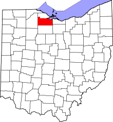 | |
| Villages | ||
| Townships | ||
| CDPs | ||
| Unincorporated communities | ||
| Footnotes | ‡This populated place also has portions in an adjacent county or counties | |