Foster Pond, Illinois
| Foster Pond | |
| Unincorporated community | |
| Country | United States |
|---|---|
| State | Illinois |
| County | Monroe |
| Precinct | 22 |
| Elevation | 643 ft (196 m) |
| Coordinates | 38°18′42″N 90°13′39″W / 38.31167°N 90.22750°WCoordinates: 38°18′42″N 90°13′39″W / 38.31167°N 90.22750°W |
| Population | 1 |
| Timezone | CST (UTC-6) |
| - summer (DST) | CDT (UTC-5) |
| Postal code | 62298 |
| Area code | 618 |
  Location of Foster Pond within Illinois | |
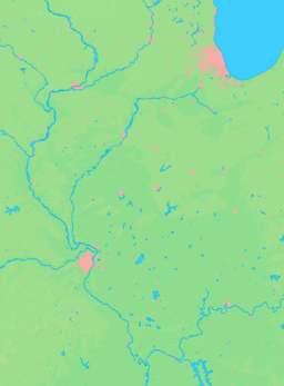
Foster Pond is an unincorporated community in the historic Bluff Precinct of Monroe County, Illinois, United States. It is located along the historic road, the present Illinois Route 156 which ran from the landings on the Mississippi River at the old county seat of Harrisonville to Waterloo and beyond.
| Counties | 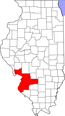 | |
|---|---|---|
| Major Cities (25,000+) | ||
| Cities (5,000-25,000) | ||
| Communities (1,000-5,000) |
| |
| Interstates | ||
| Airports | ||
| Colleges | ||
| Sports teams |
| |
Municipalities and communities of Monroe County, Illinois, United States | ||
|---|---|---|
| Cities | ||
| Villages | ||
| Unincorporated communities | ||
| Footnotes | ‡This populated place also has portions in an adjacent county or counties | |
This article is issued from
Wikipedia.
The text is licensed under Creative Commons - Attribution - Sharealike.
Additional terms may apply for the media files.