Millstadt, Illinois
| Millstadt | |
|---|---|
| Village | |
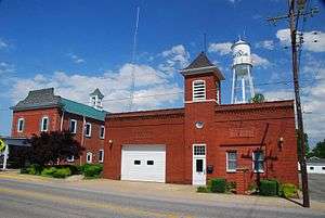
 Millstadt Water Tower, no longer used | |
 Location of Millstadt in St. Clair County, Illinois. | |
.svg.png) Location of Illinois in the United States | |
| Coordinates: 38°27′34″N 90°5′39″W / 38.45944°N 90.09417°WCoordinates: 38°27′34″N 90°5′39″W / 38.45944°N 90.09417°W | |
| Country | United States |
| State | Illinois |
| County | St. Clair |
| Government | |
| • Mayor | Michael H. Todd |
| Area[1] | |
| • Total | 3.35 sq mi (8.68 km2) |
| • Land | 3.19 sq mi (8.25 km2) |
| • Water | 0.17 sq mi (0.43 km2) |
| Population (2010) | |
| • Total | 4,011 |
| • Estimate (2016)[2] | 3,878 |
| • Density | 1,217.20/sq mi (469.95/km2) |
| Time zone | UTC-6 (CST) |
| • Summer (DST) | UTC-5 (CDT) |
| ZIP Code(s) | 62260/62220 |
| Area code(s) | 618 |
| FIPS code | 17-49386 |
| Wikimedia Commons | Millstadt, Illinois |
Millstadt is a village in St. Clair County, Illinois, United States, and a suburb of St. Louis, located at the crossing of Illinois Routes 163 (locally, "Jefferson Avenue") and 158 (locally, "Washington Avenue"). The village is known for its German heritage, with more than half its people of German descent.[3][4] The population was 2,794 at the 2000 census, but a more recent study in July 2006 estimated the number at 3,247.
History
During a barn raising in 1836, it was proposed that a town be incorporated on land belonging to Henry Randleman. The name "Centerville" was proposed, as the site was equidistant from Belleville, Columbia, and Pittsburg Lake. The town was platted on March 13, 1837. In 1880, its name was changed to Millstadt, as the name Centreville was in use by another nearby town.
Another account (Millstadt School website): "The story of how Millstadt developed out of 'Centerville' goes something like this. The current Centreville and our Centerville each had a post offices through which a great deal of mail became confused and mis-delivered. Our town's forefathers, upon applying for formal organization through the state, supposedly decided on the name 'Mittlestadt' or 'Middlestadt,' which means literally 'center city'; somehow the state misread the writing and sent back the papers reading 'Millstadt.' As you can guess, the governing group decided to keep that name as we had several mills at that time and the name fit."
In 1874, a German immigrant farm family was killed in a farming hamlet known as Saxtown, just south of the town. It made national headlines and became the subject of the book The Ax Murders of Saxtown. [5]
Demographics
| Historical population | |||
|---|---|---|---|
| Census | Pop. | %± | |
| 1880 | 1,229 | — | |
| 1890 | 1,186 | −3.5% | |
| 1900 | 1,172 | −1.2% | |
| 1910 | 1,140 | −2.7% | |
| 1920 | 907 | −20.4% | |
| 1930 | 1,014 | 11.8% | |
| 1940 | 1,290 | 27.2% | |
| 1950 | 1,566 | 21.4% | |
| 1960 | 1,830 | 16.9% | |
| 1970 | 2,168 | 18.5% | |
| 1980 | 2,736 | 26.2% | |
| 1990 | 2,566 | −6.2% | |
| 2000 | 2,794 | 8.9% | |
| 2010 | 4,011 | 43.6% | |
| Est. 2016 | 3,878 | [2] | −3.3% |
| U.S. Decennial Census[6] | |||
As of the census[7] of 2000, there were 2,794 people, 1,148 households, and 813 families residing in the village. The population density was 2,511.9 people per square mile (971.9/km²). There were 1,196 housing units at an average density of 1,075.2 per square mile (416.0/km²). The racial makeup of the village was 99% White, 0% Native American, 1% Asian, 0% from other races, and 0% from two or more races. Hispanic or Latino of any race were 0% of the population.
There were 1,148 households out of which 31.8% had children under the age of 18 living with them, 59.1% were married couples living together, 8.9% had a female householder with no husband present, and 29.1% were non-families. 25.3% of all households were made up of individuals and 12.5% had someone living alone who was 65 years of age or older. The average household size was 2.43 and the average family size was 2.92.
In the village, the population was spread out with 23.7% under the age of 18, 7.6% from 18 to 24, 28.6% from 25 to 44, 22.9% from 45 to 64, and 17.3% who were 65 years of age or older. The median age was 39 years. For every 100 females there were 91.5 males. For every 100 females age 18 and over, there were 87.5 males.
The median income for a household in the village was $47,824, and the median income for a family was $56,378. Males had a median income of $40,893 versus $27,196 for females. The per capita income for the village was $21,914. About 3.2% of families and 4.0% of the population were below the poverty line, including 5.9% of those under age 18 and 5.1% of those age 65 or over.
Geography

According to the 2010 census, the village has a total area of 3.58 square miles (9.3 km2), of which 3.41 square miles (8.8 km2) (or 95.25%) is land and 0.17 square miles (0.44 km2) (or 4.75%) is water.[8]
The town center is formed by the intersection of two state highways. Illinois Route 158, or Washington Avenue, leads west to Columbia and east to Belleville. The other main street is Jefferson Avenue, the north part of which forms the southern end of Illinois Route 163, leading north to Centreville, where it intersects highways providing access to St. Louis. The south end of Jefferson Avenue, as it leaves Millstadt, becomes Floraville Road.
Schools, churches, cemeteries

- Elementary schools:
- Millstadt Primary Center -
- Millstadt Consolidated School - www.millstadt.stclair.k12.il.us
- St. James Catholic School - www.stjames.pvt.k12.il.us
- High schools: (all are in nearby Belleville, Illinois)
- Althoff Catholic High School - www.althoff.net
- Belleville Township High School West, District 201 - www.bths201.org
- Churches in Millstadt:
- Cemeteries:
Notable people
- William N. Baltz, U.S. Representative and Millstadt mayor.
- Miles Dewey Davis, Jr., father of jazz trumpeter Miles Davis[4]
- Fred J. Kern, U.S. Representative
- Admiral Waldemar F. A. Wendt, United States Navy
- Amanda Valentine, CMA award winning radio personality and afternoon host on B105 in Cincinnati
Sister cities
See also
References
- ↑ "2016 U.S. Gazetteer Files". United States Census Bureau. Retrieved Jun 29, 2017.
- 1 2 "Population and Housing Unit Estimates". Retrieved June 9, 2017.
- ↑ http://factfinder.census.gov/servlet/QTTable?_bm=y&-geo_id=16000US1749386&-qr_name=DEC_2000_SF3_U_DP2&-ds_name=DEC_2000_SF3_U&-_lang=en&-redoLog=false&-_sse=on
- 1 2 Johnson, John H., ed. (November 1959). "Landrace hog breeder:Illinois doctor imports special breeding stock from Europe". Ebony. Chicago, Illinois: Johnson Publishing Company, Inc. 15 (1): 75–79.
- ↑ http://news.stlpublicradio.org/post/140-year-old-millstadt-murder-mystery-gets-new-life-ax-murders-saxtown
- ↑ "Census of Population and Housing". Census.gov. Retrieved June 4, 2015.
- ↑ "American FactFinder". United States Census Bureau. Retrieved 2008-01-31.
- ↑ "2010 Census U.S. Gazetteer Files for Places – Illinois". United States Census. Archived from the original on 2012-08-10. Retrieved 2012-10-13.
External links
- * Village website
- Millstadt Township
- Millstadt Library
- Millstadt History & Research 2010
- Millstadt Chamber of Commerce
Municipalities and communities of St. Clair County, Illinois, United States | ||
|---|---|---|
| Cities | ||
| Villages | ||
| Townships | ||
| CDPs | ||
| Other unincorporated communities | ||
| Footnotes | ‡This populated place also has portions in an adjacent county or counties | |