Faverolles-en-Berry
| Faverolles-en-Berry | |
|---|---|
| Commune | |
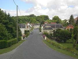 The road into Faverolles | |
 Faverolles-en-Berry Location within Centre-Val de Loire region  Faverolles-en-Berry | |
| Coordinates: 47°10′22″N 1°24′33″E / 47.1728°N 1.4092°ECoordinates: 47°10′22″N 1°24′33″E / 47.1728°N 1.4092°E | |
| Country | France |
| Region | Centre-Val de Loire |
| Department | Indre |
| Arrondissement | Châteauroux |
| Canton | Valençay |
| Intercommunality | Valençay |
| Government | |
| • Mayor (2008–2014) | William Guimpier |
| Area1 | 41.41 km2 (15.99 sq mi) |
| Population (2009)2 | 342 |
| • Density | 8.3/km2 (21/sq mi) |
| Time zone | UTC+1 (CET) |
| • Summer (DST) | UTC+2 (CEST) |
| INSEE/Postal code | 36072 /36360 |
| Elevation |
91–154 m (299–505 ft) (avg. 122 m or 400 ft) |
|
1 French Land Register data, which excludes lakes, ponds, glaciers > 1 km2 (0.386 sq mi or 247 acres) and river estuaries. 2 Population without double counting: residents of multiple communes (e.g., students and military personnel) only counted once. | |
Faverolles-en-Berry (before 2017: Faverolles)[1] is a commune in the Indre department in central France.
Population
| Historical population | ||
|---|---|---|
| Year | Pop. | ±% |
| 1793 | 530 | — |
| 1800 | 723 | +36.4% |
| 1806 | 589 | −18.5% |
| 1821 | 706 | +19.9% |
| 1831 | 747 | +5.8% |
| 1836 | 769 | +2.9% |
| 1841 | 758 | −1.4% |
| 1846 | 721 | −4.9% |
| 1851 | 683 | −5.3% |
| 1856 | 702 | +2.8% |
| 1861 | 676 | −3.7% |
| 1866 | 760 | +12.4% |
| 1872 | 732 | −3.7% |
| 1876 | 733 | +0.1% |
| 1881 | 803 | +9.5% |
| 1886 | 859 | +7.0% |
| 1891 | 864 | +0.6% |
| 1896 | 836 | −3.2% |
| 1901 | 840 | +0.5% |
| 1906 | 858 | +2.1% |
| 1911 | 836 | −2.6% |
| 1921 | 808 | −3.3% |
| 1926 | 830 | +2.7% |
| 1931 | 854 | +2.9% |
| 1936 | 838 | −1.9% |
| 1946 | 838 | +0.0% |
| 1954 | 848 | +1.2% |
| 1962 | 748 | −11.8% |
| 1968 | 688 | −8.0% |
| 1975 | 551 | −19.9% |
| 1982 | 444 | −19.4% |
| 1990 | 411 | −7.4% |
| 1999 | 379 | −7.8% |
| 2009 | 342 | −9.8% |
See also
References
- ↑ Décret n° 2017-149 7 February 2017 (in French)
| Wikimedia Commons has media related to Faverolles (Indre). |
This article is issued from
Wikipedia.
The text is licensed under Creative Commons - Attribution - Sharealike.
Additional terms may apply for the media files.