La Chapelle-Orthemale
| La Chapelle-Orthemale | |
|---|---|
| Commune | |
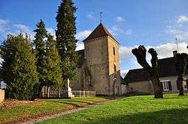 The church in La Chapelle-Orthemale | |
 La Chapelle-Orthemale Location within Centre-Val de Loire region  La Chapelle-Orthemale | |
| Coordinates: 46°50′38″N 1°27′10″E / 46.8439°N 1.4528°ECoordinates: 46°50′38″N 1°27′10″E / 46.8439°N 1.4528°E | |
| Country | France |
| Region | Centre-Val de Loire |
| Department | Indre |
| Arrondissement | Châteauroux |
| Canton | Buzançais |
| Intercommunality | Val de l'Indre-Brenne |
| Government | |
| • Mayor (2008–2014) | Philippe Dixneuf |
| Area1 | 16.8 km2 (6.5 sq mi) |
| Population (2009)2 | 124 |
| • Density | 7.4/km2 (19/sq mi) |
| Time zone | UTC+1 (CET) |
| • Summer (DST) | UTC+2 (CEST) |
| INSEE/Postal code | 36040 /36500 |
| Elevation |
111–151 m (364–495 ft) (avg. 150 m or 490 ft) |
|
1 French Land Register data, which excludes lakes, ponds, glaciers > 1 km2 (0.386 sq mi or 247 acres) and river estuaries. 2 Population without double counting: residents of multiple communes (e.g., students and military personnel) only counted once. | |
La Chapelle-Orthemale is a commune in the Indre department in central France.
Population
| Historical population | ||
|---|---|---|
| Year | Pop. | ±% |
| 1793 | 228 | — |
| 1800 | 191 | −16.2% |
| 1806 | 272 | +42.4% |
| 1821 | 288 | +5.9% |
| 1831 | 272 | −5.6% |
| 1836 | 274 | +0.7% |
| 1841 | 261 | −4.7% |
| 1846 | 274 | +5.0% |
| 1851 | 249 | −9.1% |
| 1856 | 257 | +3.2% |
| 1861 | 232 | −9.7% |
| 1866 | 239 | +3.0% |
| 1872 | 239 | +0.0% |
| 1876 | 247 | +3.3% |
| 1881 | 255 | +3.2% |
| 1886 | 261 | +2.4% |
| 1891 | 257 | −1.5% |
| 1896 | 233 | −9.3% |
| 1901 | 244 | +4.7% |
| 1906 | 249 | +2.0% |
| 1911 | 252 | +1.2% |
| 1921 | 252 | +0.0% |
| 1926 | 197 | −21.8% |
| 1931 | 213 | +8.1% |
| 1936 | 197 | −7.5% |
| 1946 | 202 | +2.5% |
| 1954 | 190 | −5.9% |
| 1962 | 201 | +5.8% |
| 1968 | 154 | −23.4% |
| 1975 | 141 | −8.4% |
| 1982 | 115 | −18.4% |
| 1990 | 109 | −5.2% |
| 1999 | 95 | −12.8% |
| 2009 | 124 | +30.5% |
See also
References
| Wikimedia Commons has media related to La Chapelle-Orthemale. |
This article is issued from
Wikipedia.
The text is licensed under Creative Commons - Attribution - Sharealike.
Additional terms may apply for the media files.