Farciennes
| Farciennes | |||
|---|---|---|---|
| Municipality | |||
 | |||
| |||
 Farciennes Location in Belgium
Location of Farciennes in Hainaut 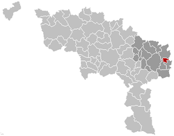 | |||
| Coordinates: 50°26′N 04°33′E / 50.433°N 4.550°ECoordinates: 50°26′N 04°33′E / 50.433°N 4.550°E | |||
| Country | Belgium | ||
| Community | French Community | ||
| Region | Wallonia | ||
| Province | Hainaut | ||
| Arrondissement | Charleroi | ||
| Government | |||
| • Mayor | Hugues Bayet | ||
| • Governing party/ies | PS | ||
| Area | |||
| • Total | 10.39 km2 (4.01 sq mi) | ||
| Population (1 January 2017)[1] | |||
| • Total | 11,281 | ||
| • Density | 1,100/km2 (2,800/sq mi) | ||
| Postal codes | 6240 | ||
| Area codes | 071 | ||
| Website | www.farciennes.be | ||


Farciennes is a Walloon municipality located in the Belgian province of Hainaut. On January 1, 2006, Farciennes had a total population of 11,099. The total area is 10.39 km² which gives a population density of 1,069 inhabitants per km². It is located on the entre-Sambre-et-Meuse in the periphery of Charleroi.
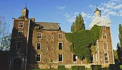
In the past, Farciennes was an industrial city. It declined with the closure of the last Walloon coal mine, namely the Sainte-Catherine shaft of the Roton company, and the fall of the iron and steel industries, formerly large employers in the area between Liège and Charleroi. Today, the site of Roton, of which only the tower and the cloakroom remain, has been developed to accommodate small and medium-sized businesses.
Since the merger of the communes of 1977, the small commune of Pironchamps was integrated into Farciennes. The districts of Wainage, Wairchat and Tergnée were and still are part of the territory of Farciennes.
Notable people
- Olivier Carette, footballer
- Laurent Ciman, footballer
See also
References
- ↑ Population per municipality as of 1 January 2017 (XLS; 397 KB)
External links

Places adjacent to Farciennes | ||||||||||
|---|---|---|---|---|---|---|---|---|---|---|
| ||||||||||