Fanar (Matn)
| Fanar الفنار | |
|---|---|
| City | |
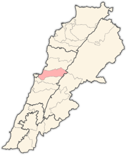
 Fanar Location within Lebanon | |
| Coordinates: 33°52′N 35°34′E / 33.867°N 35.567°ECoordinates: 33°52′N 35°34′E / 33.867°N 35.567°E | |
| Country |
|
| Governorate | Mount Lebanon Governorate |
| District | Matn District |
| Government | |
| • Time Zone | GMT +2 (UTC) |
| • - Summer (DST) | +3 (UTC) |
| • Area Code(s) | (+961) 1 |
| Area | |
| • Total | 2.10 km2 (0.81 sq mi) |
| Elevation | 250 m (820 ft) |
| Highest elevation | 250 m (820 ft) |
| Lowest elevation | 200 m (700 ft) |
| Population | |
| • Total | 30 000 |
| • Density | 500/km2 (1,000/sq mi) |
| Time zone | UTC+2 (EET) |
| • Summer (DST) | UTC+3 (EEST) |
| Dialing code | +961 |
Fanar (Arabic: الفنار translit. al-Fanar) (also Al-Fanar) is a village in the Matn District of the Mount Lebanon Governorate, Lebanon. It is situated in the heart of Lebanon, 7 km from Beirut.
Etymology
Geography
Fanar is 8 km to the Capital (Beirut). Elevation is approx. 250m above sea level.
Demographics
As of 2008, Fanar houses a population of approx. 30000 of whom 850 are registered voters. .[1]
Education
Higher education in Fanar is provided by a large number of schools and universities, such as Lebanese University (Faculty of Science, Faculty of Media and Communication, Faculty of Literatures), Al-Kafaàt University (AKU), College De la Sainte Famille Francaise Fanar, Institution Moderne du Liban (IML), and Collège Notre Dame du Mont Carmel des Sœurs Carmelites de Florence à Fanar. College Stes. Hripsimiantz des soeurs Armeniennes Catholiques de l'Immaculée Conception.
References and footnotes
- ↑ "Local Liban". Retrieved December 17, 2009.
External links
Capital: Jdeideh | ||
| Towns and villages |
|  |
| Notable landmarks | ||
| Notable touristic sites | ||