Beit Chabab
| Beit Chabab بيت شباب | |
|---|---|
| City | |
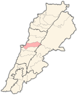
 Beit Chabab Location within Lebanon | |
| Coordinates: 33°55′N 35°41′E / 33.917°N 35.683°ECoordinates: 33°55′N 35°41′E / 33.917°N 35.683°E | |
| Country |
|
| Governorate | Mount Lebanon Governorate |
| District | Matn District |
| Highest elevation | 700 m (2,300 ft) |
| Lowest elevation | 600 m (2,000 ft) |
| Time zone | UTC+2 (EET) |
| • Summer (DST) | UTC+3 (EEST) |
| Dialing code | +961 4 |
Beit Chabab (Syriac: Bet Shebāba, Arabic: بيت شباب) pronounced "Beit Chabéb" is a mountain village 24 km north of Beirut in Lebanon.
It is the site of Lebanon's only bell foundry.[1] The bells of Beit Chabab are sold to Christian communities in Lebanon and abroad to many countries.[2] The village was completely embosomed in mulberry gardens at the turn of the century.[3]
The oldest church in Beit Chabab is Our Lady of the Forest, which was built in 1761.[1]
The Hôpital Beit Chabab - Collège du Liban pour les handicapés is located in the village[4]
Emigrants from Beit Chabab to the USA built the town of Youngstown in Ohio and named it after their original village in mount Lebanon. Beit Chabab translated to English is Youngstown.
Etymology
The name "Beit Chabab" is widely believed to originate from the Arabic "بيت شباب" (meaning:"house of the young men"), but in reality it has roots in Syriac. Anis Freiha sites in his Dictionary of the Names of Town and Villages in Lebanon that it comes from the Syriac: "Bet Shebāba" meaning "house of the neighbor".
References
- 1 2 http://www.ikamalebanon.com/national_heritage/mount_nh/mt_cities_nh/beitchabab.htm
- ↑ Slivka, Rose. The Crafts of the Modern World, page 23
- ↑ The Entomologist's Record and Journal of variation, Volume 13
- ↑ http://www.centrehospbc.com/
External links
- Beit Chabab - Chaouiyeh El Qnaytra, Localiban
Capital: Jdeideh | ||
| Towns and villages |
|  |
| Notable landmarks | ||
| Notable touristic sites | ||