Ain Saadeh
| Ain Saadeh عين سعادة | |
|---|---|
| City | |
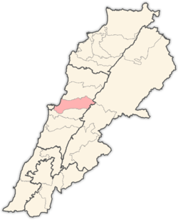
 Ain Saadeh Location within Lebanon | |
| Coordinates: 33°51′58″N 35°35′42″E / 33.8660°N 35.5951°ECoordinates: 33°51′58″N 35°35′42″E / 33.8660°N 35.5951°E | |
| Country |
|
| Governorate | Mount Lebanon Governorate |
| District | Matn District |
| Area | |
| • Total | 5.48 km2 (2.12 sq mi) |
| Highest elevation | 650 m (2,130 ft) |
| Lowest elevation | 400 m (1,300 ft) |
| Time zone | UTC+2 (EET) |
| • Summer (DST) | UTC+3 (EEST) |
| Dialing code | +961-4- |
Ain Saadeh (Arabic: عين سعادة, also spelled Ain Saadée and Ain Saade) is suburb located northeast of the capital Beirut in Lebanon.
Demography
Ain Saade is a traditional Christian village located in the mountains of Lebanon overlooking the Mediterranean Sea, with approximately 10,000 residents and 2,000 voters. The village has several nurseries, schools, colleges, technical institutes, universities, and various amenities and facilities.
The village in addition has a large range of active groups including the Legion Marie, Boy Scouts, sports clubs, etc, as well as several churches and an orphanage. Furthermore, the village has several industrial, commercial, residential and agriculture zones.
Ain Saadeh is located about 10 kilometers away from Beirut at an altitude ranging from 200 to 700 meters above sea level. There are several possible routes to Ain Saade:
- Through Mkalles to Mansourieh
- Through Fanar
- Through Nahr El Mawt, Roumieh
- Through Ras el Matn
- Through Brummana to Beit Mery
Etymology
The name "Ain Saadeh" means "Spring of Happiness," referring to the town's natural spring.
Education
Schools:
- Collège des Frères Mont La Salle - French international school[1]
- Sagesse High School
- Collège des sœurs des saints-cœurs Ain Najm, http://www.ainnajm.sscc.edu.lb/
References
- ↑ "Collège Mont-La-Salle." AEFE. Retrieved on May 7, 2015.
External links
- Ain Saadeh, Localiban
Capital: Jdeideh | ||
| Towns and villages |
|  |
| Notable landmarks | ||
| Notable touristic sites | ||