Dik El Mehdi
| Dik El Mehdi ديك المحدي | |
|---|---|
| City | |
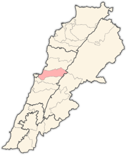
 Dik El Mehdi Location within Lebanon | |
| Coordinates: 33°55′49.8″N 35°37′20.6″E / 33.930500°N 35.622389°E | |
| Country |
|
| Governorate | Mount Lebanon Governorate |
| District | Matn District |
| Time zone | UTC+2 (EET) |
| • Summer (DST) | UTC+3 (EEST) |
| Dialing code | +961 |
Dik El Mehdi is a village, at 325 meters elevation, in the Matn District governorate of Mount Lebanon.[1] Its population has been estimated at 2,096 by Aayroun. The village is around 18 km. from Beirut. The majority of it inhabitants derives from the Ashkar family. Many of its inhabitants come from various regions in Lebanon covering diverse political beliefs.
Dik el Mehdi has an elementary, high and secondary school "College Mariste Champville".
References
- ↑ Localiban site
Capital: Jdeideh | ||
| Towns and villages |
|  |
| Notable landmarks | ||
| Notable touristic sites | ||
This article is issued from
Wikipedia.
The text is licensed under Creative Commons - Attribution - Sharealike.
Additional terms may apply for the media files.