Escalante (El Apagado)
| Volcán Escalante | |
|---|---|
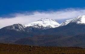 Volcán Escalante seen from the SW. | |
| Highest point | |
| Elevation | 5,819 m (19,091 ft) |
| Coordinates | 22°36.762′S 67°53.031′W / 22.612700°S 67.883850°WCoordinates: 22°36.762′S 67°53.031′W / 22.612700°S 67.883850°W |
| Geography | |
| Location | Chile |
| Parent range | Andes |
| Geology | |
| Mountain type | Stratovolcano |
Volcán Escalante also known as "El Apagado" is a stratovolcano on the Chilean side of the border between Bolivia and Chile. It lies immediately SE of Cerro Colorado and SW to volcán Curiquinca, all of which are considered to be part of the Sairecabur volcanic group.
See also
References
- "Sairecabur". Global Volcanism Program. Smithsonian Institution.
- González-Ferrán, Oscar (1995). Volcanes de Chile. Santiago, Chile: Instituto Geográfico Militar. p. 640 pp. ISBN 956-202-054-1. (Spanish)
External links
- SI Google Earth Placemarks - Smithsonian Institution Global Volcanism Program: Download placemarks with SI Holocene volcano-data.
This article is issued from
Wikipedia.
The text is licensed under Creative Commons - Attribution - Sharealike.
Additional terms may apply for the media files.