River Ely
| River Ely (Afon Elái) | |
| River | |
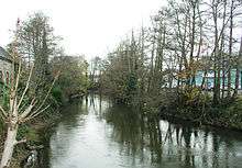
 The river flowing through Peterston-super-Ely | |
| Countries | United Kingdom, Wales |
|---|---|
| Region | South Wales |
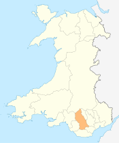
| County | Vale of Glamorgan, Cardiff, Rhondda Cynon Taf |
| Tributaries | |
| - left | Nant Muchud, Afon Clun |
| - right | Nant y Drope |
| Cities | Tonyrefail, Llantrisant, Pontyclun, Peterston-super-Ely, Ely, Cardiff, Penarth |
| Source | |
| - location | Northwest of Tonyrefail, Rhondda Cynon Taf, Wales |
| - elevation | 580 m (1,903 ft) |
| - coordinates | 51°36′12″N 3°27′36″W / 51.6034°N 3.460°W |
| Mouth | |
| - location | Cardiff Bay |
| - elevation | 0 m (0 ft) |
| - coordinates | 51°27′22″N 3°10′26″W / 51.456°N 3.174°WCoordinates: 51°27′22″N 3°10′26″W / 51.456°N 3.174°W |
| Length | 39.6 km (25 mi) |
The River Ely (Welsh: Afon Elái) is in South Wales flowing generally southeast, from Tonyrefail to Cardiff.
The river is about 24 miles (39 km) long. The Ely's numerous sources lie in the mountains to the south of Tonypandy, near the town of Tonyrefail, rising in the eastern slopes of Mynydd Penygraig (Penygraig) and Mynydd y Gilfach (Penrhiwfer) and the western slopes of Mynydd Dinas (Williamstown), whose eastern slopes feed the Rhondda by Porth. The source of the Ogwr Fach lies just to the west.

After flowing through Tonyrefail and through the grounds of the Royal Glamorgan Hospital at Ynysmaerdy, it follows the A4119 road through the valley pass formed between Mynydd Garthmaelwg (Llantrisant Forest), to the west and Llantrisant, to the east. Flowing through Talbot Green, the Ely is joined by the Afon Clun at Pontyclun. Although numerous smaller streams join the river, the Clun is its only large tributary.
The Ely turns to the southeast on reaching the Vale of Glamorgan alongside the South Wales Main Line immediately south of Miskin and after being traversed by the M4 motorway, it flows through farmland. It passes the St Fagans National History Museum and continues towards Cardiff and Ely (Welsh: Trelái) before flowing under the Vale of Glamorgan Line and into Cardiff Bay at Penarth Marina.
Quality
The Ely has had a long history of moderate to severe pollution from which it is now recovering. Prior to the 1980s it had received large volumes of poorly treated or untreated sewage from the urban areas in the valleys. Even after the construction of sewage treatment works at Miskin and Rhiwsaeson, the quality of the effluent continued to cause pollution until the late 1980s.
These problems were exacerbated by the highly polluting discharge from Coedely coke ovens. At the mouth of the river, the effluent a large paper mill rendered large parts of the estuary anoxic for most of the tidal cycle preventing the passage of migratory fish. The recovery of the river since that time owes much to the regulatory effort of the NRA, and more lately the Environment Agency Wales, and to the massive capital investment made by Dŵr Cymru / Welsh Water.
Ecology
As the pollution of the river abated, so fish populations slowly returned to the river from the many small tributaries. Roach, Brown trout, perch, chub, eel, grayling, sea trout and salmon and more recently some barbel.
Ely Valley Trail
The Countryside Council for Wales and Cardiff Council are developing a cycleway beside the river known as the Ely Trail. The intended benefits are to allow people from urban western Cardiff easier access to the countryside, and for people in rural areas to have another commuting option into the city centre. Parts of this trail are now open.
Ely Valley
The River Ely passes through the following:
Rhondda Cynon Taf
Vale of Glamorgan
Cardiff
See also
| About Cardiff | 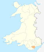 | |
|---|---|---|
| Cardiff templates |
| |
| Neighbourhoods |
| |
Principal areas of Wales | ||