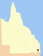
The County of Churchill is a county (a cadastral division) in Queensland, Australia.[1] Like all counties in Queensland, it is a non-functional administrative unit, that is used mainly for the purpose of registering land titles. The county lies between 152°E and 153°E longitude, and is centred on the West Moreton region, extending east to the suburbs of Ipswich.[2] The county was named for Lord Randolph Churchill, who was born in 1849, by the Surveyor-General of New South Wales the following year; the area was officially named and bounded by the Governor in Council on 7 March 1901 under the Land Act 1897.[1]
Parishes
Churchill is divided into parishes, as listed below:
| Parish | LGA | Coordinates | Towns |
| Alfred | Ipswich | 27°42′S 152°26′E / 27.700°S 152.433°E / -27.700; 152.433 (Alfred Parish) | Grandchester |
| Blenheim | Lockyer Valley | 27°36′S 152°20′E / 27.600°S 152.333°E / -27.600; 152.333 (Blenheim Parish) | Forest Hill, Lawes |
| Brassall | Ipswich | 27°33′S 152°43′E / 27.550°S 152.717°E / -27.550; 152.717 (Brassall Parish) | Brassall, Leichhardt, Pine Mountain |
| Campbell | Lockyer Valley | 27°39′S 152°03′E / 27.650°S 152.050°E / -27.650; 152.050 (Campbell Parish) | Flagstone Creek, Preston |
| Clumber | Scenic Rim | 28°06′S 152°30′E / 28.100°S 152.500°E / -28.100; 152.500 (Clumber Parish) | |
| Colin | Lockyer Valley | 27°43′S 152°02′E / 27.717°S 152.033°E / -27.717; 152.033 (Colin Parish) | |
| East Haldon | Lockyer Valley | 27°52′S 152°14′E / 27.867°S 152.233°E / -27.867; 152.233 (East Haldon Parish) | |
| Fassifern | Scenic Rim | 27°57′S 152°34′E / 27.950°S 152.567°E / -27.950; 152.567 (Fassifern Parish) | Aratula, Kalbar |
| Ferguson | Ipswich | 27°42′S 152°31′E / 27.700°S 152.517°E / -27.700; 152.517 (Ferguson Parish) | |
| Flagstone | Lockyer Valley | 27°37′S 152°04′E / 27.617°S 152.067°E / -27.617; 152.067 (Flagstone Parish) | Middle Ridge, Withcott |
| Flinders | Scenic Rim | 27°47′S 152°42′E / 27.783°S 152.700°E / -27.783; 152.700 (Flinders Parish) | Harrisville |
| Forbes | Scenic Rim | 27°47′S 152°34′E / 27.783°S 152.567°E / -27.783; 152.567 (Forbes Parish) | |
| Franklin | Ipswich | 27°48′S 152°27′E / 27.800°S 152.450°E / -27.800; 152.450 (Franklin Parish) | |
| Gatton | Lockyer Valley | 27°35′S 152°17′E / 27.583°S 152.283°E / -27.583; 152.283 (Gatton Parish) | Gatton |
| Goolman | Scenic Rim | 27°49′S 152°47′E / 27.817°S 152.783°E / -27.817; 152.783 (Goolman Parish) | Peak Crossing |
| Grandchester | Lockyer Valley | 27°37′S 152°30′E / 27.617°S 152.500°E / -27.617; 152.500 (Grandchester Parish) | Hatton Vale |
| Jeebropilly | Ipswich | 27°40′S 152°39′E / 27.667°S 152.650°E / -27.667; 152.650 (Jeebropilly Parish) | Amberley |
| Laidley | Lockyer Valley | 27°37′S 152°24′E / 27.617°S 152.400°E / -27.617; 152.400 (Laidley Parish) | Laidley |
| Mort | Lockyer Valley | 27°43′S 152°21′E / 27.717°S 152.350°E / -27.717; 152.350 (Mort Parish) | |
| Mutdapilly | Ipswich | 27°43′S 152°36′E / 27.717°S 152.600°E / -27.717; 152.600 (Mutdapilly Parish) | Mutdapilly |
| Normanby | Scenic Rim | 27°51′S 152°38′E / 27.850°S 152.633°E / -27.850; 152.633 (Normanby Parish) | Warrill View |
| North | Somerset | 27°28′S 152°39′E / 27.467°S 152.650°E / -27.467; 152.650 (North Parish) | Fernvale |
| Purga | Ipswich | 27°41′S 152°44′E / 27.683°S 152.733°E / -27.683; 152.733 (Purga Parish) | Churchill, Ripley, Yamanto |
| Rosevale | Scenic Rim | 27°53′S 152°27′E / 27.883°S 152.450°E / -27.883; 152.450 (Rosevale Parish) | Rosevale |
| Rosewood | Lockyer Valley | 27°32′S 152°29′E / 27.533°S 152.483°E / -27.533; 152.483 (Rosewood Parish) | Glenore Grove |
| Tarampa | Somerset | 27°29′S 152°33′E / 27.483°S 152.550°E / -27.483; 152.550 (Tarampa Parish) | Lowood |
| Taylor | Lockyer Valley | 27°31′S 152°01′E / 27.517°S 152.017°E / -27.517; 152.017 (Taylor Parish) | Murphys Creek, Withcott |
| Tenthill | Lockyer Valley | 27°39′S 152°14′E / 27.650°S 152.233°E / -27.650; 152.233 (Tenthill Parish) | Lower Tenthill |
| Terry | Lockyer Valley | 27°35′S 152°07′E / 27.583°S 152.117°E / -27.583; 152.117 (Terry Parish) | |
| Thorn | Scenic Rim | 27°52′S 152°32′E / 27.867°S 152.533°E / -27.867; 152.533 (Thorn Parish) | Rosevale |
| Thornton | Lockyer Valley | 27°48′S 152°21′E / 27.800°S 152.350°E / -27.800; 152.350 (Thornton Parish) | |
| Townson | Lockyer Valley | 27°53′S 152°22′E / 27.883°S 152.367°E / -27.883; 152.367 (Townson Parish) | |
| Walloon | Ipswich | 27°35′S 152°40′E / 27.583°S 152.667°E / -27.583; 152.667 (Walloon Parish) | Rosewood, Marburg, Minden |
| Whitestone | Lockyer Valley | 27°46′S 152°13′E / 27.767°S 152.217°E / -27.767; 152.217 (Whitestone Parish) | |