County of Cavendish

Cavendish
Queensland
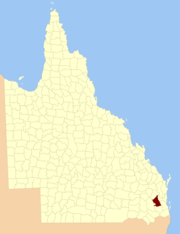
Location within Queensland
Lands administrative divisions around Cavendish:
Fitzroy Fitzroy Canning
Aubigny Cavendish Canning
Aubigny Churchill Stanley

The County of Cavendish is a county (a cadastral division) in Queensland, Australia.[1] Like all counties in Queensland, it is a non-functional administrative unit, that is used mainly for the purpose of registering land titles. The county includes the northern part of the Toowoomba Region and the western part of the Somerset Region.[2] The county was officially named and bounded by the Governor in Council on 7 March 1901 under the Land Act 1897.[1]

Parishes

Cavendish is divided into parishes, listed as follows:

ParishLGACoordinatesTowns
AndurambaSomerset27°12′S 152°10′E / 27.200°S 152.167°E / -27.200; 152.167 (Anduramba Parish)
AvocaSomerset26°37′S 152°12′E / 26.617°S 152.200°E / -26.617; 152.200 (Avoca Parish)
BiarraSomerset27°06′S 152°19′E / 27.100°S 152.317°E / -27.100; 152.317 (Biarra Parish)Toogoolawah
BuarabaSomerset27°22′S 152°18′E / 27.367°S 152.300°E / -27.367; 152.300 (Buaraba Parish)
ClarendonLockyer Valley27°29′S 152°22′E / 27.483°S 152.367°E / -27.483; 152.367 (Clarendon Parish)
ColintonSomerset26°52′S 152°15′E / 26.867°S 152.250°E / -26.867; 152.250 (Colinton Parish)Moore
CooyarToowoomba26°55′S 151°55′E / 26.917°S 151.917°E / -26.917; 151.917 (Cooyar Parish)Cooyar, Yarraman
CressbrookSomerset27°07′S 152°26′E / 27.117°S 152.433°E / -27.117; 152.433 (Cressbrook Parish)
Crows NestToowoomba27°15′S 152°03′E / 27.250°S 152.050°E / -27.250; 152.050 (Crows Nest Parish)Crows Nest
DeongwarSomerset27°15′S 152°11′E / 27.250°S 152.183°E / -27.250; 152.183 (Deongwar Parish)
DjuanToowoomba27°08′S 151°56′E / 27.133°S 151.933°E / -27.133; 151.933 (Djuan Parish)Haden
Emu CreekToowoomba27°00′S 152°02′E / 27.000°S 152.033°E / -27.000; 152.033 (Emu Creek Parish)
EnglandSomerset27°25′S 152°27′E / 27.417°S 152.450°E / -27.417; 152.450 (England Parish)Coominya, Mount Tarampa
EskSomerset27°14′S 152°25′E / 27.233°S 152.417°E / -27.233; 152.417 (Esk Parish)Esk
EskdaleToowoomba27°06′S 152°10′E / 27.100°S 152.167°E / -27.100; 152.167 (Eskdale Parish)
HelidonLockyer Valley27°30′S 152°07′E / 27.500°S 152.117°E / -27.500; 152.117 (Helidon Parish)Helidon
LockyerLockyer Valley27°30′S 152°14′E / 27.500°S 152.233°E / -27.500; 152.233 (Lockyer Parish)Grantham
MurphyLockyer Valley27°27′S 152°06′E / 27.450°S 152.100°E / -27.450; 152.100 (Murphy Parish)
NukinendaSomerset27°01′S 152°11′E / 27.017°S 152.183°E / -27.017; 152.183 (Nukinenda Parish)
RavensbourneToowoomba27°21′S 152°08′E / 27.350°S 152.133°E / -27.350; 152.133 (Ravensbourne Parish)Ravensbourne
TaromeoSouth Burnett26°49′S 152°07′E / 26.817°S 152.117°E / -26.817; 152.117 (Taromeo Parish)Benarkin, Blackbutt
WivenhoeSomerset27°21′S 152°32′E / 27.350°S 152.533°E / -27.350; 152.533 (Wivenhoe Parish)Lake Wivenhoe

References

  1. 1 2 "Cavendish (entry 6681)". Queensland Place Names. Queensland Government. Retrieved 1 September 2015.
  2. Moreton District, County of Cavendish Maps - A4 Series at Queensland Archives.

Coordinates: 27°25′S 152°10′E / 27.417°S 152.167°E / -27.417; 152.167


This article is issued from Wikipedia. The text is licensed under Creative Commons - Attribution - Sharealike. Additional terms may apply for the media files.